
Ask price
Map of Africa Poster
Poster-size digital map of Africa with detailed political and geographical information.
Adobe Illustrator, Acrobat PDF
Ask price
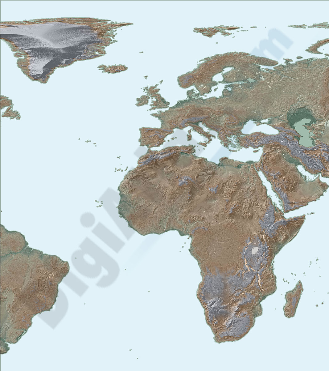
Map of Africa and Europe
Map of Africa and Europe with a TIFF-image relief and vectorized bathimetry
imagen TIFF

79,00 €
Africa physical vectorized-relief map
Physical map of Africa.
Digital map of the African continent with the altimetry and bathymetry strips coloured and separated into fully editable layers. Includes geographical names, country boundaries, capitals, cities and major towns.
Poster-size map of Africa.
Adobe Illustrator, Acrobat PDF

79,00 €
Africa political and geographical map
Fully editable vectorized file map of Africa with coloured countries, international boundaries, major lakes, important cities and capitals and relevant geographic features. Poster size map in high-resolution color shaded relief TIFF image.
Adobe Illustrator, PDF + TIFF, JPG (300dpi)

79,00 €
America physical vectorized-relief map
Fully editable vector file map of all american continent. Shows colored altimetry and bathymetry, international boundaries, major lakes, country capitals and relevant geographic names. High-resolution TIFF relief-image is included.
Adobe Illustrator, Acrobat PDF

79,00 €
America political and geographical map
Fully editable vector file. Layers: colour and name of countries, international boundaries, major lakes, country capitals and relevant geographic names. High-resolution TIFF relief-image is included.
Adobe Illustrator, PDF + TIFF, JPG (300dpi)

98,00 €
Asia physical vectorized-relief map
Digital map of Asia.
Map in 100% editable vector format of the entire Asian continent, with the altimetry and bathymetry strips coloured and separated in layers, all country borders with their capitals, geographical names and important towns.
A TIFF image with shaded and coloured relief is included.
Adobe Illustrator, Acrobat PDF, TIFF image

98,00 €
Asia political and geographical map
Digital political and geographical map of Asia.
Download 100% editable vectorized files with political and geographical layers of information (borders, countries, rivers, lakes, capitals, important cities and geographical names).
Includes a TIFF image with the relief.
Adobe Illustrator, Acrobat PDF, TIFF image
79,00 €
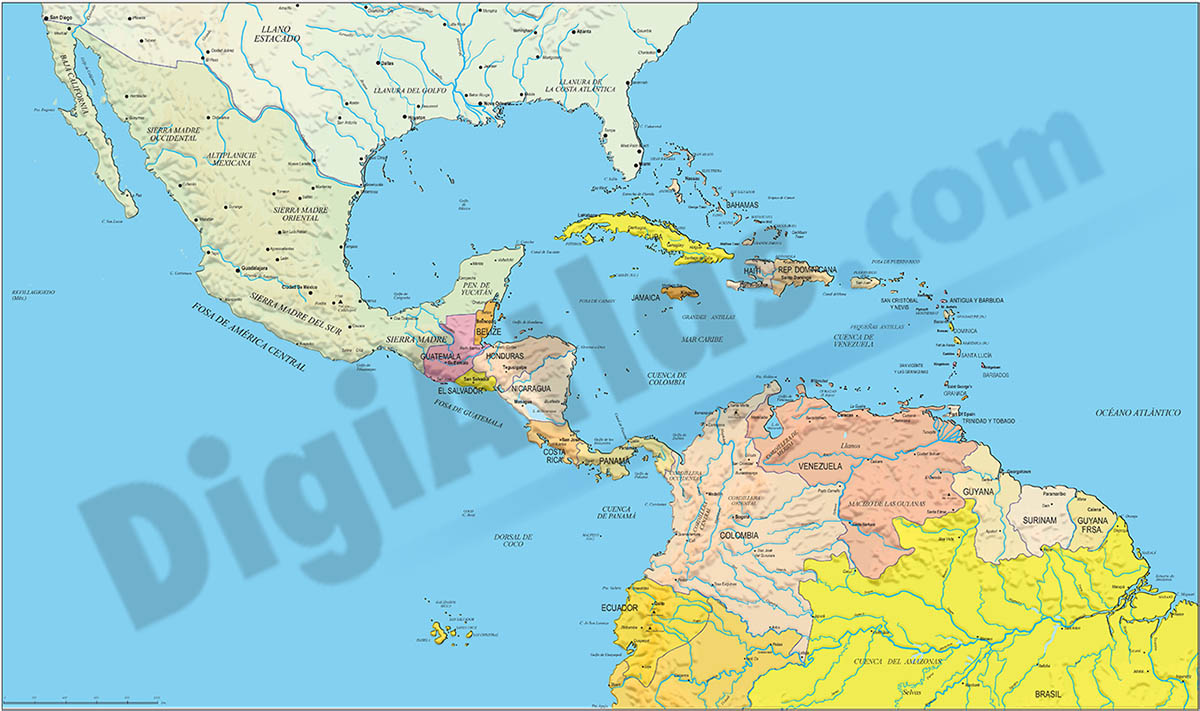
Central America political map
Digital file of Central America (Central America or América del centro) with the delimitation of the countries and other layers with geographical and political information (relief, rivers, lakes, capitals and important cities).
It shows the countries in colour and also includes a TIFF image with shaded relief.
Adobe Illustrator, Acrobat PDF, image TIFF

95,00 €
Europe map with seaports
Fully vectorized and editable map of Europe with more than 1200 seaports, country names, their capitals, and a color shaded-relief TIFF image.
Adobe Illustrator, Acrobat PDF, imagen TIFF
59,00 €
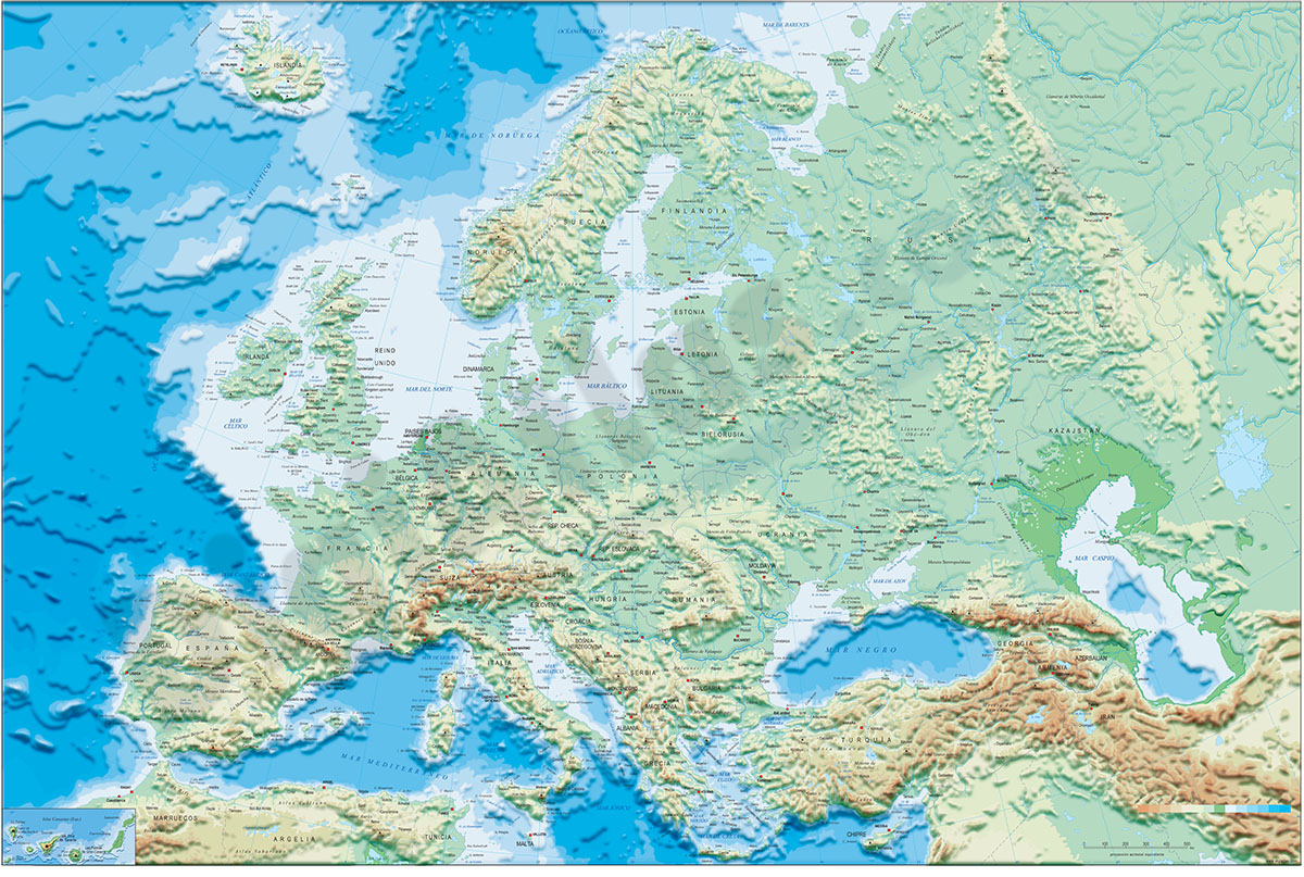
Europe physical vectorized-relief map
Fully editable digital map of Europe continent, showing layers of altitude intervals and Bathymetry colours.
Include geographical and major cities of all countries in Europe.
Poster size map for large format printing at maximum quality.
Adobe Illustrator, Acrobat PDF

79,00 €
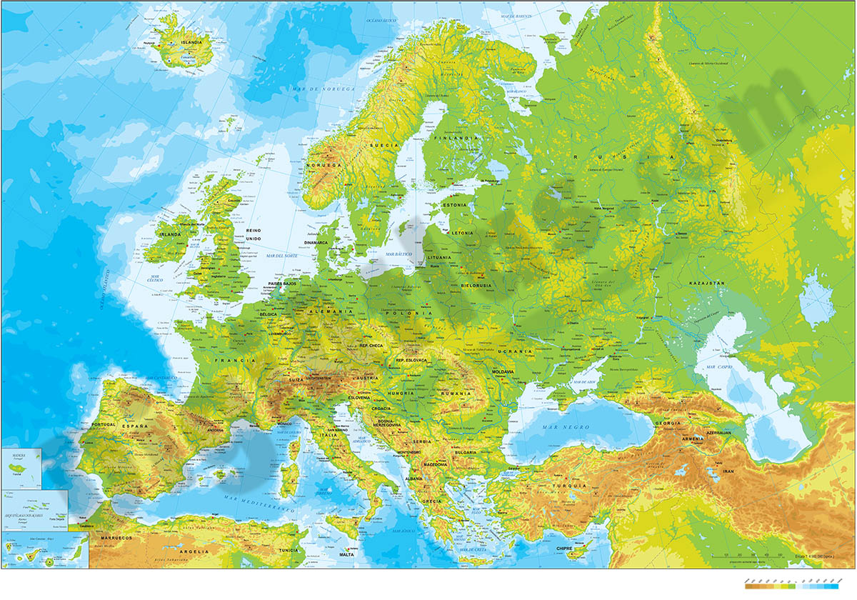
Europe political and geographical map
Digital physical and geographical map of Europe.
Digital cartography of the entire European continent with relevant physical and political information. Includes country borders, capitals, major rivers and lakes, important cities and geographical names.
It also incorporates a TIFF image with the relief shaded and coloured as a background layer, to alternate the physical and political version.
Files are downloaded in 100% editable vector format, organised in separate layers and ready to be printed in poster size with the highest quality.
Adobe Illustrator, Acrobat PDF + TIFF

79,00 €
Map of Antarctica
Fully editable vector file map of Antarctica. Colored lands and glaciers.
Adobe Illustrator, PDF, JPG (300dpi)

79,00 €
North America physical vectorized-relief map
Digital map of North America. Editable vector file with the altimetry and bathymetry bands coloured and separated into layers. Includes geographic names and important towns.
Adobe Illustrator, Acrobat PDF

79,00 €
North America political and geographical map
Digital physical and political map of North America (Canada, USA and Mexico). The map is organised in separate layers with political and geographical information (borders, countries, rivers, lakes, capitals, major cities and geographical names).
It includes a TIFF image as a background layer with shaded and coloured relief.
Adobe Illustrator, Acrobat PDF + TIFF
