


PACK DIGIATLAS
Download up to 15 digital maps of your choice through a subscription to the 'Pack DigiAtlas'.
-Description:
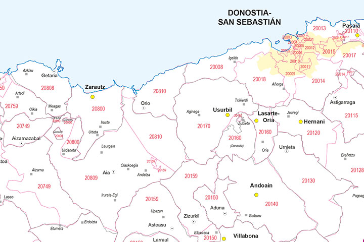
Digital map of the province of Gipuzkoa (Basque Country - Spain) with the areas of all 5-digits postal codes, administrative boundaries (state border, autonomous, provincial and municipal boundaries), cities and towns grouped and separated according to the number of inhabitants.
Available in 100% editable vector format, organized in separate layers to modify colors, texts and styles.
The map also contains the road network in a separate layer that can be displayed or hidden as desired.
-Original measurements:
59x42 cm (A2) (Fully resizable vector file for High-quality printing).
-Download formats:
Adobe Illustrator, Acrobat PDF
-You can also request a quote » to modify this map and adapt it to your projects.
Download up to 15 digital maps of your choice through a subscription to the 'Pack DigiAtlas'.

Postcode maps of cities, regions and countries. Optionally with demographic data for geo-marketing projects.

City street maps with delineation of urban areas, streets, squares, parks, green areas, buildings of interest, etc.