98,00 €
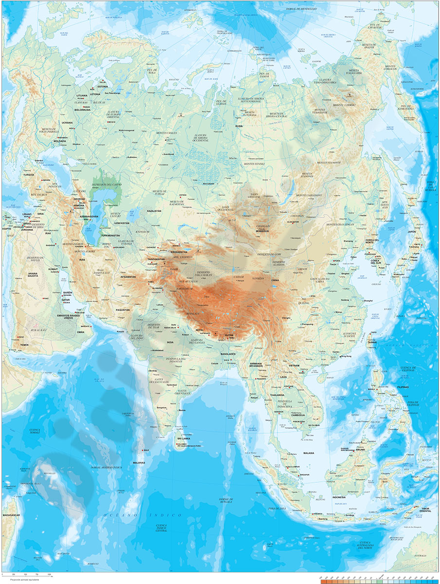
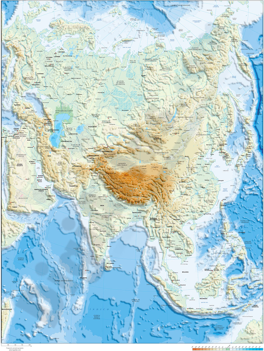
Asia physical vectorized-relief map
Digital map of ASIA.
(...) Read more »
Adobe Illustrator, Acrobat PDF, TIFF image
98,00 €
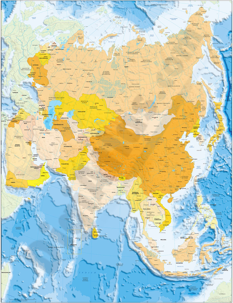
Asia political and geographical map
Digital political and geographical map of ASIA.
Download 100% editable vectorized files with political and geographical layers of information (borders, countries, rivers, lakes, capitals, important cities and geographical names).
Includes a TIFF image with the relief.
See less «
Adobe Illustrator, Acrobat PDF, TIFF image

19,95 €
Map of Malaysia
Fully editable vector file of Malaysia. Include political layers of inner administrative division, with their names and capitals.
Adobe Illustrator, Acrobat PDF