90,75 €
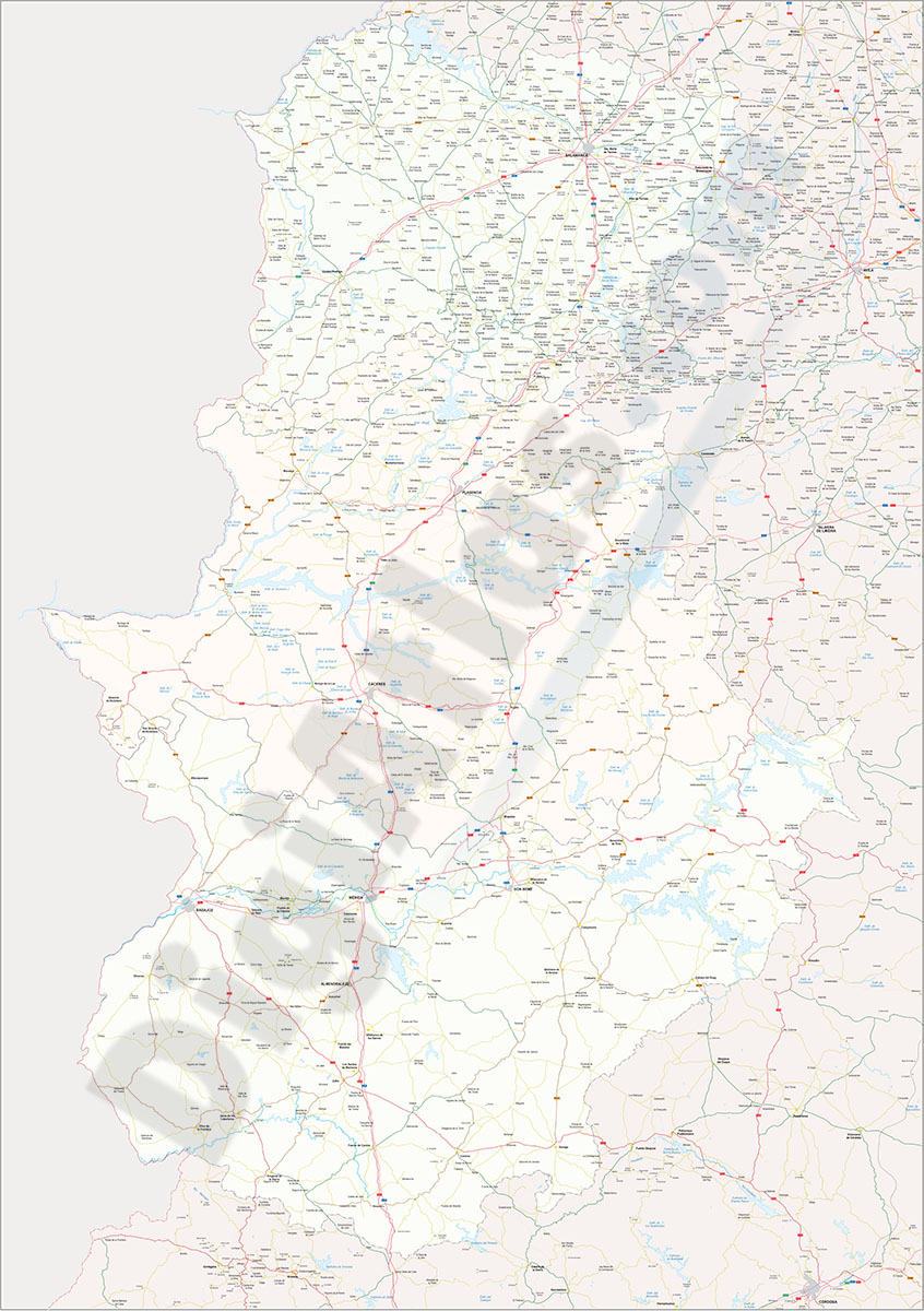
Cáceres-Badajoz-Salamanca provinces (Spain) - vector maps
Digital map of Spanish provinces of Cáceres, Badajoz and Salamanca with administrative borders, municipalities and localities, motorways, highways, national roads, regional and local roads, rail netw
(...) Read more »
Adobe Illustrator, Acrobat PDF

59,99 €
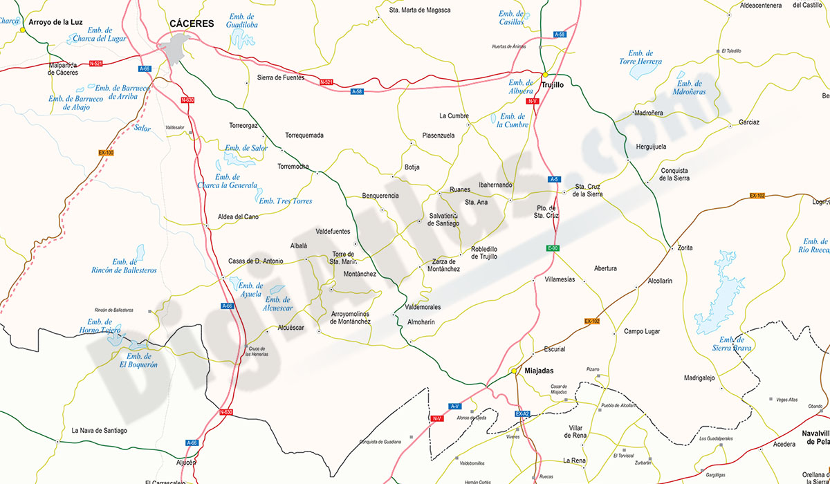
Map of Caceres
Digital map of the province of Cáceres (Extremadura, Spain) on a scale of 1:300.000
The map shows the regional and provincial boundaries, municipalities and towns, motorways, dual carriageways, national and regional roads of the first and second order, local roads, railway network, main rivers and lakes.
Tourist map of the province of Cáceres with relevant political and geographical information. Download files in vector format organised in layers and fully editable, to generate customised versions of the map and print at high quality.
See less «
Adobe Illustrator, Acrobat PDF