79,00 €
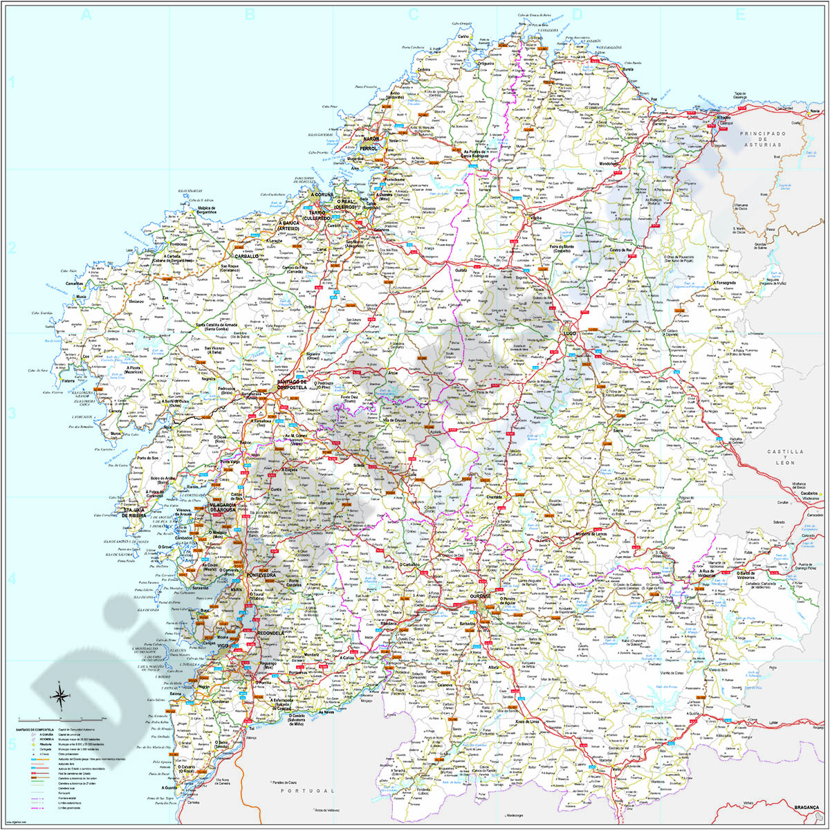
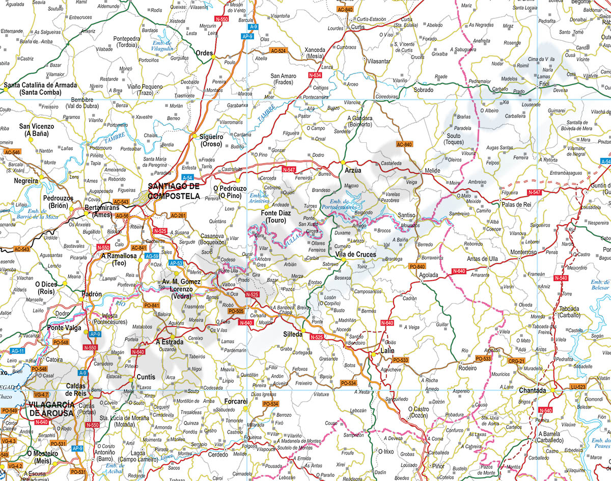
Galicia (Galizia) Spain autonomous community map
Digital poster size map of GALICIA autonomous community (Spain).
The map shows the autonomous, provincial and municipal limits (concellos), road and rail network with the labeling of highways and national roads, capitals, cities and population centers.
Two digital files are downloaded in vector format (Adobe Illustrator and Acrobat PDF), both organized in separate boxes for easy editing.
Poster size map for high quality printing.
See less «
Adobe Illustrator, Acrobat PDF
59,99 €
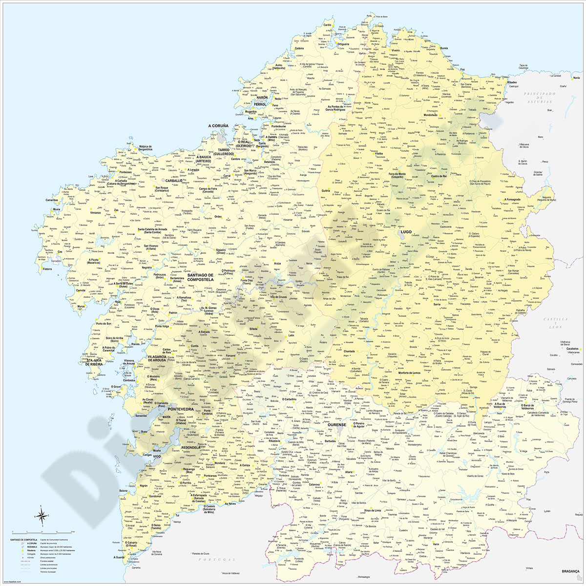
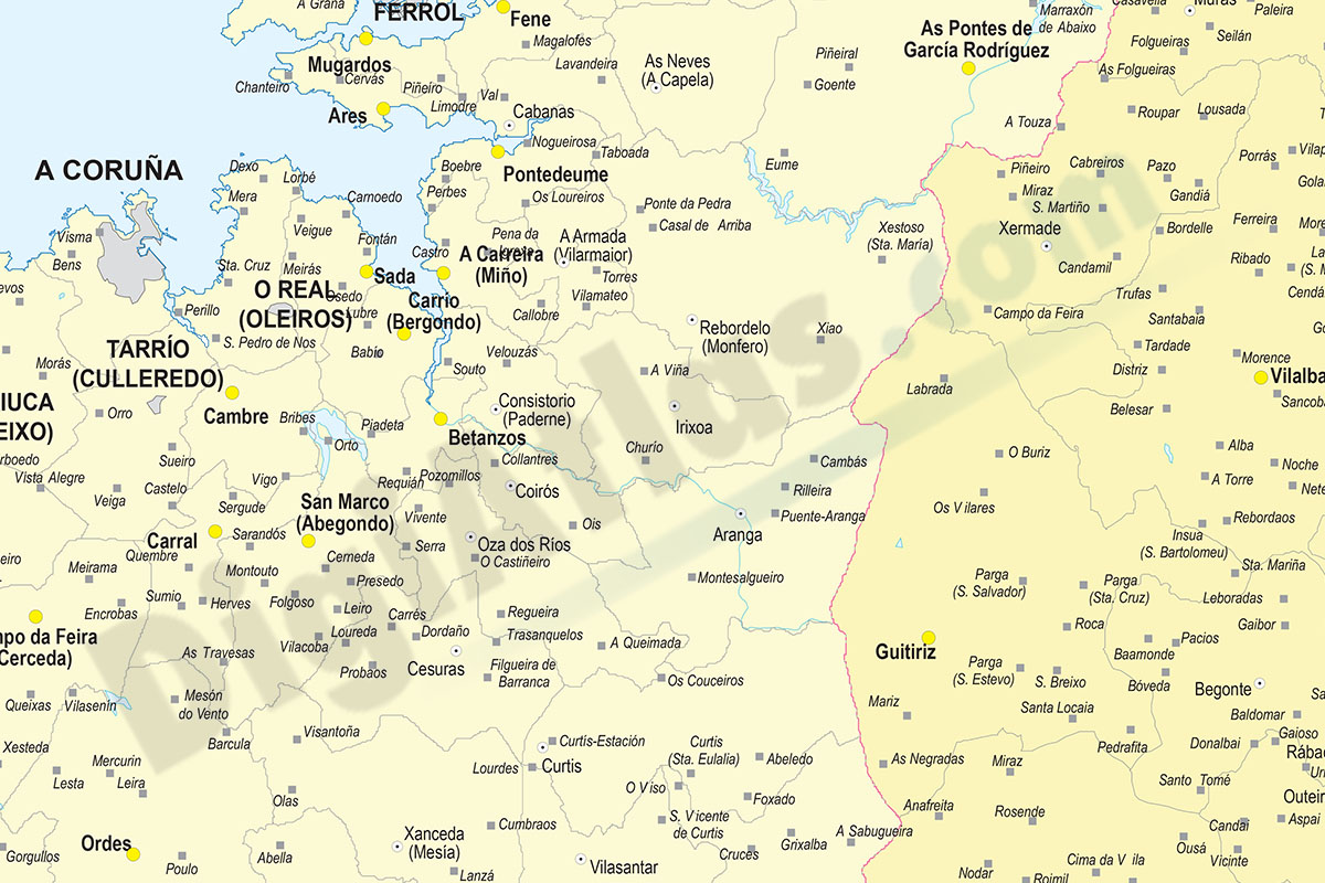
Galicia map with municipalities
Digital map of GALICIA autonomous community (northwest Spain) with the municipalities (concellos), their capitals and villages.
(...) Read more »
Adobe Illustrator, Acrobat PDF
245,00 €
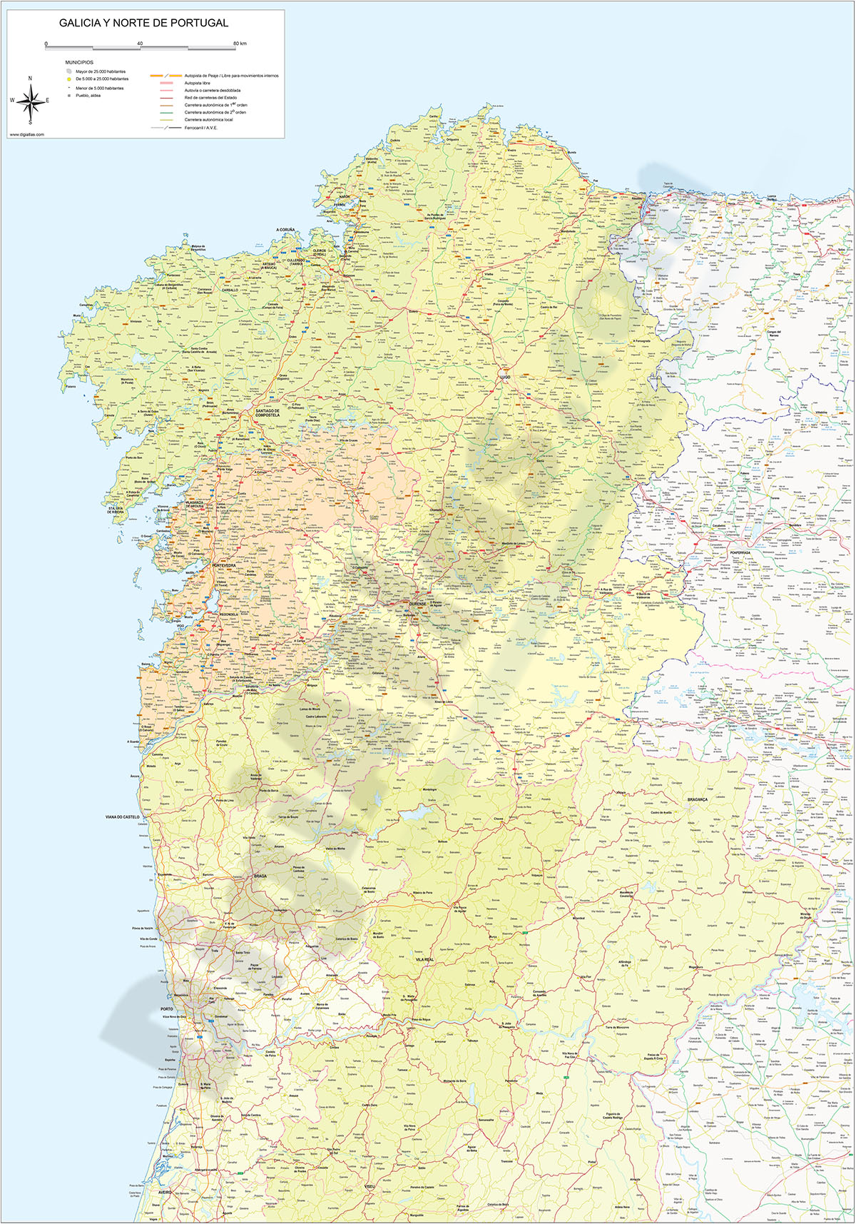
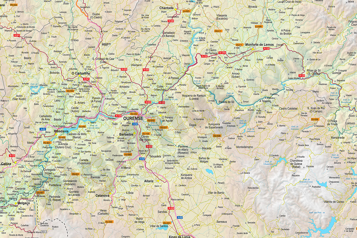
Map of Galicia and North Portugal
Vector map of the Autonomous Community of GALICIA and Northern Portugal.
(...) Read more »
Adobe Illustrator, Acrobat PDF
Ask price
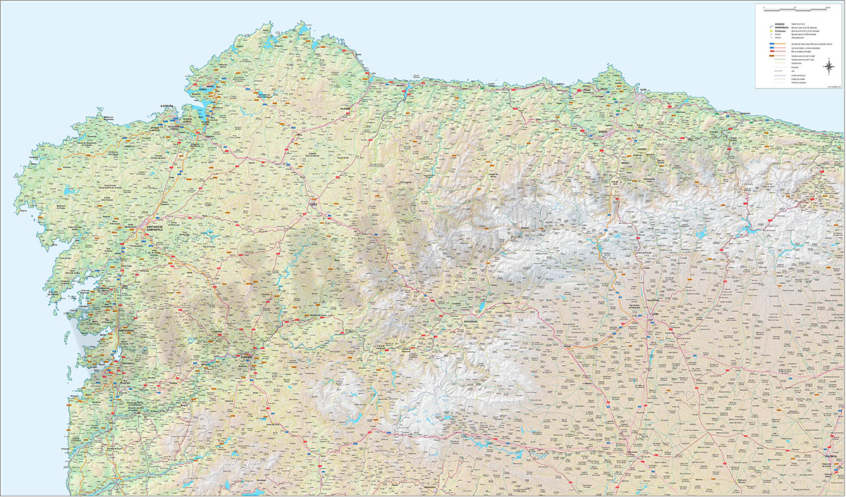
Roadmap of Galicia, Asturias and León
Detailed map of roads and towns in the northwest of Spain.
(...) Read more »
Adobe Illustrator, Acrobat PDF