
45,00 €
Cartagena - Population by postal code
Population by postal code of the municipality of Cartagena (Region of Murcia).
(...) Read more »
Excel

45,00 €
Santa Cruz de Tenerife- Population by postal code
Population data by postcode for the province of Santa Cruz de Tenerife (Canary Islands).
(...) Read more »
Excel
350,00 €
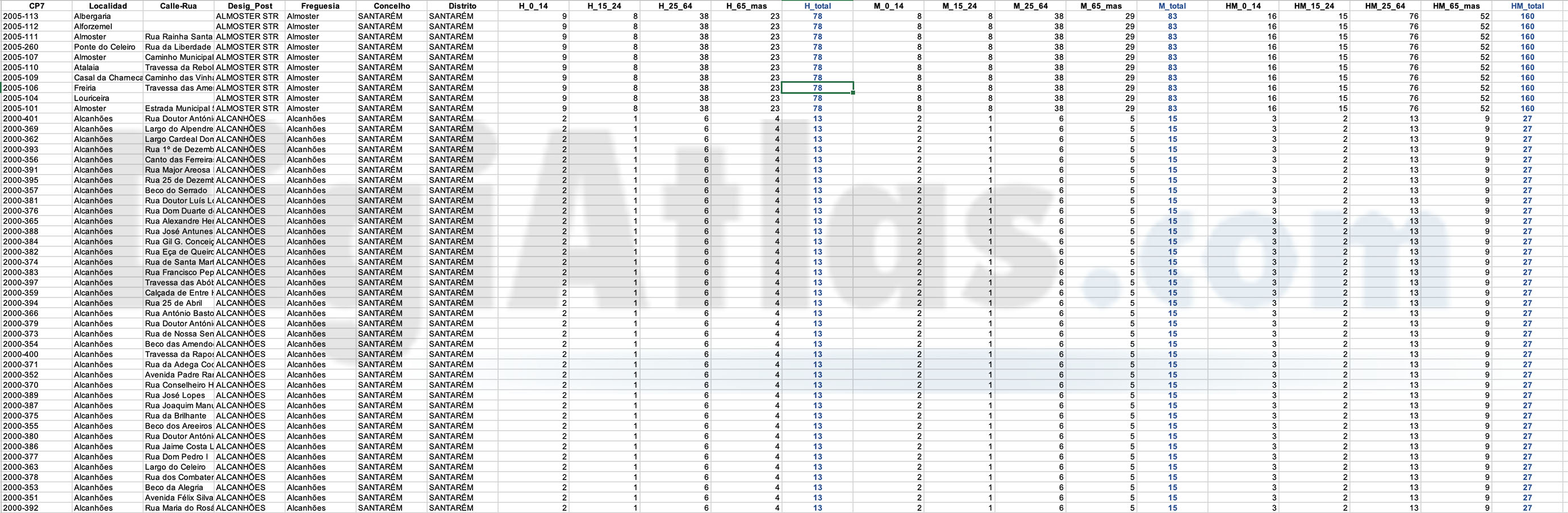
Portugal - Population by 7-digit postal code
Excel file with the inhabitants by 7-digit postcodes of Portugal.
(...) Read more »
Excel

98,00 €
Burgos and La Rioja - inhabitants by postcode
Digital map of the province of Burgos and the autonomous community of La Rioja showing the municipalities, postcode boundaries and the number of inhabitants of each postcode.
(...) Read more »
Adobe Illustrator, Acrobat PDF y Excel
Ask price
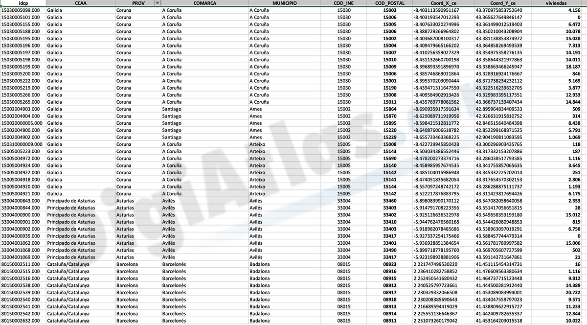
Number of dwellings by postcode in Spain
Number of dwellings by Postal Code
There are 235 municipalities in Spain with more than 25,000 inhabitants and with more than one postal code within their municipal boundaries.
(...) Read more »
Excel
125,00 €
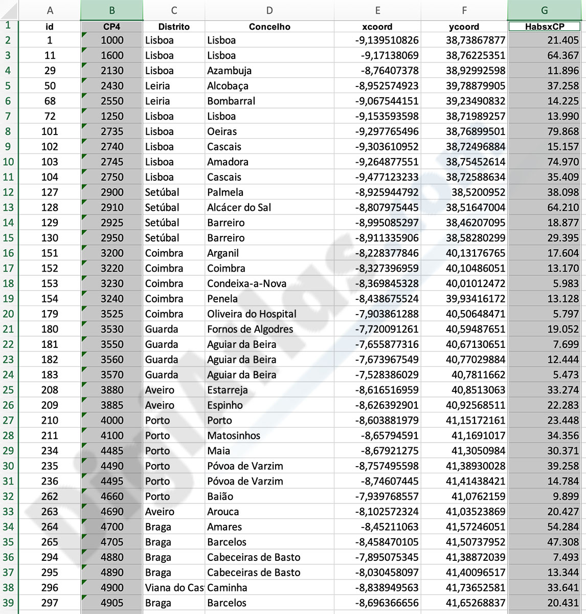
Portugal - Excel population by 4-digit postal code
Excel file with the inhabitants by 4-digit postcode of Portugal.
(...) Read more »
Excel
151,25 €
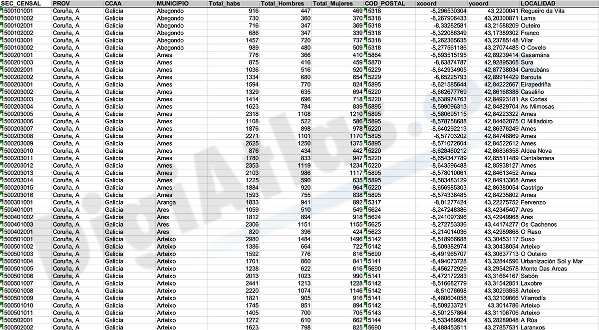
Population by census area of Galicia
Number of inhabitants for each census section in Galicia autonomous community, Spain.
(...) Read more »
Excel, KML

90,75 €
Cartagena and Madrid community - Population by postal code
Historical population data by postal code of the municipality of Cartagena (Region of Murcia) and the Community of Madrid.
Population data from 2017 to 2021.
(...) Read more »
Excel

Ask price
Spanish census sections
-Complete Digital map of Census Sections of whole Spain always 100% up to date.
-Georeferenced cartography in Shapefile format (and other file formats) of spanish Census Sections for each autonomous community, province, municipality and district of all localities of Spain, included peninsula, Balearic and Canary islands, Ceuta and Melilla.
-Our Census Sections map of Spain is one of the most detailed and up-to-date of the market, as they are manually modified and corrected permanently on the basis of spanish National Statistics Institute (INE) and Geographical National Institute (IGN) data.
-Cartographic data includes all polygons which actually covers the whole spanish national territory and that may be associated with population data offered by INE or any other kind of information related to census sections.
-Optimized for geomarketing projects and marketing research purposes, the acquisition of our cartography allows you to access to a personalized webpage in DigiAtlas and download the updated provincial maps for one year from the date of purchase. In this way, you will be able to dispose of all changes that occur during this period and to benefit from a substantial discounts for future years.
For example, you can download any map now in this month and download it again in 11 months with all changes that has been carried out during this time period.
See less «
Shapefile (.shp), kml y otros formatos.
78,65 €
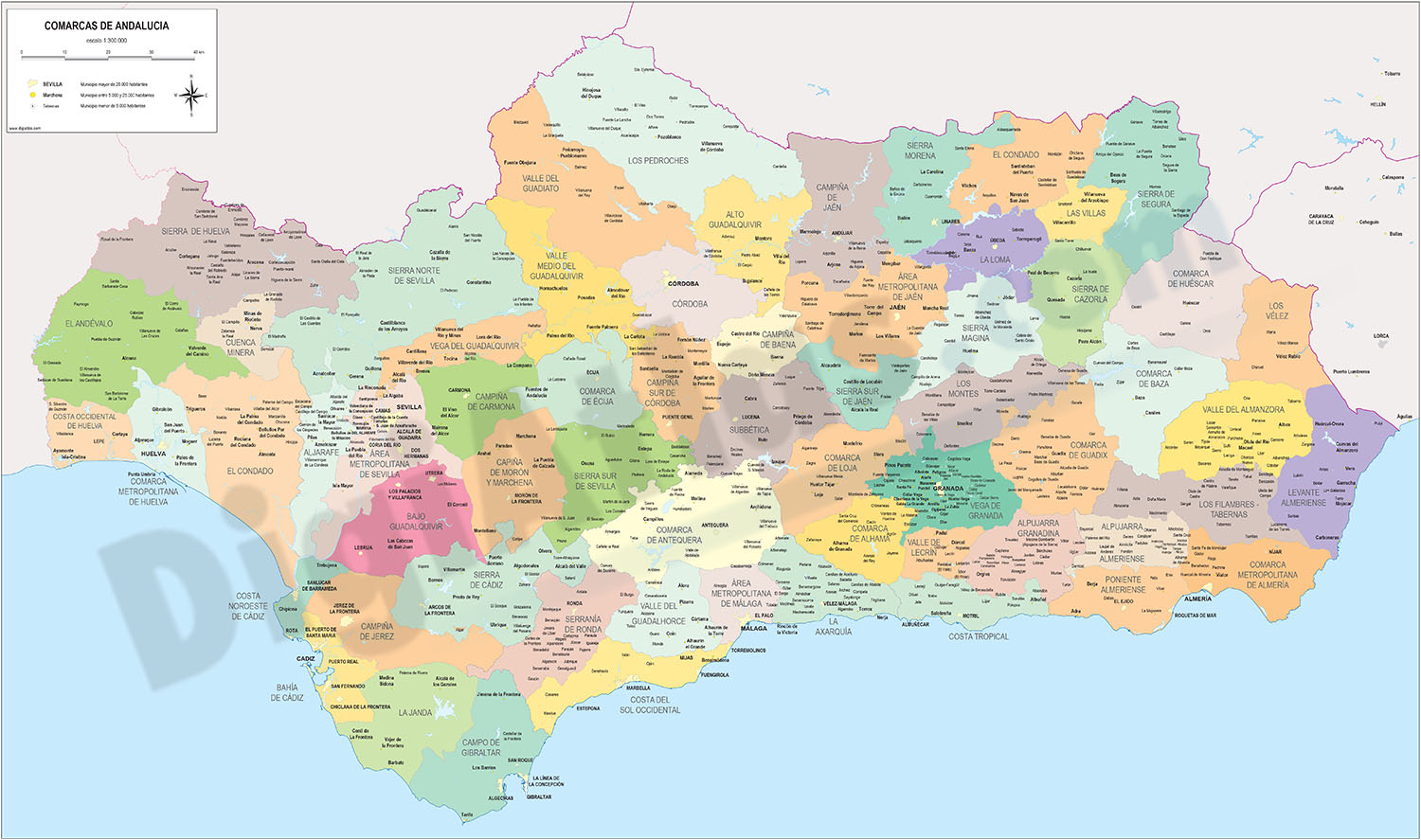
Andalucia - map of comarcas
Digital map of Andalusia (Andalucia autonomous community, Spain) with the comarcas and municipalities in 100% editable vector format.
(...) Read more »
Adobe Illustrator, Acrobat PDF

175,00 €
Population by postcode in Spain
-NUMBER OF INHABITANTS OF EACH ZIP CODE IN SPAIN.
Learn the population data for every zip code in Spain with this comprehensive database.
(...) Read more »
Excel

175,00 €
Barcelona - City map with portal numbers
Digital street map of Barcelona with street numbers.
(...) Read more »
Acrobat PDF

98,00 €
Gijón - city map
Digital street map of Gijón (Principality of Asturias) with urban area delineation, municipal boundaries and street and square names. Poster size map 1414x1000 mm (ISO B0).
(...) Read more »
Adobe Illustrator, Acrobat PDF

98,00 €
Robinson projected Worldmap centered in Bahrain
Worldmap in Robinson projection centered in Bahrain. Include physical information (colors of topography and bathimetry), country boundaries, capitals, major river and lakes and major cities. Vector fo
(...) Read more »
Acrobat PDF

79,00 €
Pontevedra (Galicia, Spain), map of province with parroquias and villages
Map of province of pontevedra (Galicia, Spain) showing Autonomous Communities and provinces limits, concellos and parroquias boundaries, cities, towns, 'aldeas', highways, major and minor roads, railr
(...) Read more »
Adobe Illustrator, PDF, JPG (300dpi)
