
79,00 €
Comarcal maps of Spain autonomous communities
Maps of the comarcal division of all 17 spanish autonomous communities. Each map shows administrative limits and their coloured and named comarcas, capitals and major cities.
(...) Read more »
Adobe Illustrator, PDF

120,00 €
Map of Spain 100x70 cm
Poster size map of Spain and Portugal, 100x70 cm.
(...) Read more »
Adobe Illustrator, Acrobat PDF

55,00 €
Map of Spain and Portugal DIN A3
Map of Spain and Portugal with major cities and roads. DIN A3 paper size. vector file 100% editable
Illustrator, PDF

55,00 €
Map of Spain and Portugal with cities
Digital map of Spain and Portugal with regional and provincial boundaries and a large number of towns.
(...) Read more »
Adobe Illustrator, Acrobat PDF
55,00 €
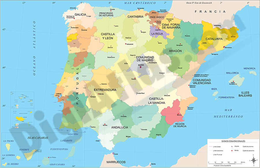
Map of Spain and Portugal with communities and provinces
Political map of Spain and Portugal in digital format, showing the internal administrative division of each country, Spanish Autonomous Communities and provinces, and the continental districts and aut
(...) Read more »
Adobe Illustrator, Acrobat PDF.

55,00 €
Map of Spain with cities over 25,000 citizens
Digital map of Spain showing cities and towns with more than 25,000 inhabitants.
(...) Read more »
Adobe Illustrator, PDF, JPG (300dpi)

55,00 €
Map of Spain with postal codes
Map of Spain showing Autonomous Communities, provinces, major cities and 2-digit postal codes. Fully editable and resizable vector file formats.
Adobe Illustrator, Acrobat PDF

55,00 €
Map of Spain with provinces and major cities (over 10000 citizens)
Digital map of Spain with regional and provincial boundaries, municipalities and all the towns with more than 10,000 inhabitants.
(...) Read more »
ArcView Shapefile (.shp)

55,00 €
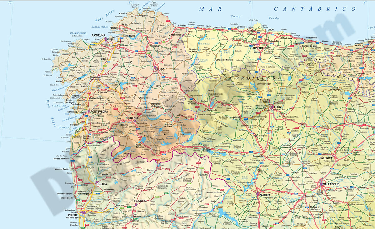
Relief map of Spain
Digital physical-political map of Spain, with the limits and colours of the Autonomous Communities and provinces, large names of capitals and important towns, geographical names and a shaded and colou
(...) Read more »
Adobe Illustrator, Acrobat PDF, TIFF

55,00 €
Spain and Portugal provinces for PPT
Political map of Spain and Portugal in PowerPoint format. The map shows the 18 Portuguese mainland districts and their two autonomous regions (Azores and Madeira) and the 17 Spanish Autonomous Communi
(...) Read more »
PowerPoint (ppt)

19,95 €
Spain map Autonomous Communities and provinces
Map of Spain in digital format showing 17 autonomous communities, 2 autonomous cities and 50 provinces and their capitals. Fully editable and resizable vector file.
Adobe Illustrator, Acrobat PDF

55,00 €
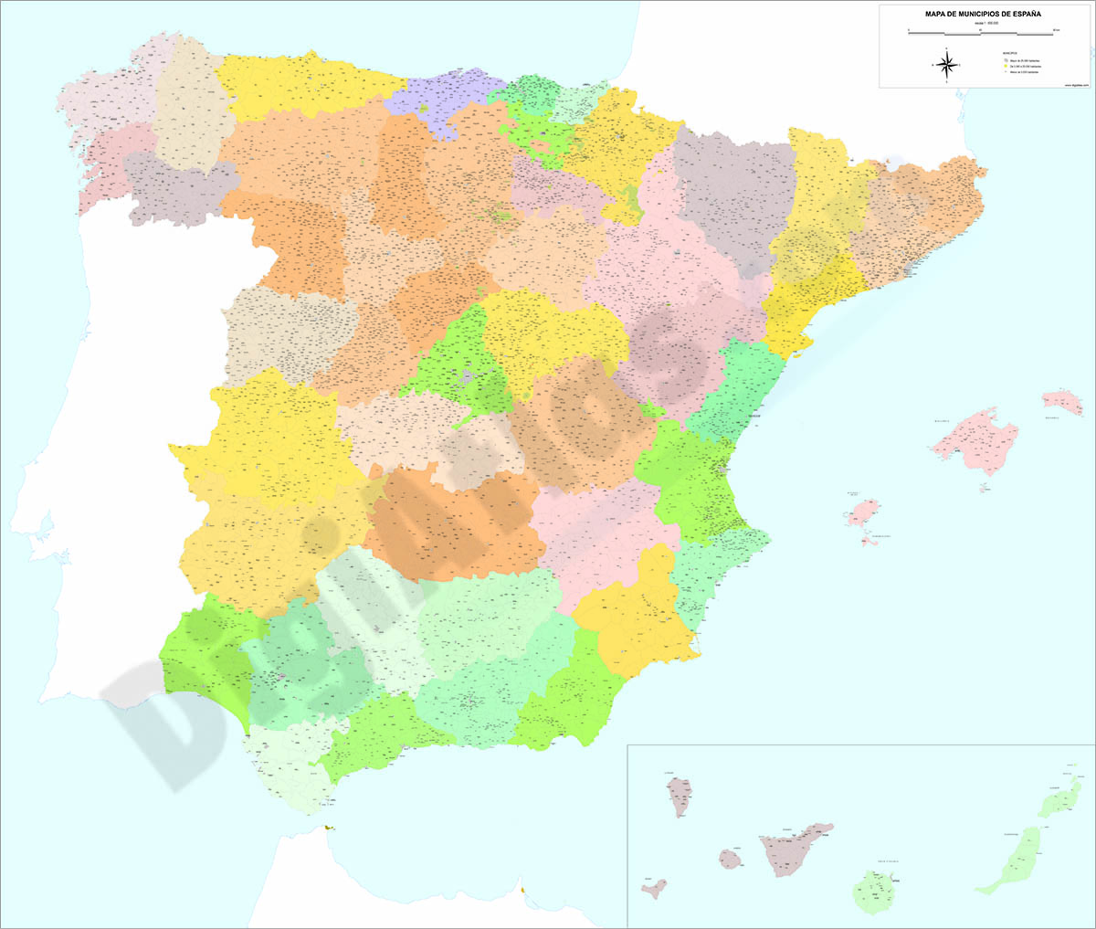
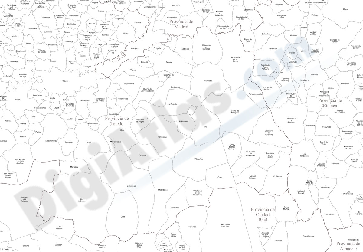
Spain map with municipalities
Digital map of Spain in georeferenced Shapefile format.
Spain vectorisez cartography showing the limits of the autonomous communities, provinces and municipalities.
(...) Read more »
ArcView Shapefile (.shp)
79,00 €
Spain map with municipalities
Fully editable vector file map of Spain, showing all municipality boundaries and cities.
Adobe Illustrator, PDF

79,00 €
Spain political-relief poster map
Physical-political Spain map. Include a lot of roads, more than 3.500 cities, major rivers and lakes and geographical names. More than 40 fully-editable layers. 1.1.000.000 scale. High-resolution colo
(...) Read more »
Adobe Illustrator, PDF, JPG (300dpi)