55,00 €
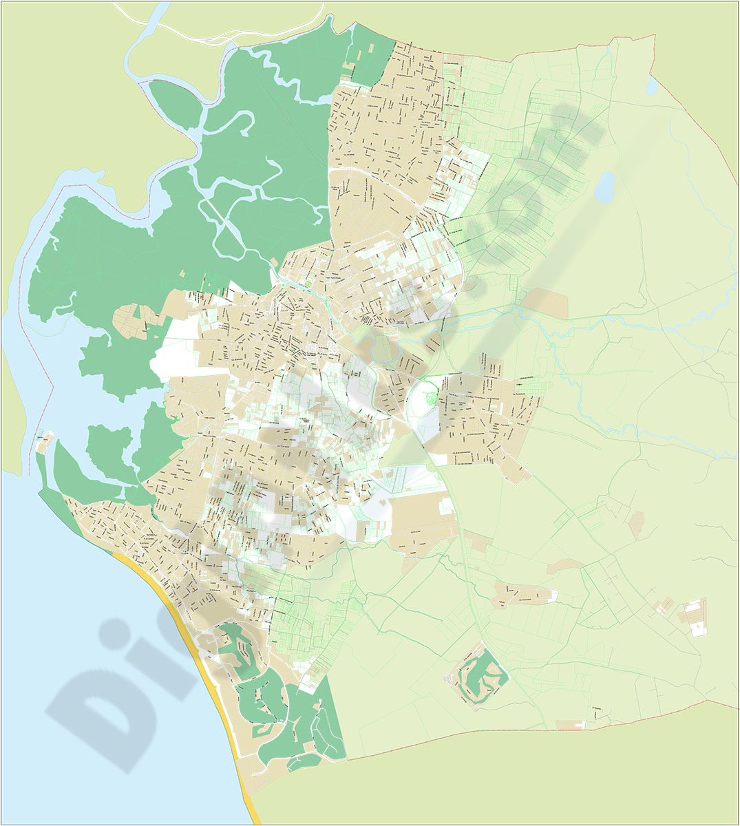
Chiclana de la Frontera - city map
Vector file map of Chiclana de la Frontera (province of Cadiz, ANDALUCIA, Spain). All features are in separated layers.
Adobe Illustrator, Acrobat PDF
151,25 €
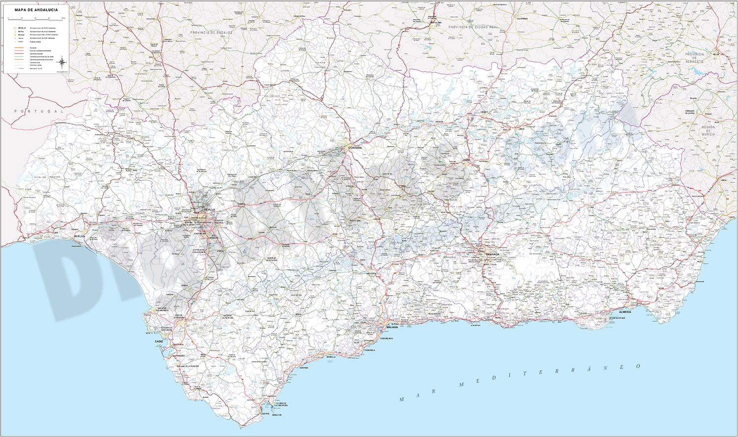
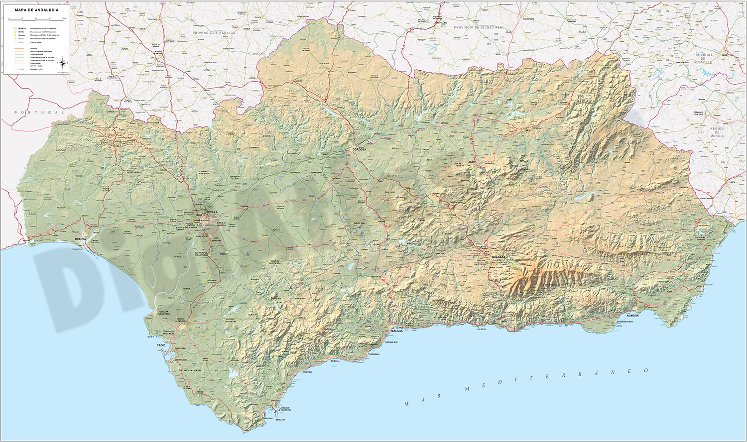
Andalucia Poster Map
Detailed map of all Andalusia autonomous community of Spain at a scale of 1:300.000, with municipal, provincial and autonomous boundaries, rivers and lakes, road network up to local road level, railwa
(...) Read more »
Adobe Illustrator, Acrobat PDF
39,00 €
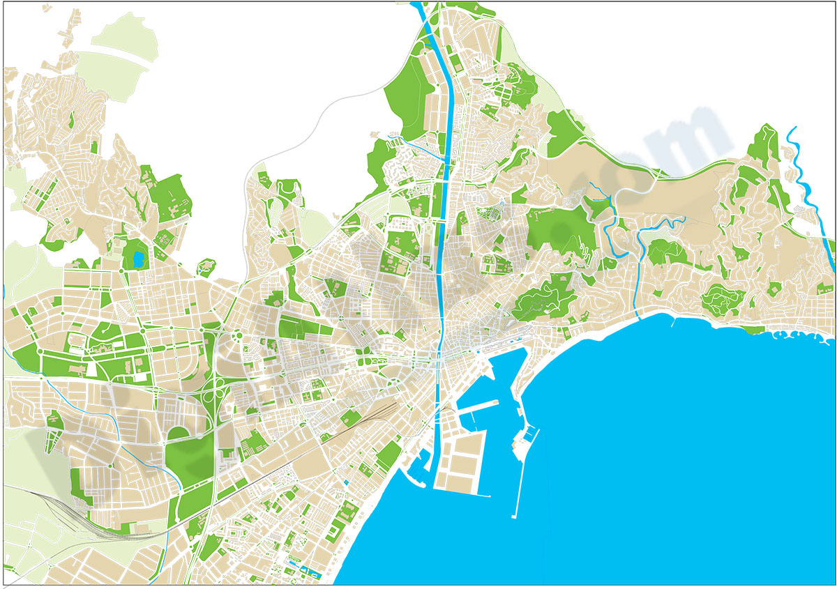
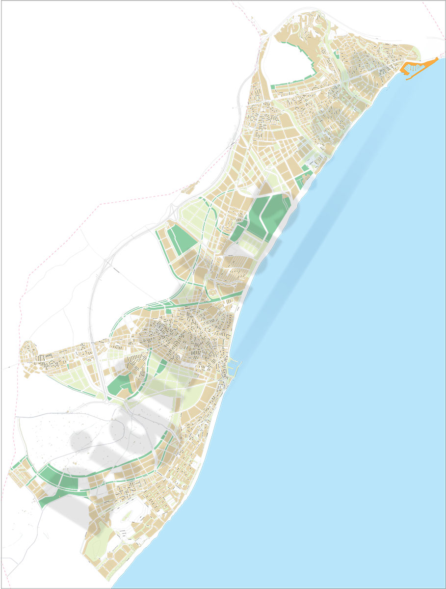
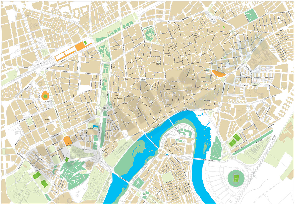
Malaga city map without text
Street map of the city of Malaga (ANDALUCIA, Spain) with the delineation of streets and squares, blocks of houses and green areas, without texts. Mute map of Malaga. Vector file organized in separate
(...) Read more »
Adobe Illustrator, Acrobat PDF
98,00 €
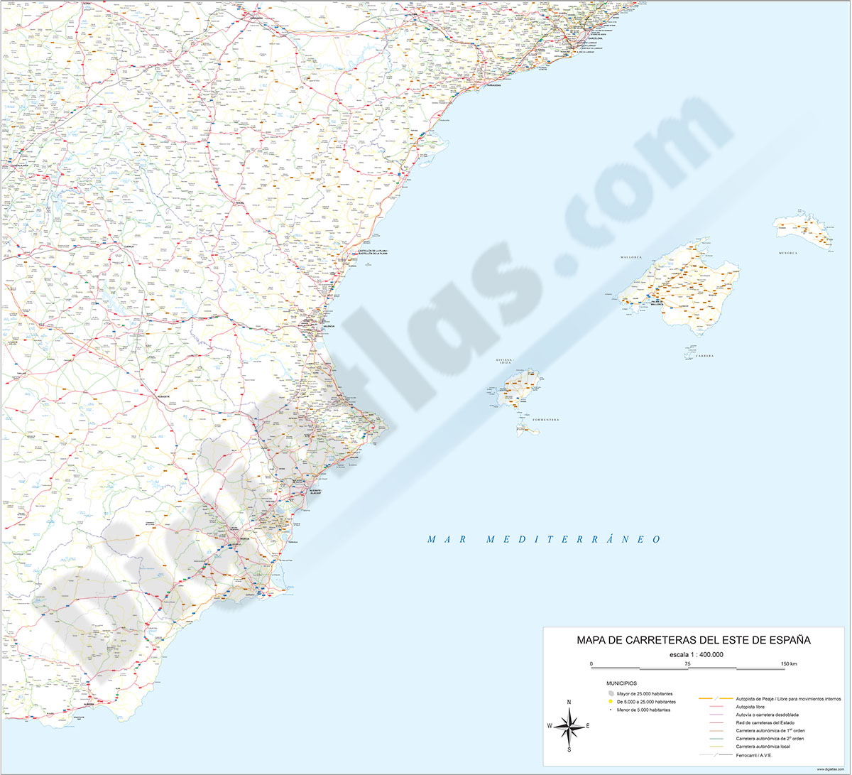
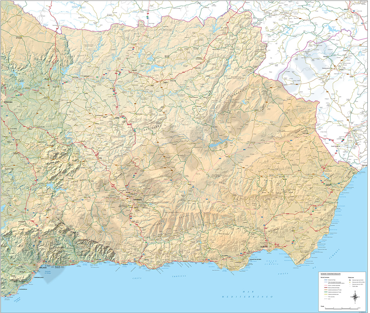
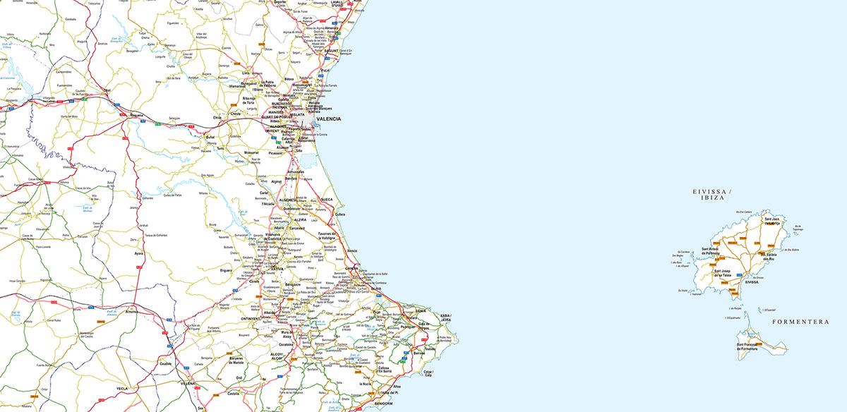
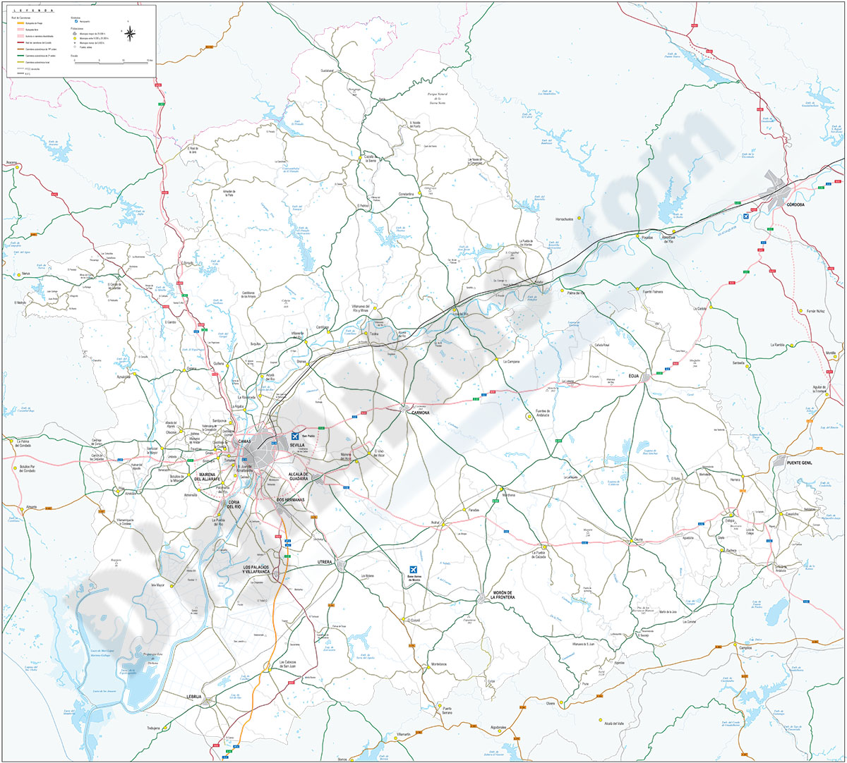
Map of south-eastern Spain
Digital map of roads and towns in south-eastern Spain.
(...) Read more »
Adobe Illustrator, Acrobat PDF

59,99 €
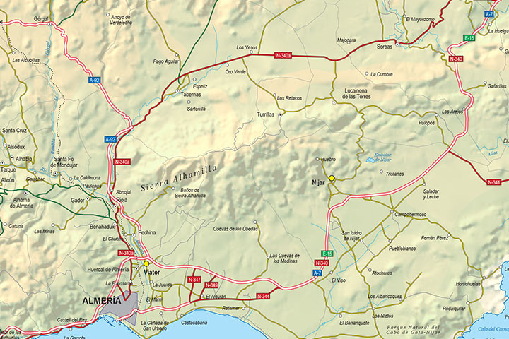
Almeria - Province digital map
Digital map of the Almeria spanish province, showing community and province boundaries, cities, highways, major and minor roads, railroad, principal rivers and lakes and other relevant political infor
(...) Read more »
Adobe Illustrator, PDF
59,00 €
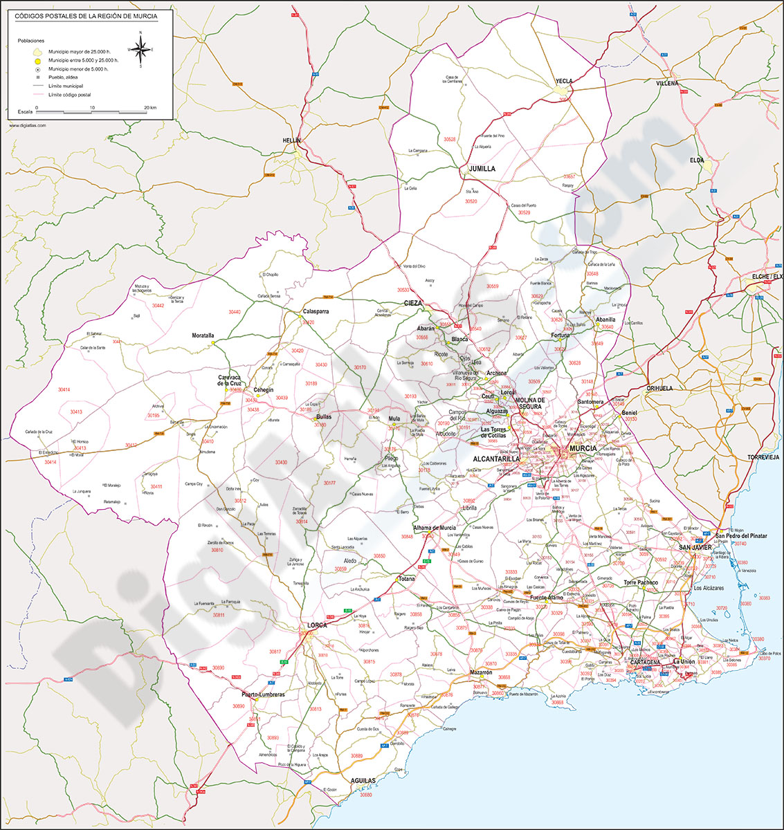
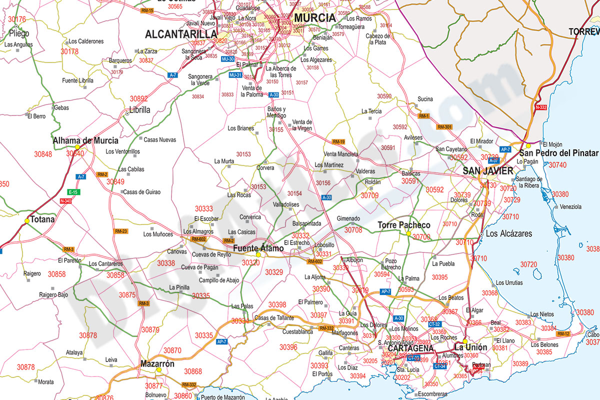
Map of Murcia autonomous community with municipalities and postal codes
Map of murcia region (Spain) showing municipalities borders and postal codes.
Adobe Illustrator, PDF, JPG(300 dpi)
59,00 €
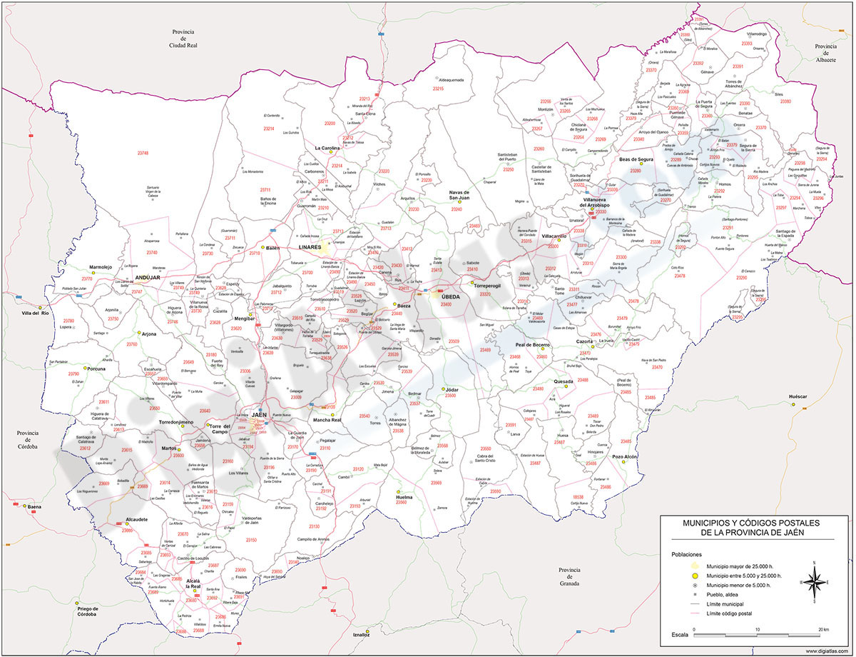
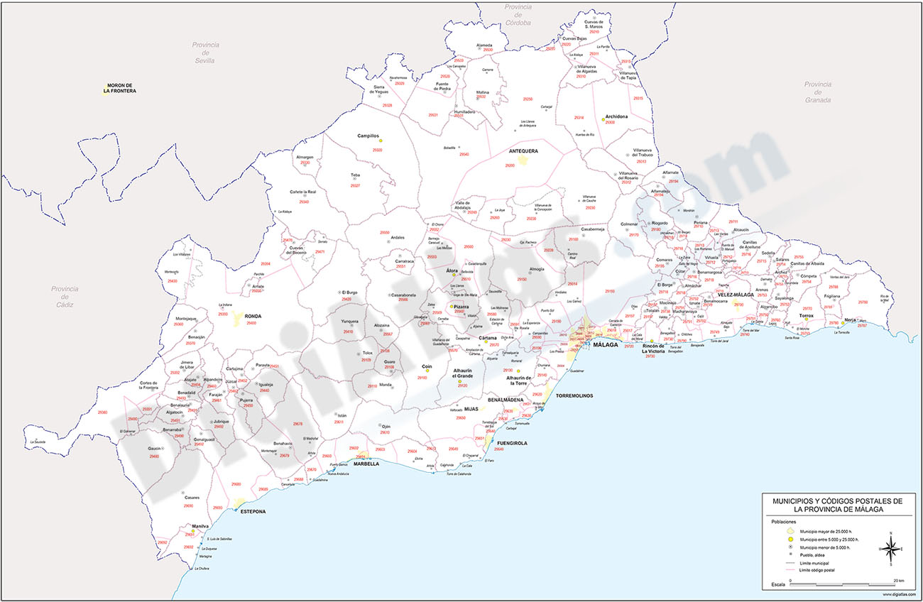
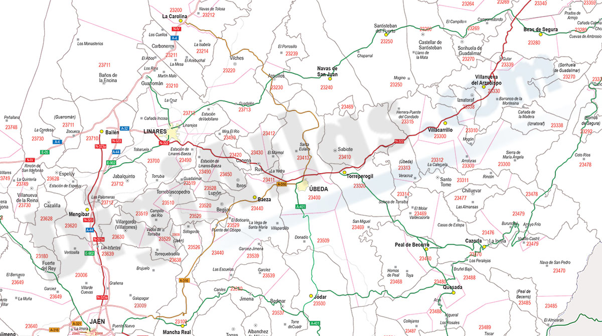
Map of Jaen province with municipalities and postal codes
Digital map of postal codes of the province of Jaén (Andalusia autonomous community). The map shows the municipalities, capitals, cities and towns grouped according to their number of inhabitants and
(...) Read more »
Adobe Illustrator, Acrobat PDF

59,00 €
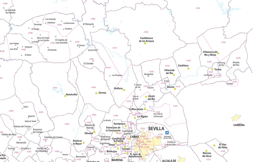
Map of Sevilla province with municipalities and postal codes
Digital map of the province of Seville (autonomous community of Andalusia, Spain) with municipalities, towns grouped according to number of inhabitants and all 5-digit postal code areas.
(...) Read more »
Adobe Illustrator, Acrobat PDF
59,00 €
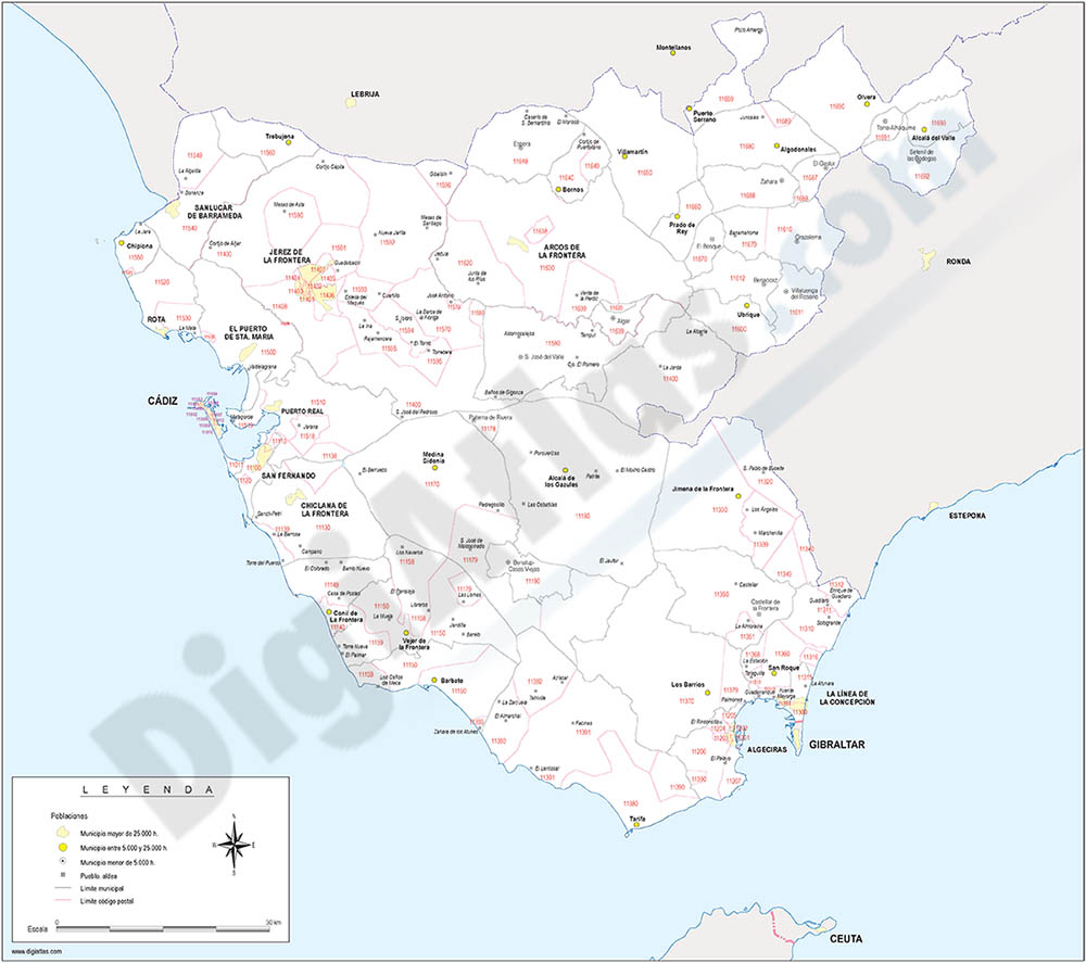
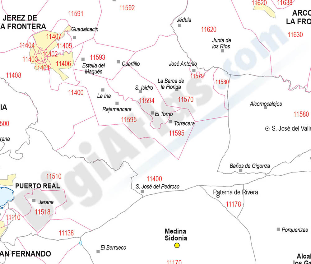
Map of Cadiz province with municipalities and postal codes
Map of Cadiz province (ANDALUCIA-Spain) showing municipalities borders, cities and 5-digit postal code areas. Vectorized fully editable format. Continuously Updated.
Adobe Illustrator, PDF, JPG(300 dpi)
59,00 €
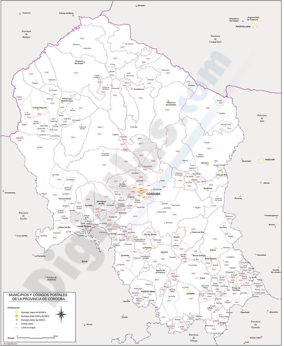
Map of Cordoba province with municipalities and postal codes
Digital map of the province of Cordoba (Andalusia, Spain) with municipalities, cities, towns and all 5-digit postal code areas.
(...) Read more »
Adobe Illustrator, Acrobat PDF
135,00 €
Andalusia - autonomous community map with municipalities and postal codes
Map of the 8 provinces of Andalusia (autonomous community in southern Spain) showing municipalities borders and 5-digit postal codes areas. Continuously Updated. Vectorized and fully editable formats.
Adobe Illustrator, PDF
55,00 €
Roquetas de Mar - city map
Vector-file map of Roquetas de Mar (Province of Almeria, autonomous community of Andalucía, Spain). All features are in separated layers.
Adobe Illustrator, PDF
79,00 €
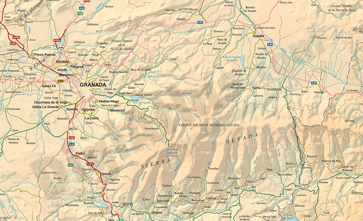
Map of Eastern Andalucia (Spain)
Map of Eastern ANDALUCIA (Granada, Jaen and Almeria provinces), showing community and province boundaries, cities, highways, major and minor roads, railroad, rivers and lakes and relevant geographic i
(...) Read more »
Adobe Illustrator, Acrobat PDF
59,99 €
Map of Sevilla
Vectorized map of province of Sevilla (Andalucía, Spain) showing community and province boundaries, municipality borders, capitals, cities and towns, highways, major and minor roads, railroad, princi
(...) Read more »
Adobe Illustrator, PDF
55,00 €
Cordoba center - city map
Vector-file map of the center city of Cordoba (ANDALUCIA, Spain). All features are in separated layers.
Illustrator, PDF, JPG (300dpi)