
175,00 €
Barcelona - City map with portal numbers
Digital street map of Barcelona with street numbers.
(...) Read more »
Acrobat PDF

75,00 €
Postcodes 50 km radius from Lleida
Map of postcodes within a 50 km radius of the centre of Lleida.
The map shows the municipal boundaries, their capitals and the areas of all the postcodes.
(...) Read more »
Adobe Illustrator, Acrobat PDF

114,95 €
Map of Huesca and Lleida
Digital map of the provinces of Huesca and Lleida at a scale of 1:300.000, with the autonomous and provincial limits, municipalities, cities and towns, road and railway network, motorways, dual carria
(...) Read more »
Adobe Illustrator, Acrobat PDF

55,00 €
Binefar - city map
Digital map of Binefar city (province of Huesca, Autonomous community of ARAGON, Spain) showing urban area, streets and squares delineation, blocks of buildings, parks, green areas and urban toponymy.
(...) Read more »
Acrobat PDF
59,00 €
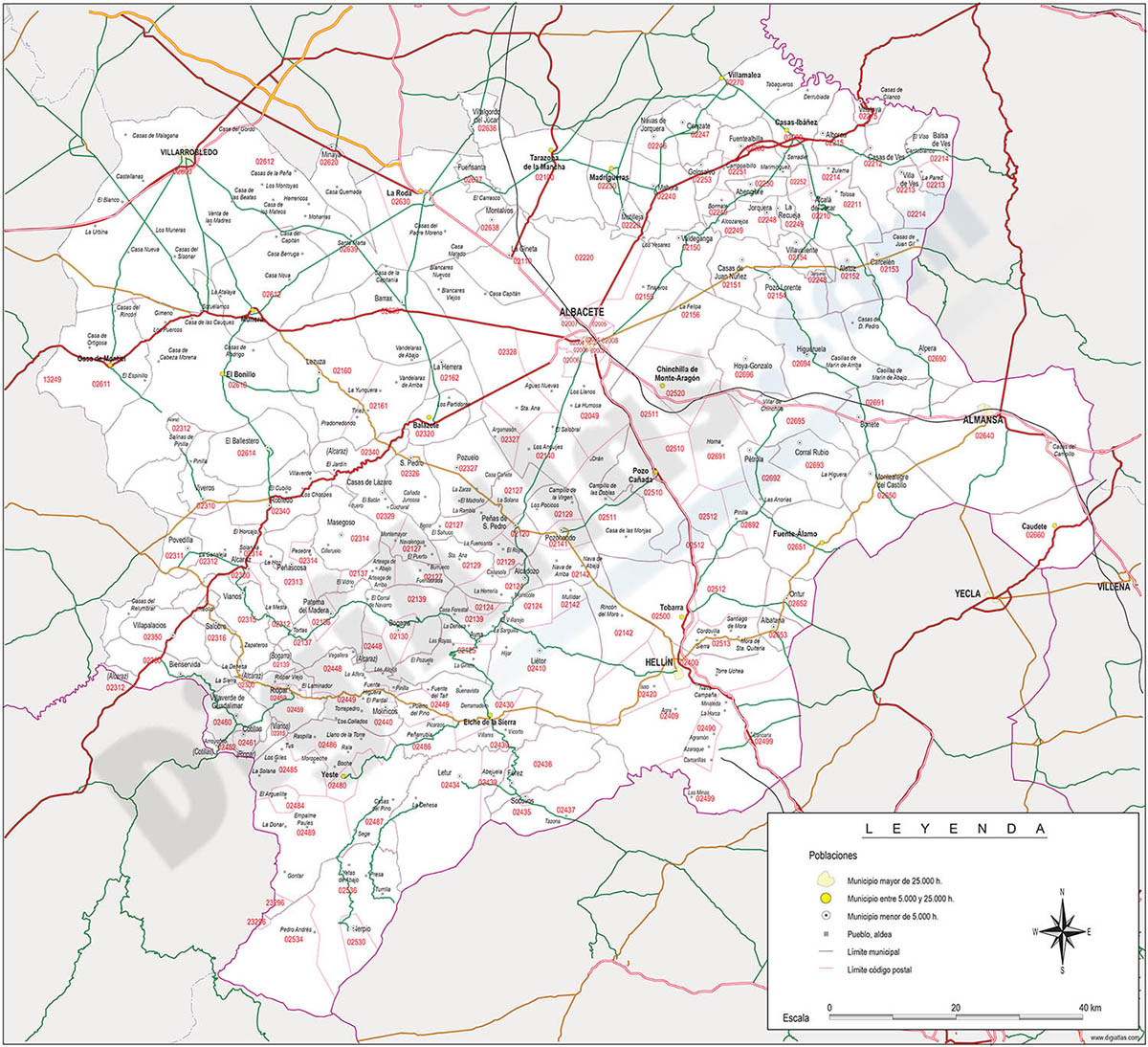
Map of Albacete province with municipalities, postal codes and major roads
Map of Albacete province (Castilla-La Mancha, Spain) showing municipalities borders, 5-digit postal codes areas and major roads. Continuously updated.
Adobe Illustrator, PDF

125,00 €
Barcelona City map
Digital street map of Barcelona with the delineation of streets and squares, blocks of houses, parks and green areas, with colours and names of all the streets.
(...) Read more »
Adobe Illustrator, Acrobat PDF

125,00 €
Northern roadmap of Spain
Vector file map of Cantabria, Basque Country, Navarra, La Rioja and Aragón Autonomous communities of Spain, with all cities and roads, railroad, principal rivers and lakes and other relevant politica
(...) Read more »
Adobe Illustrator, Acrobat PDF

98,00 €
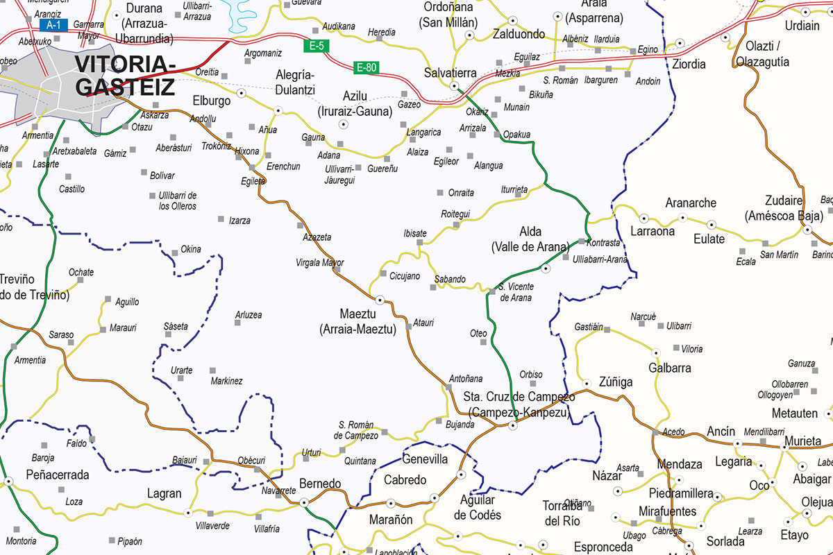
Map of Basque Country, Navarra, La Rioja, Burgos, Soria and Aragón
Vector-file map of the Basque country, Navarra, La Rioja, Burgos, Soria and Aragón spanish provinces, with detailed political and geographical information, such as administrative limits, towns and ci
(...) Read more »
Acrobat PDF, JPG (300dpi)
79,00 €
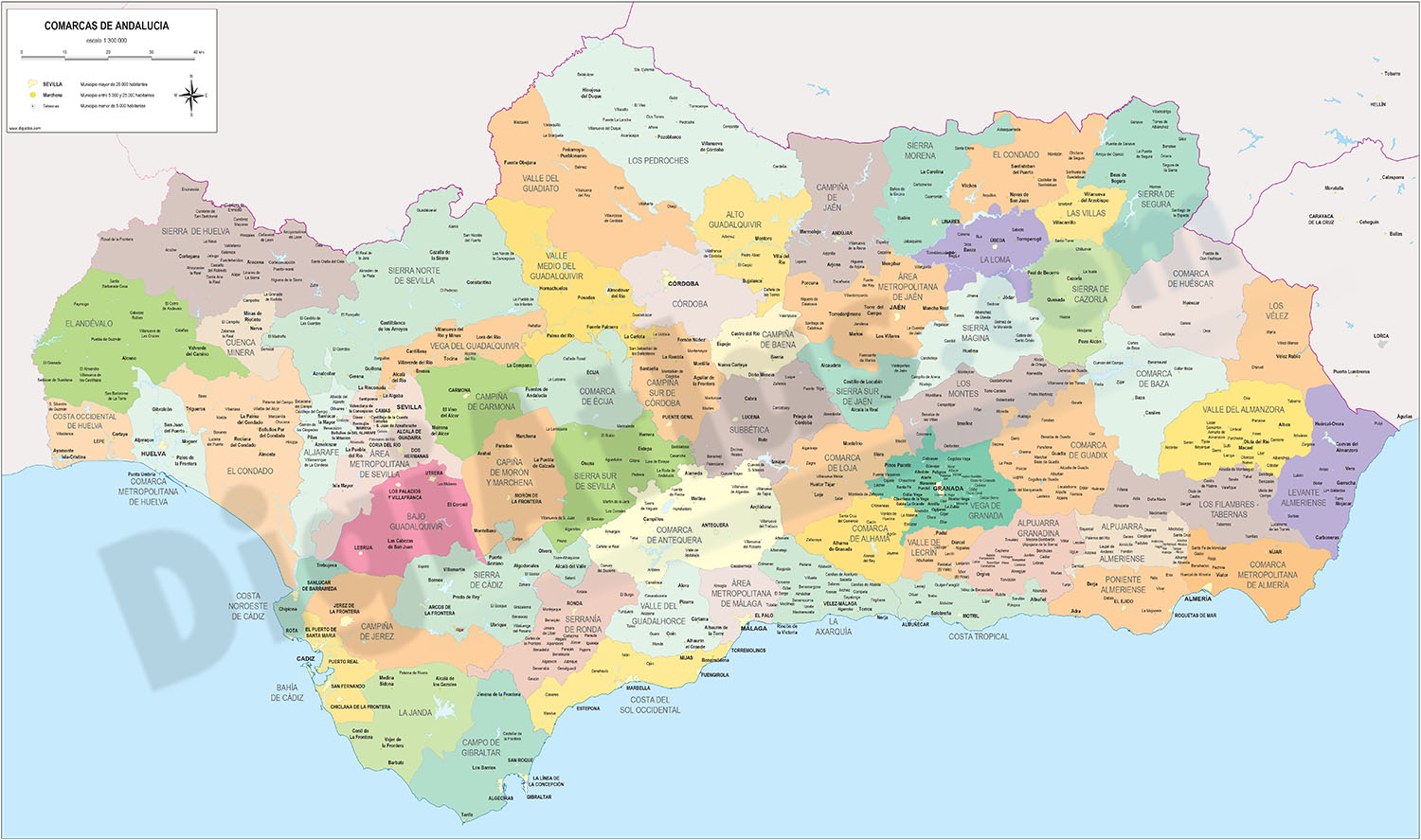
Comarcal maps of Spain autonomous communities
Maps of the comarcal division of all 17 spanish autonomous communities. Each map shows administrative limits and their coloured and named comarcas, capitals and major cities.
(...) Read more »
Adobe Illustrator, PDF

175,00 €
Roadmap of northwestern Spain
Vector file map of Northern and Western Autonomous communities of Spain, with all cities and roads, railroad, principal rivers and lakes and other relevant political information. Scale 1:300.000.
Adobe Illustrator, Acrobat PDF

55,00 €
Zaragoza (Saragossa ) center - city map
Street map in digital format of the city centre of Zaragoza (Spain), with the delineation of streets and squares, blocks of houses, parks and green areas, with colours and names.
(...) Read more »
Adobe Illustrator, Acrobat PDF

59,00 €
Map of Huesca province with municipalities and postal codes
Digital map of the province of Huesca (ARAGON, Spain) with municipalities, towns and postal codes.
(...) Read more »
Adobe Illustrator, Acrobat PDF
89,00 €
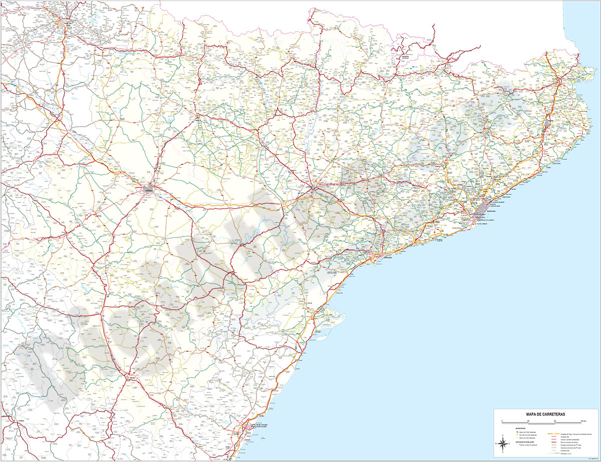
Map of Catalonia and Aragon with all roads and cities
Detailed map of Catalonia and ARAGON autonomous communities at scale 1:300,000 showing all motorways, national, regional and local roads and all towns and villages. vectorized file organized in separa
(...) Read more »
Adobe Illustrator, PDF, JPG (300dpi)

95,00 €
Albacete - city map
Street map of Albacete city (capital of the province of Albacete, autonomous community of Castilla-La Mancha, Spain) in digital format.
(...) Read more »
Adobe Illustrator, Acrobat PDF

59,00 €
Map of Basque Country, Navarra and La Rioja
Map of the Basque Country, Navarra and La Rioja at a scale of 1: 300,000. Digital map with the provinces of the 3 autonomous communities, their municipalities, capitals, cities and towns grouped accor
(...) Read more »
Adobe Illustrator, Acrobat PDF, JPG (300dpi)