
59,00 €
Major roads map of Spain and Portugal
Digital map of Spain and Portugal with the general road network, hydrographic network and main towns.
(...) Read more »
Adobe Illustrator, Acrobat PDF

Ask price
Detailed roads and cities map of Spain
Detailed vector road map of Spain (excluding Portugal) at a scale of 1:600.000 and adjusted to 2 meters wide.
(...) Read more »
Acrobat PDF

79,00 €
Spain political-relief poster map
Physical-political Spain map. Include a lot of roads, more than 3.500 cities, major rivers and lakes and geographical names. More than 40 fully-editable layers. 1.1.000.000 scale. High-resolution colo
(...) Read more »
Adobe Illustrator, PDF, JPG (300dpi)

59,00 €
Map of A Coruña province with municipalities, major roads and postal cod
Map of A Coruña province showing municipalities, postal codes areas and major roads
Illustrator, PDF
59,00 €
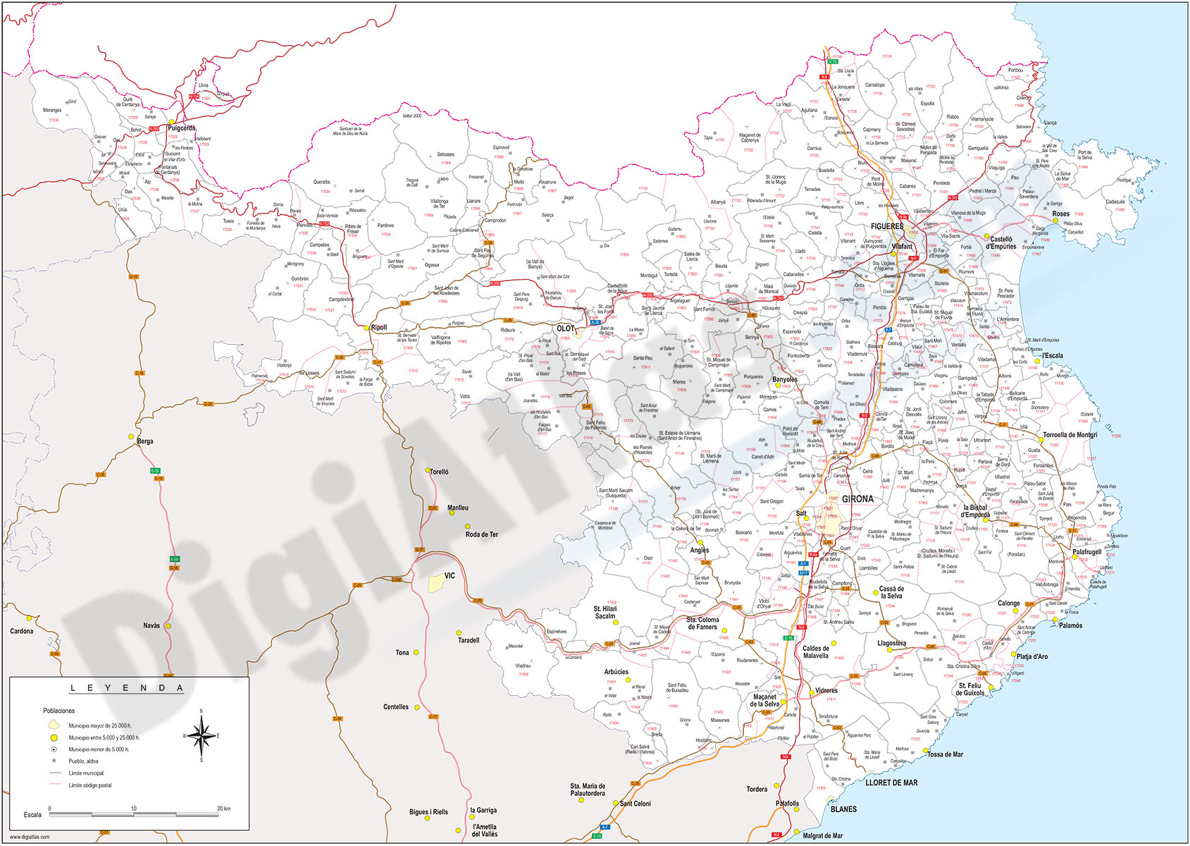
Girona - province map with municipalities, postal codes and roads
Fully editable vector file of province of Girona, showing municipalities borders, 5-digit postcode areas and roads.
Illustrator, PDF

59,00 €
Barcelona - province map with municipalities, postal codes and roads
Fully editable vector file of province of Barcelona, showing municipalities borders, 5-digit postcode areas and roads.
Illustrator, PDF

55,00 €
Map of Spain and Portugal DIN A3
Map of Spain and Portugal with major cities and roads. DIN A3 paper size. vector file 100% editable
Illustrator, PDF

59,00 €
Map of Ciudad Real province with municipalities, major roads and postal cod
Map of Ciudad Real province showing municipalities, postal codes areas and major roads
Illustrator, PDF

59,99 €
Maps of 17 Autonomous Communities of Spain
Separated vector file for all Spanish Autonomous Communities. Map files contains a lot of political information, such as roads and cities. Also includes a TIFF images relief.
Adobe Illustrator, Acrobat PDF, TIFF