
79,00 €
Roadmap of center Spain
Detailed digital map of Center of Spain, include the Autonomous communities of CASTILLA–La Mancha (Castile–La Mancha) and Community of Madrid, also the province of Soria. Roadmap and all cities, r
(...) Read more »
Adobe Illustrator, PDF

59,00 €
Map of Albacete province with municipalities, postal codes and major roads
Map of Albacete province (CASTILLA-La Mancha, Spain) showing municipalities borders, 5-digit postal codes areas and major roads. Continuously updated.
Adobe Illustrator, PDF

132,50 €
Castile-La Mancha - map of postal codes, municipalities and major roads
Vector-file map of Castile-La Mancha autonomous community (Spain) with cities, towns, municipalities borders and 5-digit postal codes.
Adobe Illustrator, Acrobat PDF
98,00 €
Map of south-eastern Spain
Digital map of roads and towns in south-eastern Spain.
(...) Read more »
Adobe Illustrator, Acrobat PDF

55,00 €
León (Spain) - center of city map
Vector file map of Leon city center (autonomous community of Castile and León, Spain). All features are in separated layers.
Adobe Illustrator, PDF

151,25 €
Map of Zamora and Valladolid
vectorized map of Zamora and Valladolis Spain provinces, showing autonomous communities and province boundaries, cities, highways, major and minor roads, railroad, principal rivers and lakes and other
(...) Read more »
Adobe Illustrator, Acrobat PDF

59,00 €
Map of Guadalajara province with municipalities, major roads and postal cod
Editable vector map of the province of Guadalajara (CASTILLA-La Mancha) with municipalities, towns separated in layers according to their number of inhabitants, 5-digit postcode areas and the road and
(...) Read more »
Adobe Illustrator, Acrobat PDF

55,00 €
Avila - city map center
Digital street map of the city centre of Ávila (Autonomous Community of Castile and León - Spain), with the delineation of streets and squares, blocks of houses, parks and green areas, with colours
(...) Read more »
Adobe Illustrator, Acrobat PDF

55,00 €
Santa María del Páramo - city map
Vector file map of Santa María del Páramo (Province of León, Castile and León, Spain). All features are in separated layers.
FreeHand, Illustrator, PDF

95,00 €
León (Spain) - city map
Vector file map of Leon city (autonomous community of Castile and León, Spain). All features are in separated layers.
Adobe Illustrator, PDF

122,50 €
Castile-La Mancha - map of postal codes and municipalities
Vector-file map of Castile-La Mancha autonomous community (Spain) with cities, towns, municipalities borders and 5-digit postal codes. Continuously Updated
Adobe Illustrator, PDF, JPG (300dpi)

95,00 €
Burgos - city map
Digital map of Burgos capital city (Province of Burgos, autonomous community of Castile and León, Spain). Maps include streets and square, their names and postal code areas. All features are in separ
(...) Read more »
Adobe Illustrator, PDF

55,00 €
Salamanca - city map
Digital street map of the historic centre of Salamanca, with the delineation of streets and squares, blocks of houses and green areas, with colours and names.
(...) Read more »
Adobe Illustrator, Acrobat PDF

175,00 €
Roadmap of northwestern Spain
Vector file map of Northern and Western Autonomous communities of Spain, with all cities and roads, railroad, principal rivers and lakes and other relevant political information. Scale 1:300.000.
Adobe Illustrator, Acrobat PDF

89,00 €
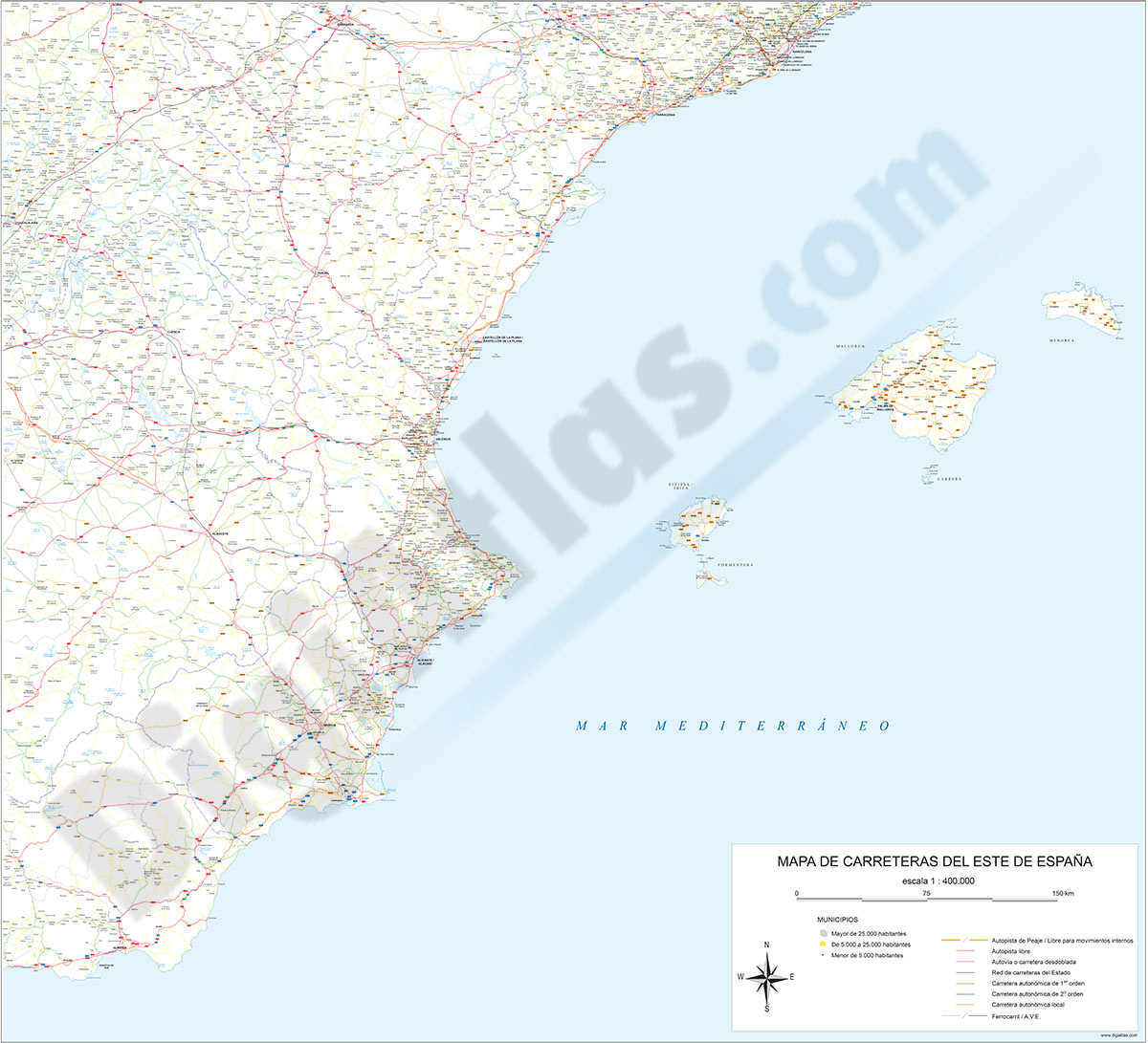
Southeast roadmap of Spain
Digital map of roads and towns in southeastern Spain
(...) Read more »
Adobe Illustrator, Acrobat PDF