59,99 €
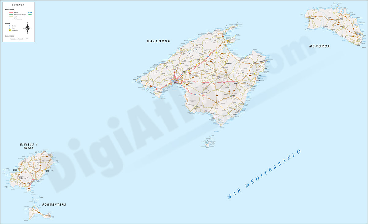
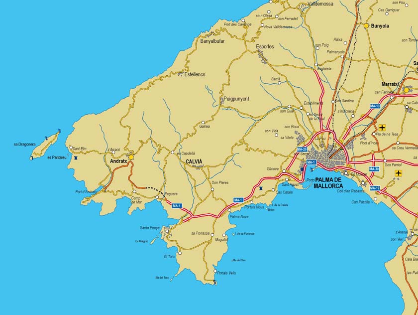
Mallorca - Map of Balearic Islands
Digital map of the Balearic Islands, including the entire Balearic archipelago: Mallorca, Menorca, Ibiza-Eivissa and Formentera. Tourist map at a scale of 1:300.000 with the main towns, road network,
(...) Read more »
Adobe Illustrator, Acrobat PDF
59,99 €
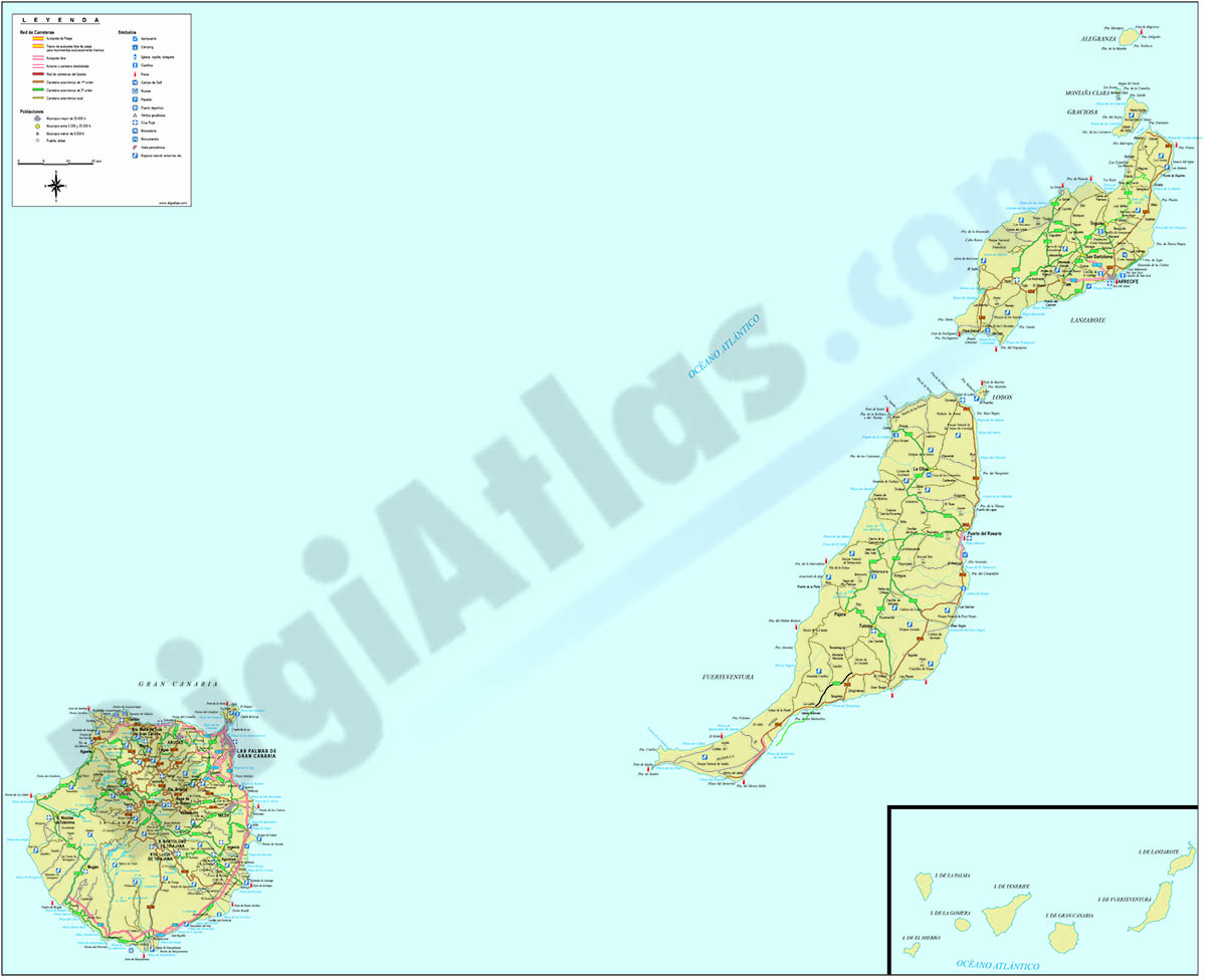
Map of Las Palmas de Gran Canaria
Digital map of the province of Las Palmas (Canary Islands). The map shows the islands of Gran Canaria, Lanzarote and Fuerteventura at a scale of 1:300.000, with the cities and towns grouped by number
(...) Read more »
Adobe Illustrator, PDF
55,00 €
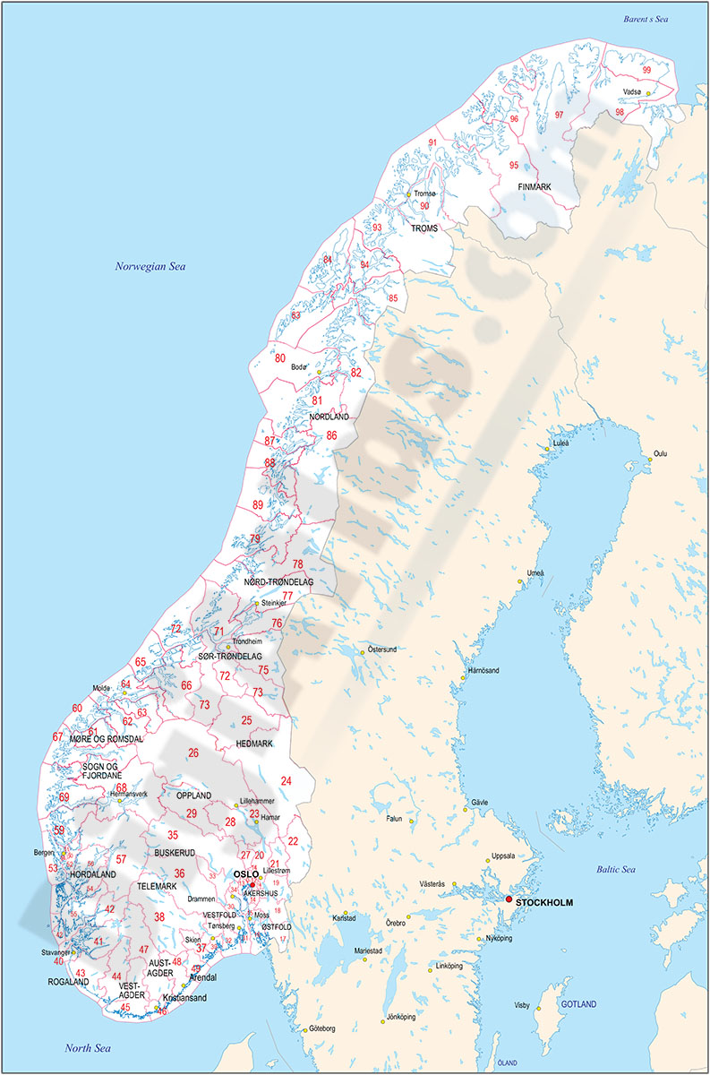
Map of Norway with regions and 2 digit postal codes areas
Vectorized and fully editable Map of Norway with regions, capitals and 2-digit postal codes areas. Include a KML file for Google Earth.
Illustrator, PDF, KML

55,00 €
Tenerife - map of the island with municipalities and postal codes
Map of the island of Tenerife (Canary Islands - Spain) showing municipalities borders and 5-digits postal codes.
Download vectorized and fully editable map organized in separated layers.
Adobe Illustrator, Acrobat PDF
98,00 €
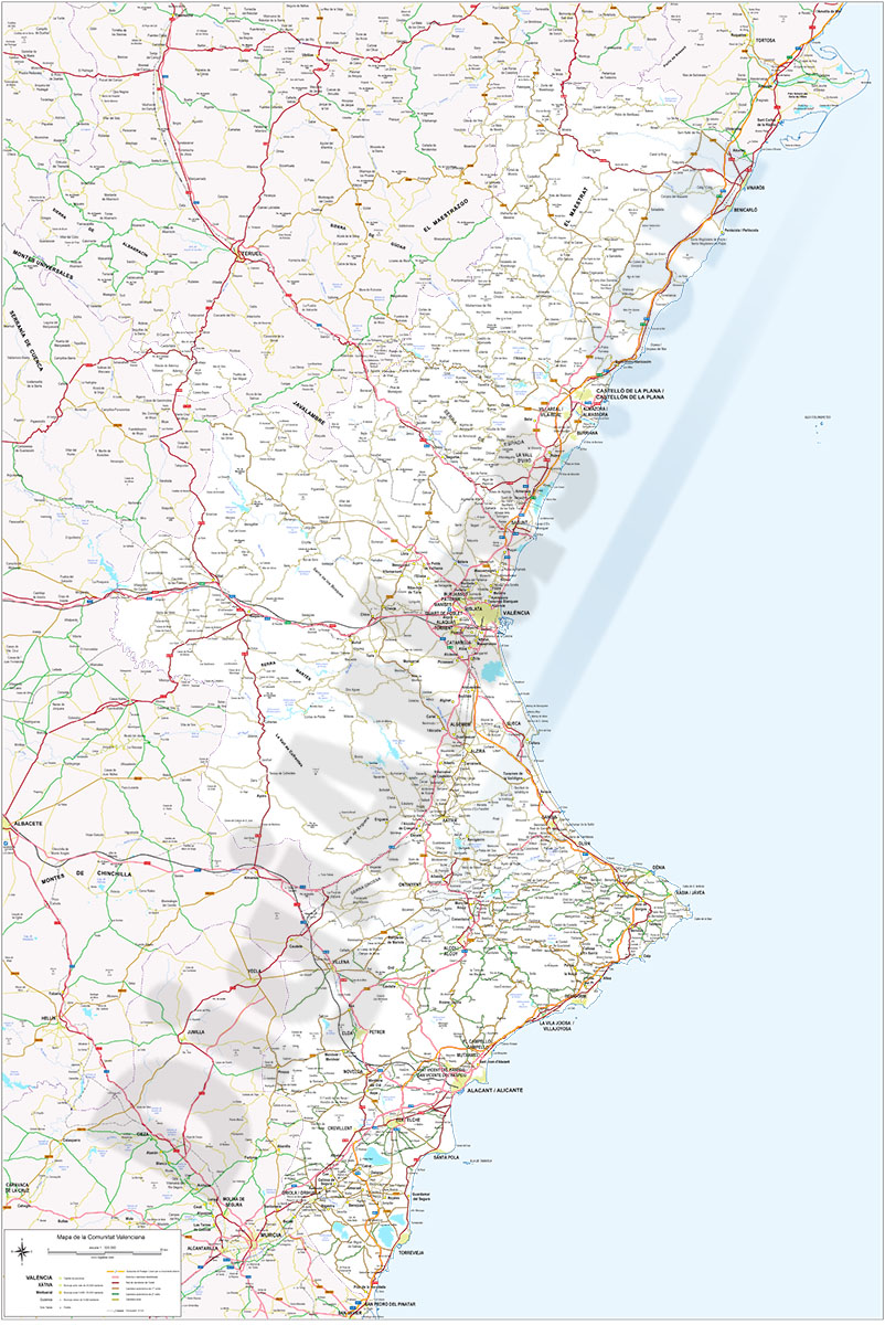
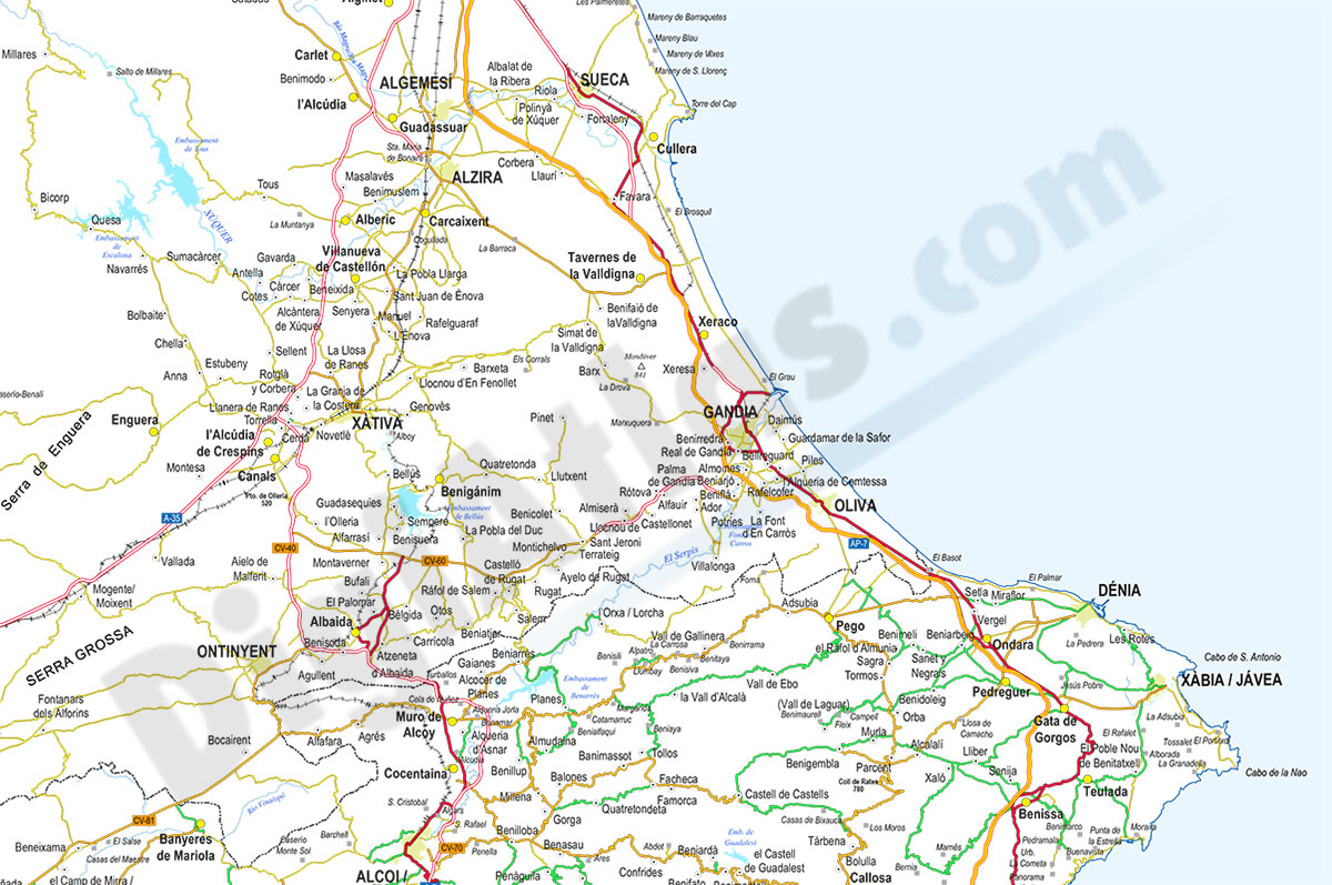
Valencian Community road map
Detailed digital map of the Valencian Community, in digital format and at a scale of 1:325,000.
(...) Read more »
Adobe Illustrator, Acrobat PDF
55,00 €
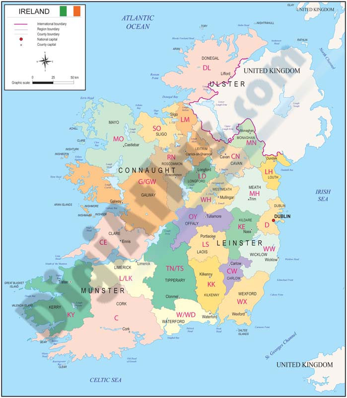
Map of Ireland with regions and Postal Codes
Vectorized and fully editable Map of Ireland with regions, capitals and 2-digit postal codes.
Illustrator, PDF
79,00 €
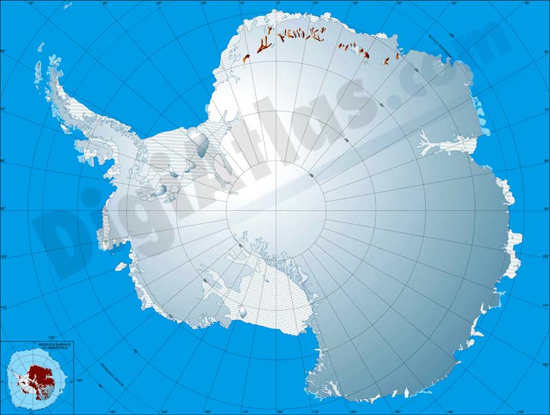
Map of Antarctica
Fully editable vector file map of Antarctica. Colored lands and glaciers.
Adobe Illustrator, PDF, JPG (300dpi)
Ask price
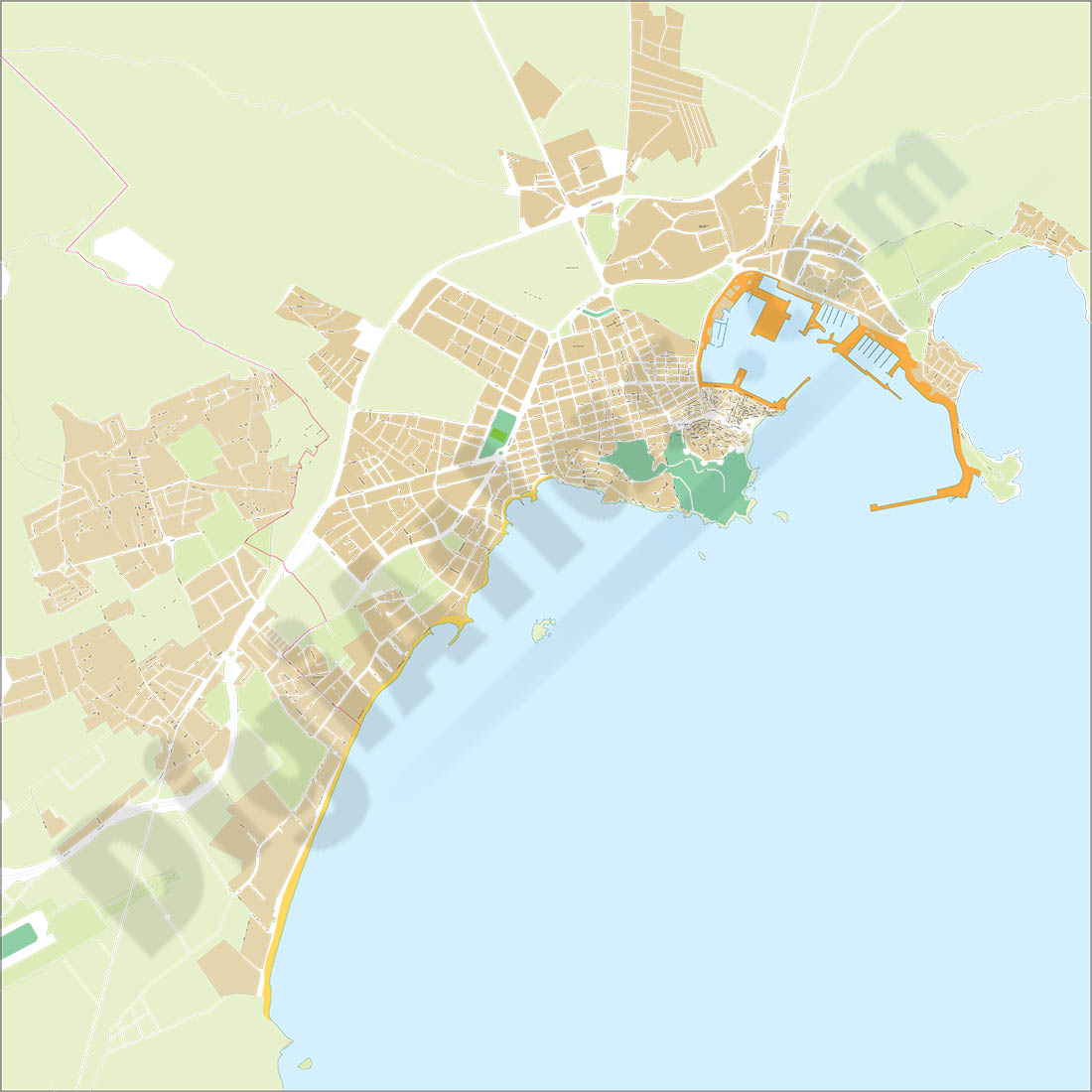
Eivissa-Ibiza - city map
Vector-file map of Eivissa (Ibiza, Balearic Islands) urban city. All features are in separated layers.
Adobe Illustrator, PDF
55,00 €
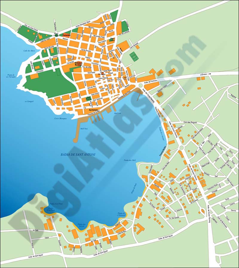
Sant Antoni de Portmany (Ibiza) city map
Vector-file map of Sant Antoni de Portmany (town on the western coast of Ibiza island, Balearic Islands, Spain). All features are in separated layers.
FreeHand, Illustrator, PDF