120,00 €
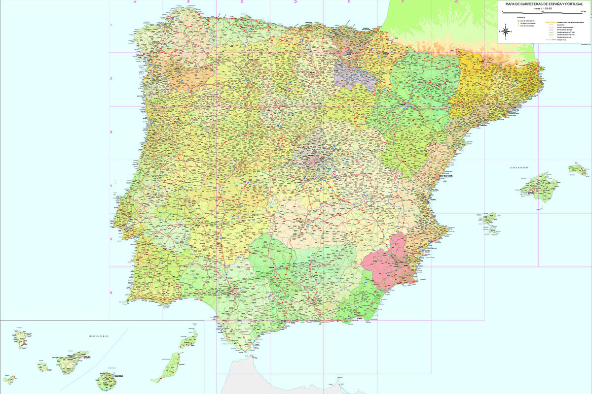
Roadmap of Spain and Portugal
Digital map of roads and towns in Spain and Portugal.
(...) Read more »
Adobe Illustrator, Acrobat PDF

79,00 €
Comarcal maps of Spain autonomous communities
Maps of the comarcal division of all 17 spanish autonomous communities. Each map shows administrative limits and their coloured and named comarcas, capitals and major cities.
(...) Read more »
Adobe Illustrator, PDF
Ask price
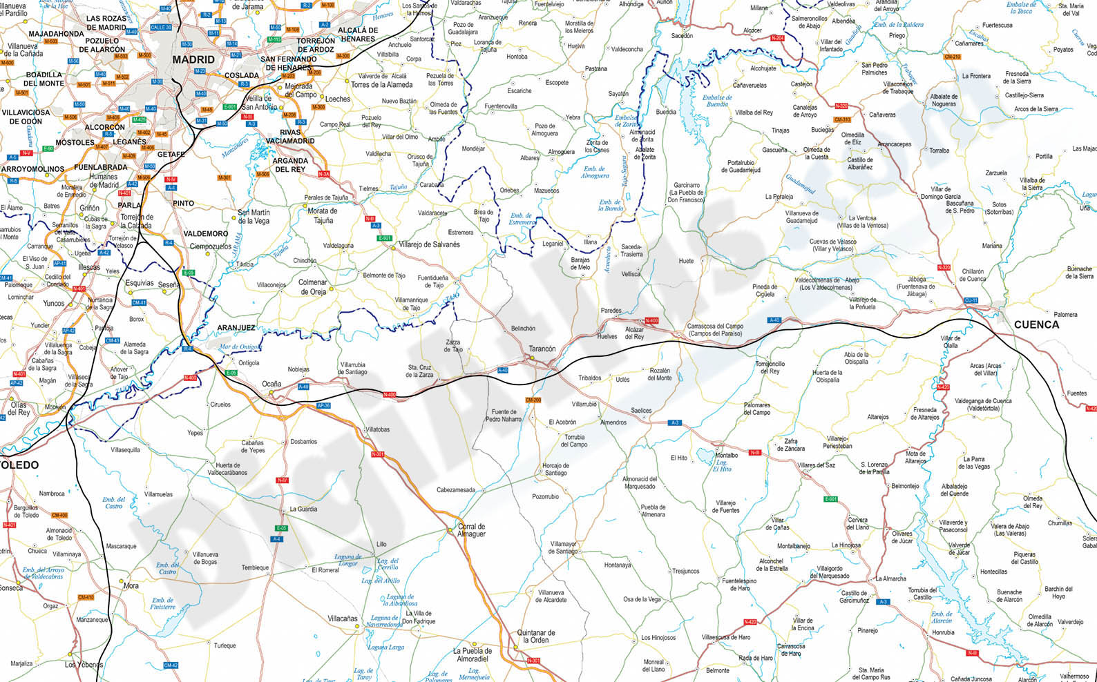
Detailed Road Map of Spain and Portugal
Detailed digital road map of Spain and Portugal, at a working scale of 1:100.000 and adjusted to poster size of 2 meters wide.
Includes the road network (all Highways, Motorways, National, Autonomous and Local roads, AVE and railroads) and all cities and towns of municipal rank, grouped and separated in layers according to number of inhabitants.
Two digital files are downloaded: one in Adobe Illustrator vector format (.ai) which is 100% editable and allows modifying and customizing colors, texts and styles. The second file is delivered in vectorial PDF format, which can be opened directly in Acrobat Reader to work on screen or to print directly at the desired size, always with the maximum resolution.
Both files are vectorized and organized in separate layers, which can be displayed and/or hidden to generate different types and customized versions of the map.
Click here to download a sample map in vector format.
See less «
Adobe Illustrator, Acrobat PDF

Ask price
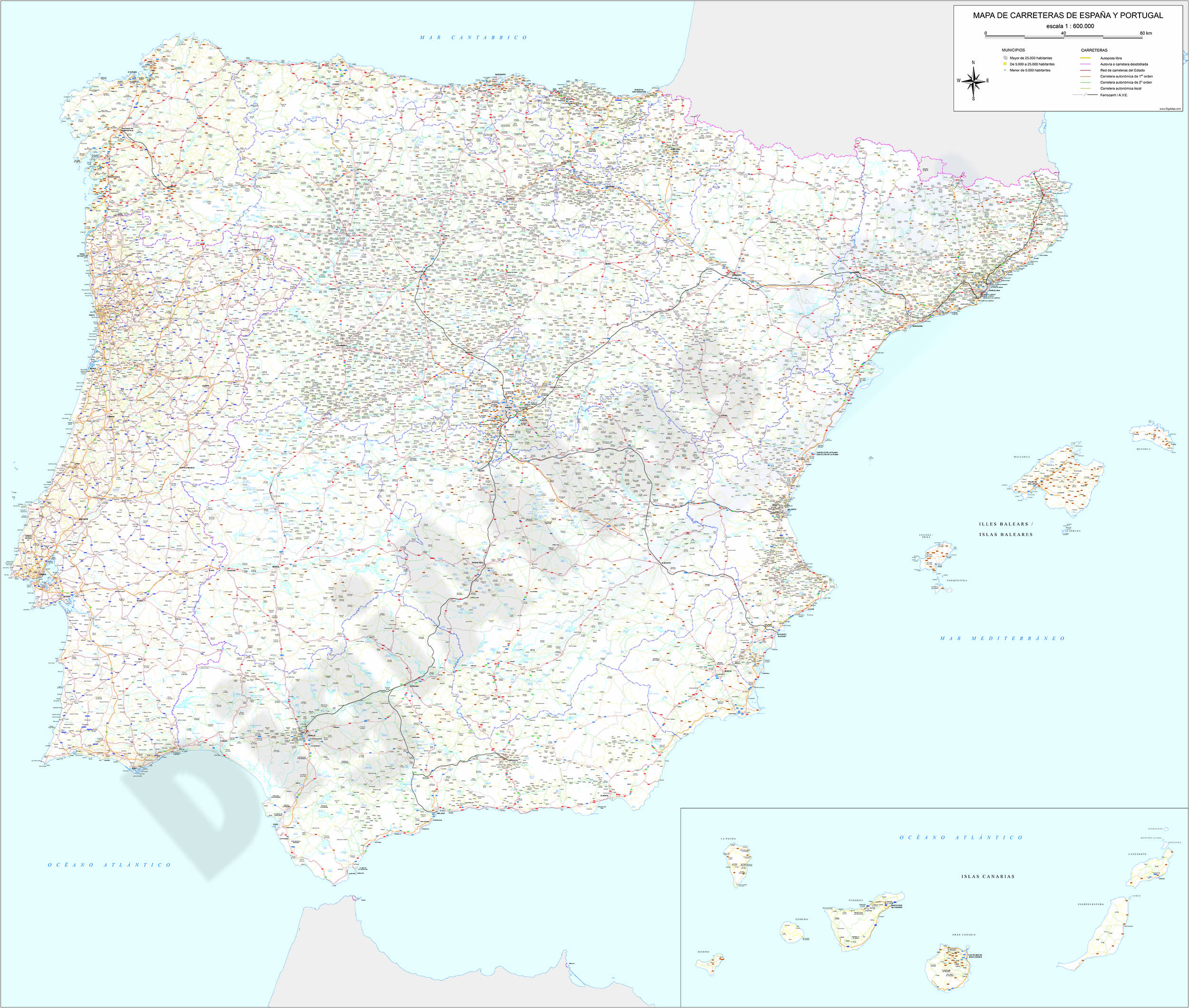
Detailed roads and cities map of Spain
Detailed vector road map of Spain (excluding Portugal) at a scale of 1:600.000 and adjusted to 2 meters wide.
(...) Read more »
Acrobat PDF

Ask price
Digital Elevation Models (DEM)
We offers a wide variety of DEM adjusting the resolution and accuracy to suit the needs and budgets of our clients, using our exclusive interpolation method to obtain more quality and accuracy in de D
(...) Read more »
Imagenes Bitmap Georeferenciadas
59,00 €
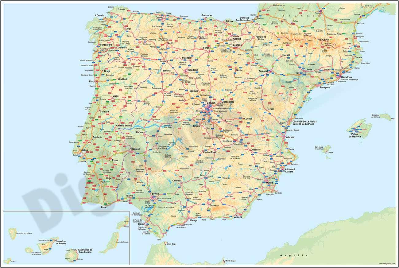
Major roads map of Spain and Portugal
Digital map of Spain and Portugal with the general road network, hydrographic network and main towns.
(...) Read more »
Adobe Illustrator, Acrobat PDF

79,00 €
Map of some provinces of Spain
Map of the spanish provinces of Albacete, Alicante, Cuenca and Region of Murcia.
It includes the entire road network, municipalities and population centres.
(...) Read more »
Adobe Illustrator, Acrobat PDF

98,00 €
Map of south-eastern Spain
Digital map of roads and towns in south-eastern Spain.
(...) Read more »
Adobe Illustrator, Acrobat PDF

19,95 €
Map of Spain
Political map of Spain in digital format.
(...) Read more »
Adobe Illustrator, Acrobat PDF

120,00 €
Map of Spain 100x70 cm
Poster size map of Spain and Portugal, 100x70 cm.
(...) Read more »
Adobe Illustrator, Acrobat PDF

55,00 €
Map of Spain and Portugal DIN A3
Map of Spain and Portugal with major cities and roads. DIN A3 paper size. vector file 100% editable
Illustrator, PDF

55,00 €
Map of Spain and Portugal with cities
Digital map of Spain and Portugal with regional and provincial boundaries and a large number of towns.
(...) Read more »
Adobe Illustrator, Acrobat PDF

55,00 €
Map of Spain and Portugal with communities and provinces
Political map of Spain and Portugal in digital format, showing the internal administrative division of each country, Spanish Autonomous Communities and provinces, and the continental districts and aut
(...) Read more »
Adobe Illustrator, Acrobat PDF.

55,00 €
Map of Spain with cities over 25,000 citizens
Digital map of Spain showing cities and towns with more than 25,000 inhabitants.
(...) Read more »
Adobe Illustrator, PDF, JPG (300dpi)

55,00 €
Map of Spain with postal codes
Map of Spain showing Autonomous Communities, provinces, major cities and 2-digit postal codes. Fully editable and resizable vector file formats.
Adobe Illustrator, Acrobat PDF