55,00 €
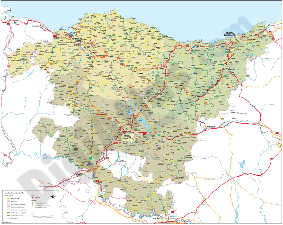
Euskadi map
Detailed autonomous map of the Basque Country, EUSKADI, at a scale of 1:300.000, with the limits of the provinces, road network, rivers and lakes, cities and towns, geographical names. 100% editable v
(...) Read more »
Adobe Illustrator, Acrobat PDF
59,99 €
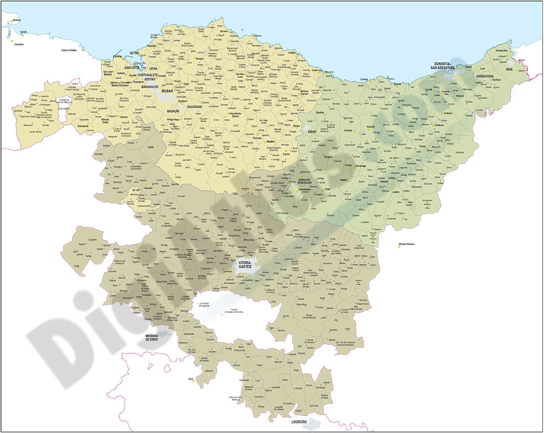
Euskadi map with municipalities borders
Map of EUSKADI autonomous community (Spain) showing municipalities borders. Municipality areas of each basque province (Bizkaia, Araba and Gipuzkoa) in a separate color.
Adobe Illustrator, PDF
55,00 €
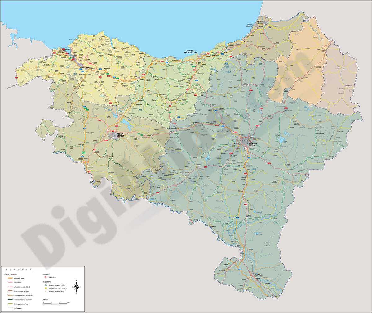
Euskal Herria map
Digital map at a scale of 1:300,000 of the 7 provinces that make up the Basque Country, with administrative boundaries, towns, road network, railway network, main rivers and lakes.
(...) Read more »
Adobe Illustrator, Acrobat PDF