
59,00 €
Map of Basque Country, Navarra and La Rioja
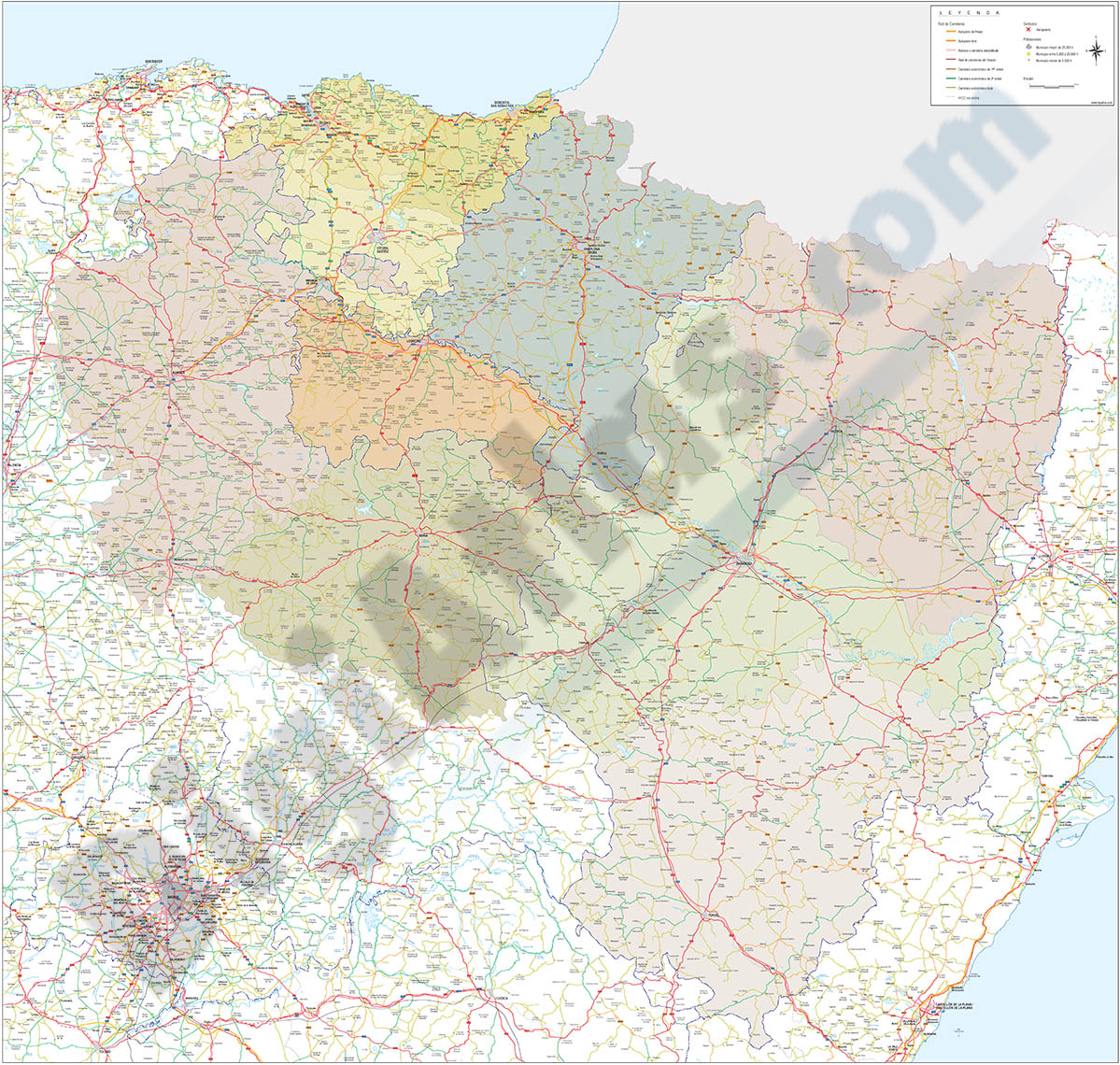
Map of the Basque Country, NAVARRA and La Rioja at a scale of 1: 300,000. Digital map with the provinces of the 3 autonomous communities, their municipalities, capitals, cities and towns grouped according to the number of inhabitants, network of highways, highways, national and regional highways of the first and second order, local roads, rail network, rivers and main lakes.
Map in vector format at poster size for high quality printing.
Two files are downloaded in vector format (Adobe Illustrator and Acrobat PDF) organized in separate layers to be able to edit and customize the map.
See less «
Adobe Illustrator, Acrobat PDF, JPG (300dpi)

89,00 €
Map of Basque Country, Navarra, La Rioja, Burgos and Soria
Vector-file map of the Basque country, NAVARRA, La Rioja, Burgos and Soria spanish provinces, with detailed political and geographical information, such as administrative limits, towns and cities, roa
(...) Read more »
Acrobat PDF, JPG (300dpi)
98,00 €
Map of Basque Country, Navarra, La Rioja, Burgos, Soria and Aragón
Vector-file map of the Basque country, NAVARRA, La Rioja, Burgos, Soria and Aragón spanish provinces, with detailed political and geographical information, such as administrative limits, towns and ci
(...) Read more »
Acrobat PDF, JPG (300dpi)

59,99 €
Navarre - Map of Chartered Community of Navarre
Digital map of the Autonomous Community of Navarre at a scale of 1:300.000, with the autonomous and provincial limits, municipalities, capitals, cities and towns grouped according to the number
(...) Read more »
Adobe Illustrator, Acrobat PDF