1- Andalucia - map of comarcas
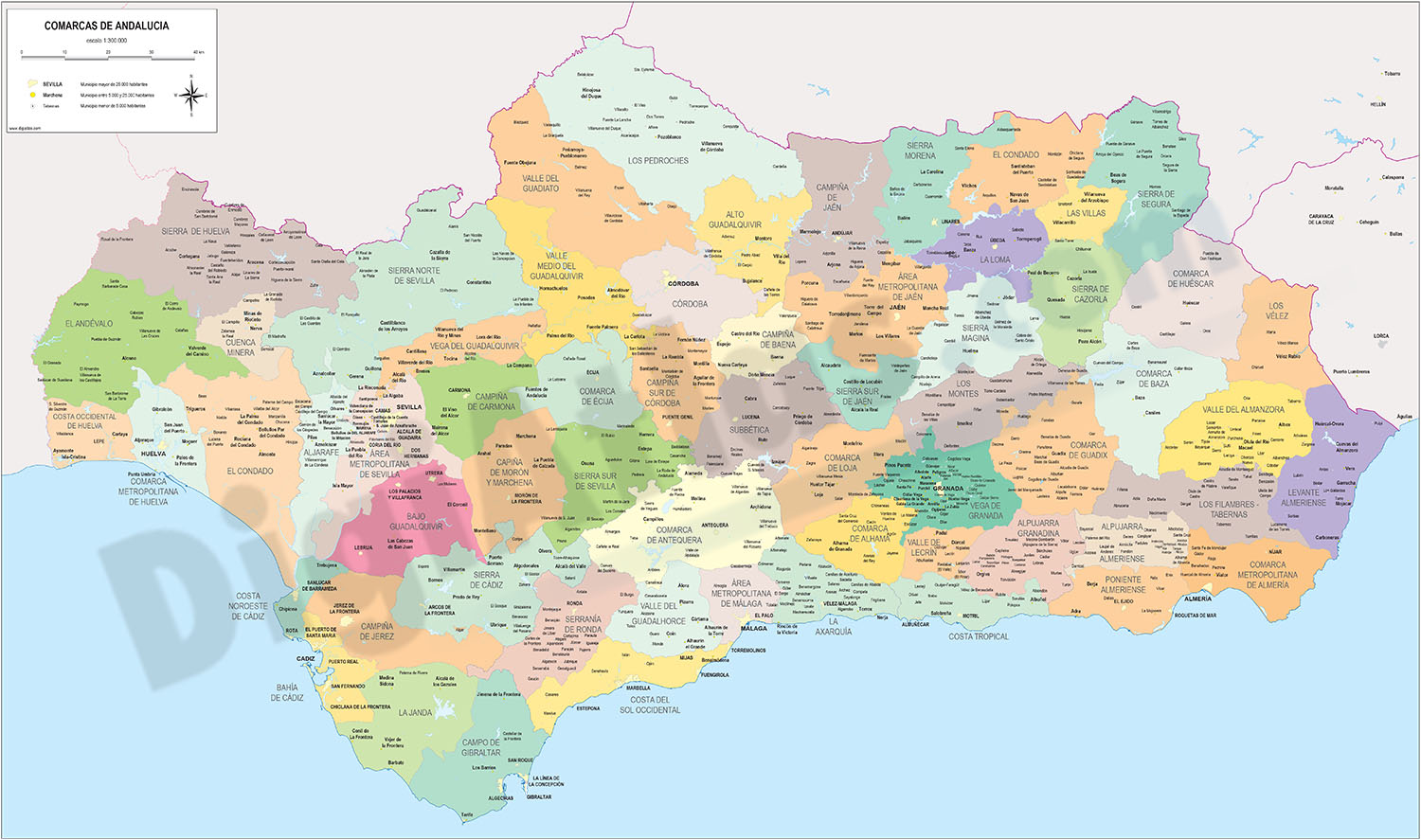
Digital map of Andalusia (Andalucia autonomous community, Spain) with the comarcas and municipalities in 100% editable vector format.
The comarcas of Andalusia are intermediate territorial demarcations between provinces and municipalities, they... Read more
Adobe Illustrator, Acrobat PDF
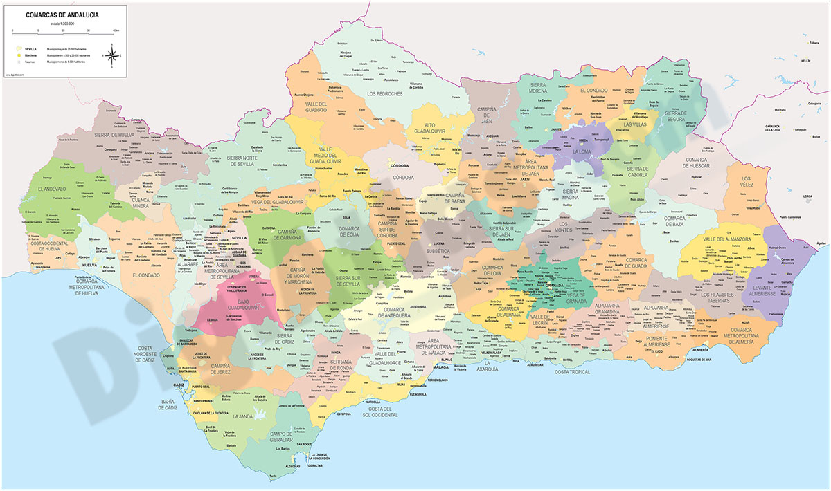
2- Andalucia provinces with municipalities

Digital maps of the 8 Andalusian provinces.
Each province is in a separate file and shows the boundaries or municipalities, the capitals, cities and towns grouped according to the number of inhabitants and the main road network (motorways, dual... Read more
Adobe Illustrator, Acrobat PDF
3- Chiclana de la Frontera - city map

Vector file map of Chiclana de la Frontera (province of CADIZ, Andalucia, Spain). All features are in separated layers.
Adobe Illustrator, Acrobat PDF
4- Chipiona (Cadiz) - city map

Vector-file map of Chipiona city (province of CADIZ, Andalucía Spain). All features are in separated layers.
Adobe Illustrator, PDF
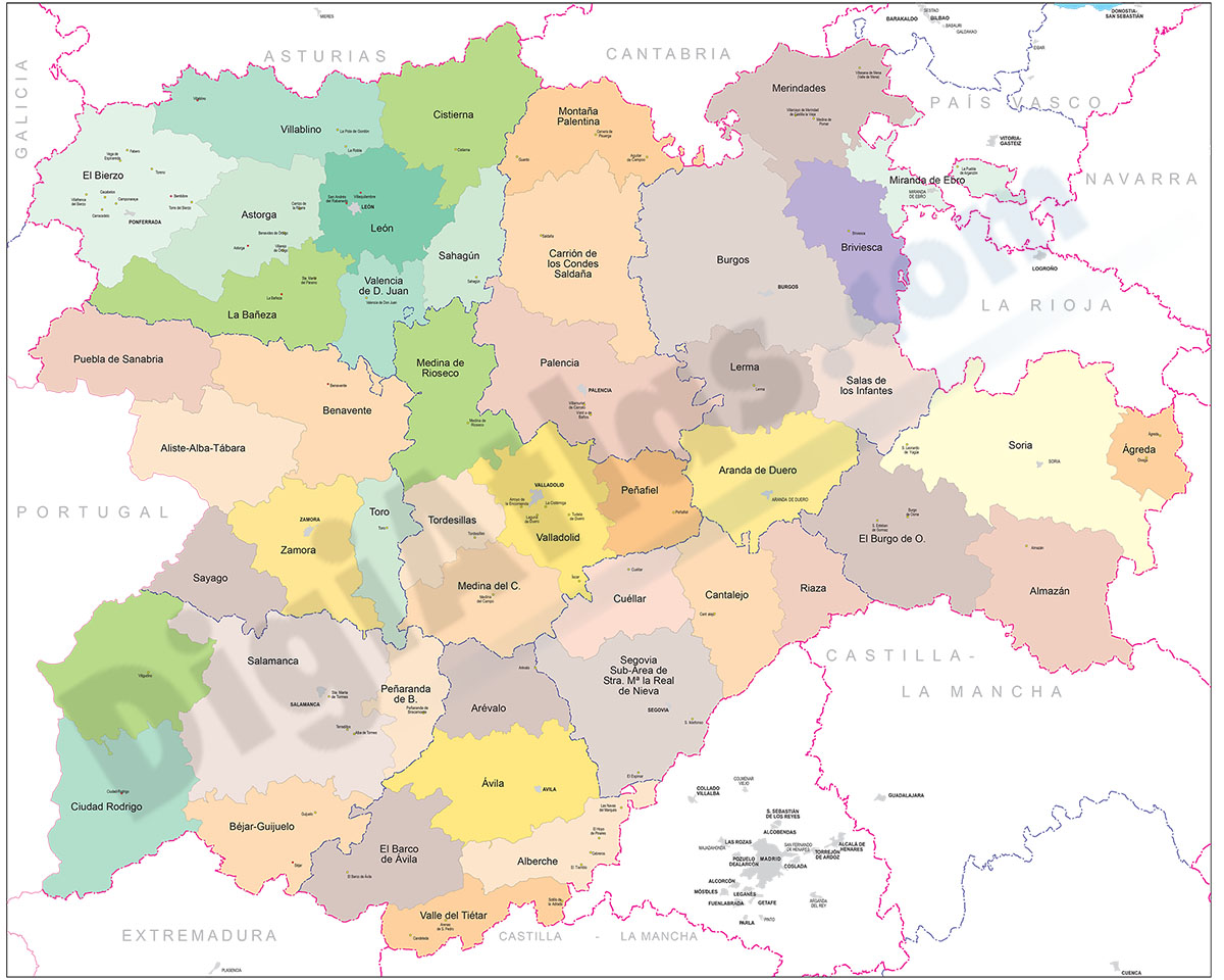
5- Comarcal maps of Spain autonomous communities
Maps of the comarcal division of all 17 spanish autonomous communities. Each map shows administrative limits and their coloured and named comarcas, capitals and major cities.
Vectorized and fully editable files in Adobe Illustrator and PDF formats.... Read more
Adobe Illustrator, PDF
6- Map of Cadiz

Map of province of CADIZ (Andalusia, Spain) showing community and province boundaries, cities, highways, major and minor roads, railroad, principal rivers and lakes and other relevant political information. Scale 1:300.000. Vectorized map organized... Read more
Adobe Illustrator, PDF