1- A Coruña (Corunna) - Map of province with parroquias and aldeas
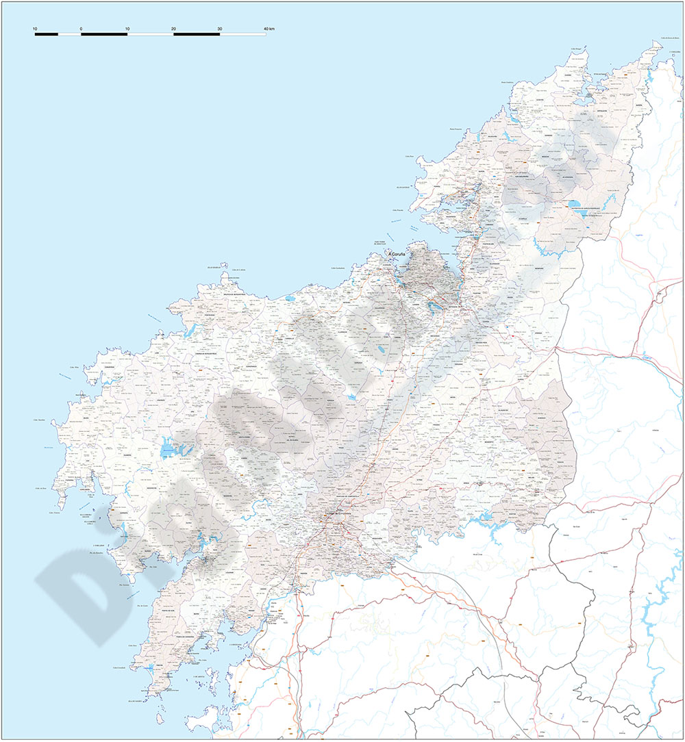
Map of A CORUñA province (Galicia, Spain) showing Autonomous Communities, provinces, concellos and parroquias boundaries. Include cities, 'aldeas', highways, major and minor roads, railroad, principal rivers and lakes and other relevant political... Read more
Adobe Illustrator, PDF
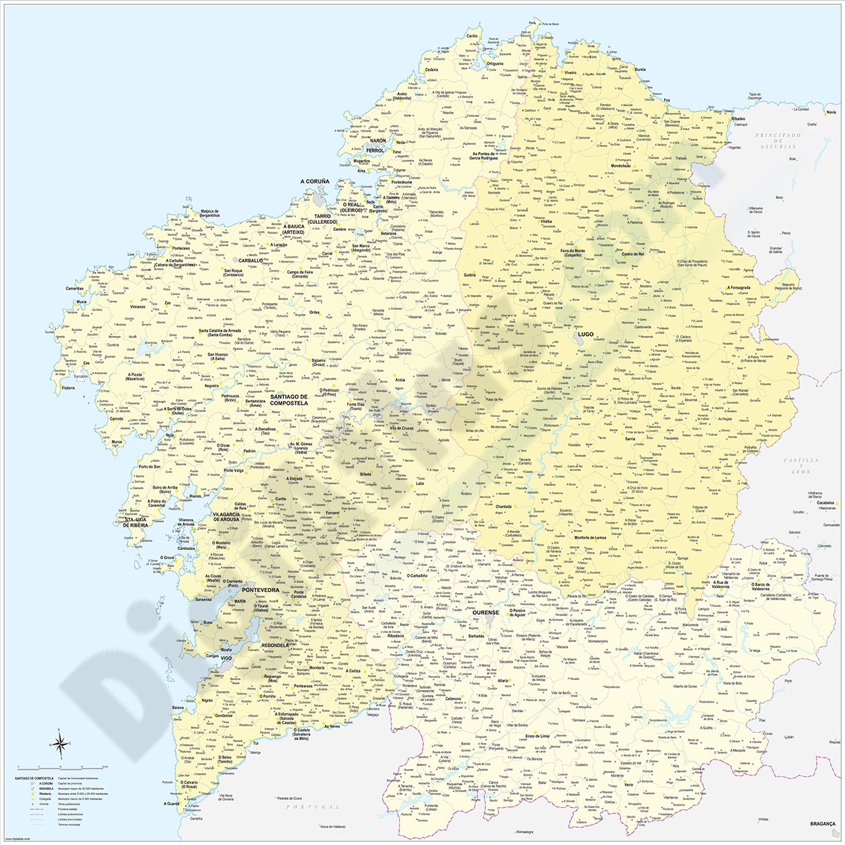
2- Galicia (Galizia) Spain autonomous community map

Digital poster size map of Galicia autonomous community (Spain).
The map shows the autonomous, provincial and municipal limits (concellos), road and rail network with the labeling of highways and national roads, capitals, cities and population... Read more
Adobe Illustrator, Acrobat PDF
3- Galicia map with municipalities
Digital map of Galicia autonomous community (northwest Spain) with the municipalities (concellos), their capitals and villages.
Two vector files are downloaded: the Adobe Illustrator (.ai) version is 100% editable and allows you to modify and... Read more
Adobe Illustrator, Acrobat PDF
4- Map of A Coruña (Corunna)
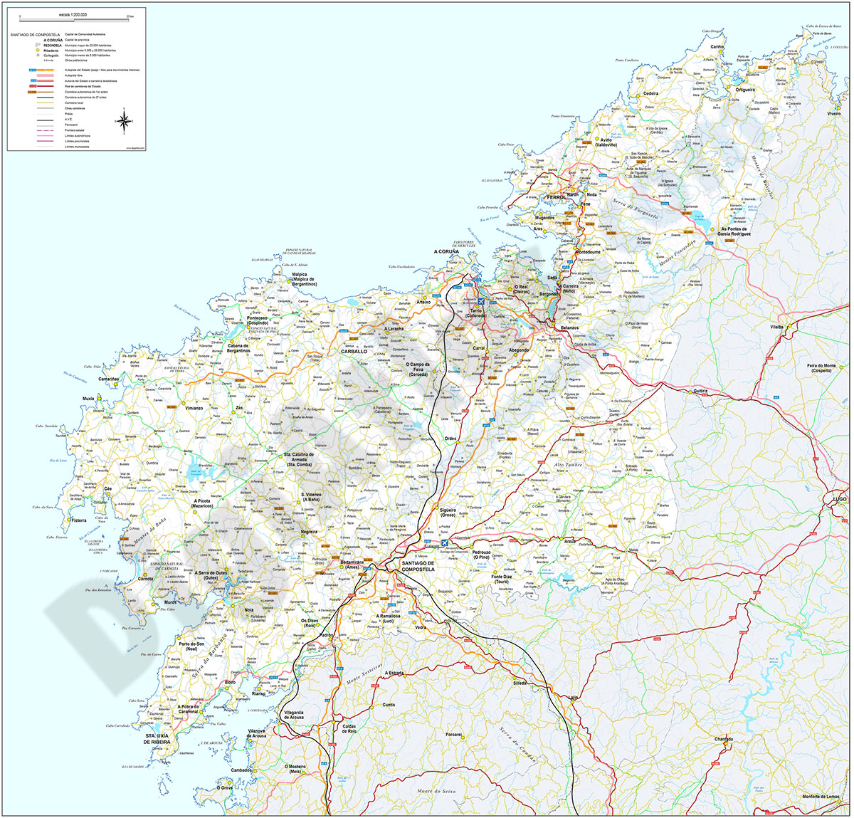
Digital map of the province of A CORUñA (Galicia) at a scale of 1:200.000 with the autonomous, provincial and municipal limits (Concellos), capitals, cities and population centres organised according to the number of inhabitants, motorway network,... Read more
Adobe Illustrator, Acrobat PDF