1- Comarcal maps of Spain autonomous communities
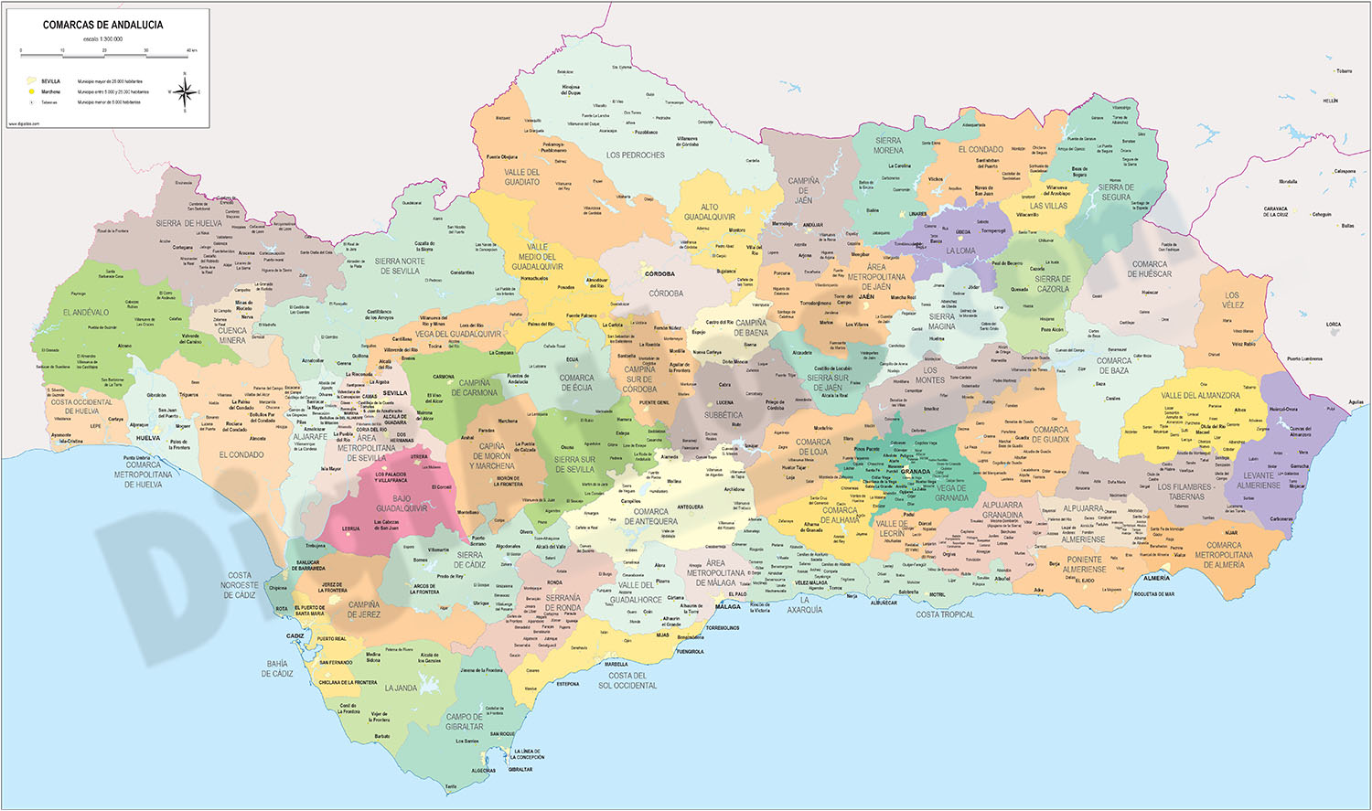
Maps of the comarcal division of all 17 spanish autonomous communities. Each map shows administrative limits and their coloured and named comarcas, capitals and major cities.
Vectorized and fully editable files in Adobe Illustrator and PDF formats.... Read more
Adobe Illustrator, PDF
2- Map of Guadalajara

Vectorized map of province of GUADALAJARA (autonomous community of Castilla–La Mancha, Spain) showing community, province and municipality boundaries, capital, cities and towns, highways, major and minor roads, AVE and railroad, principal rivers... Read more
Adobe Illustrator, Acrobat PDF