1- Europe political and geographical map
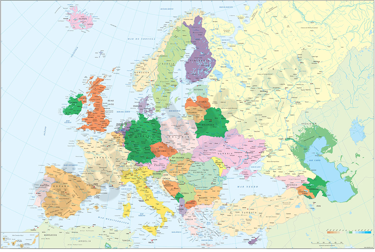
Digital physical and geographical map of Europe.
Digital cartography of the entire European continent with relevant physical and political information. Includes country borders, capitals, major rivers and lakes, important cities and geographical names.
It also incorporates a TIFF image with the relief shaded and coloured as a background layer, to alternate the physical and political version.
Files are downloaded in 100% editable vector format, organised in separate layers and ready to be printed in poster size with the highest quality.
See less «
Adobe Illustrator, Acrobat PDF + TIFF
2- Map of Hungary

Political map of Hungary, in digital format, with the twenty coloured regions: 19 counties (megyék) and the capital city Budapest, their names and capitals.
100% editable vector map organised in separate layers.
Adobe Illustrator, Acrobat PDF
3- Map of Hungary with regions and Postal Codes

Vectorized and fully editable Map of Hungary with regions, capitals and 2-digit postal codes.
Illustrator, PDF