1- Map of Kazakhstan
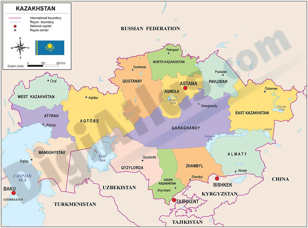
Fully editable vector file of Kazakhstan with political layers of inner administrative division, with their names and capitals.
Adobe Illustrator, PDF
2- Map of Kazakhstan with regions and Postal Codes

Postal code map of Kazakhstan in fully editable vectorized file organized into separate layers for best edition and printing. Map of Kazakhstan shows fourteen regions, their capitals and 2-digit postal codes areas.
Adobe Illustrator, PDF, JPG (300dpi)