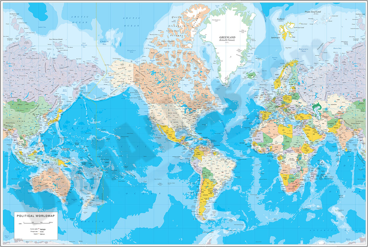
1- Physical-Political Poster World map
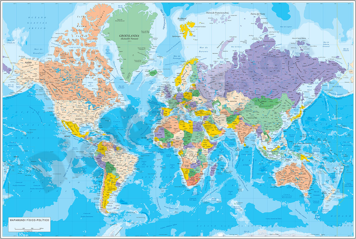
Physical and political digital world map, with borders, colours and names of countries, capitals, main rivers and lakes, capitals and important towns, geographical names and the altimetry and bathymetry strips of the land and sea relief.
Files... Read more
Adobe Illustrator, Acrobat PDF
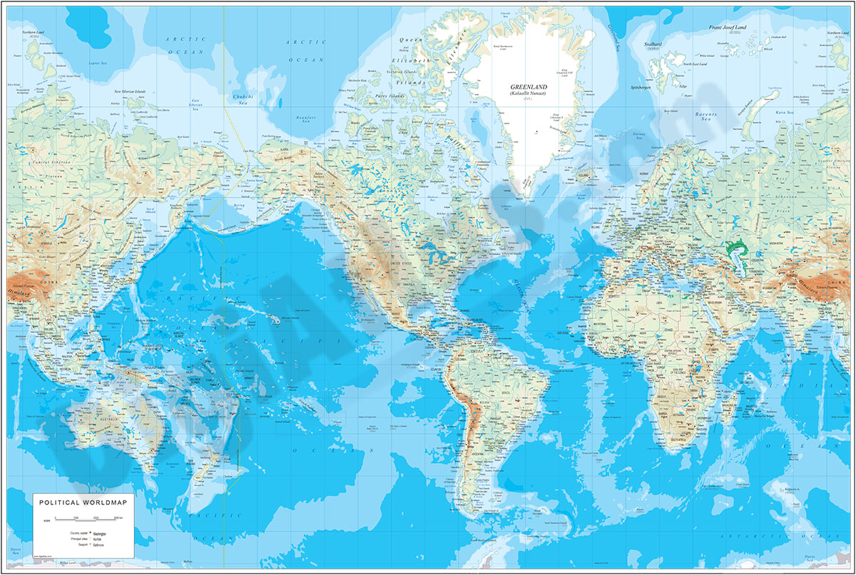
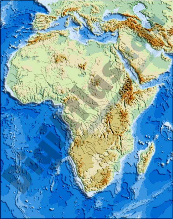
2- Africa physical vectorized-relief map

Physical map of AFRICA.
Digital map of the AFRICAn continent with the altimetry and bathymetry strips coloured and separated into fully editable layers. Includes geographical names, country boundaries, capitals, cities and major... Read more
Adobe Illustrator, Acrobat PDF
3- Africa political and geographical map

Fully editable vectorized file map of AFRICA with coloured countries, international boundaries, major lakes, important cities and capitals and relevant geographic features. Poster size map in high-resolution color shaded relief TIFF image.
Adobe Illustrator, PDF + TIFF, JPG (300dpi)
5- Carte mondiale physico-politique DIN A4
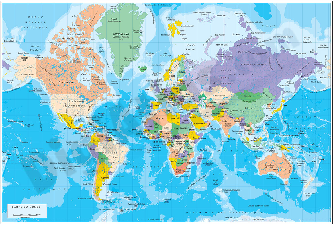
Carte digitale physico-politique du monde en format DIN A4 en français.
Carte pour l'école, la maison ou le bureau. Comprend le relief terrestre et maritime, les pays en couleur, les noms des pays, les principaux fleuves et lacs et les noms... Read more
Adobe Illustrator, Acrobat PDF
6- Map of Algeria
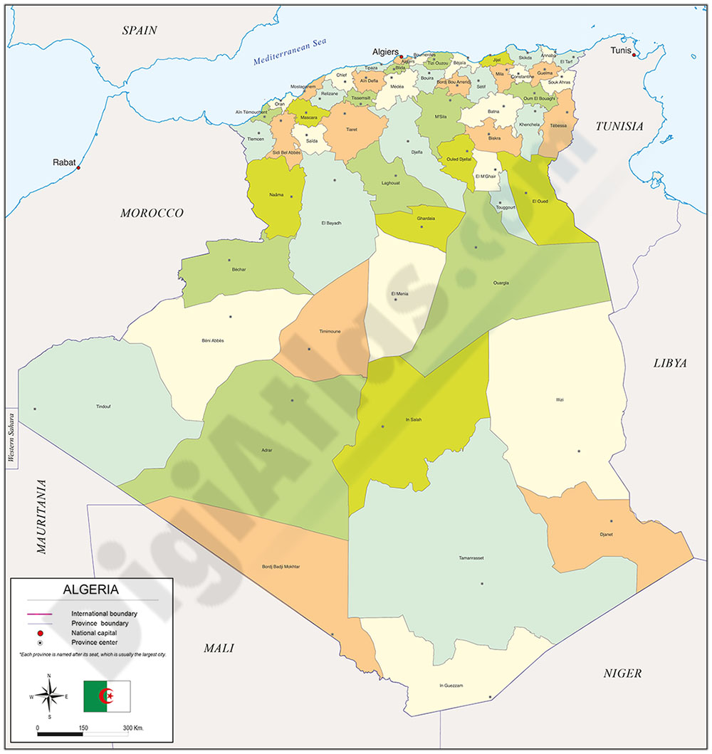
Digital political map of Algeria.
The map shows the political-administrative division of the AFRICAn country, with the boundaries, colours and names of the 58 provinces (wilayas), along with the capital or largest city of each vilayat.
Files... Read more
Adobe Illustrator, Acrobat PDF
7- Map of Angola

Fully editable vector file. Include political layers of inner administrative division, with their names and capitals.
Adobe Illustrator, PDF
8- Map of Cameroon
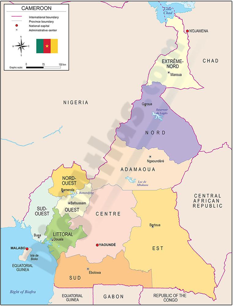
Digital map of the Republic of Cameroon, with the territorial organisation (10 regions), their names and capitals.
100% editable vector map organised in separate layers.
Adobe Illustrator, Acrobat PDF
9- Map of CapeVerde
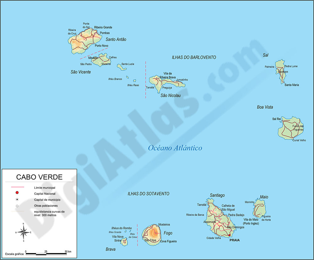
Political map of Cape Verde with the political-administrative organisation, 22 municipalities (concelhos), their names and capitals.
100% editable vector map organised in separate layers.
Adobe Illustrator, Acrobat PDF
10- Map of Central African Republic
Fully editable vector file. Include political layers of inner administrative division, with their names and capitals.
Adobe Illustrator, PDF
11- Map of Djibouti
Fully editable vectorized file map of Republic of Djibouti showing political layers of inner administrative division, with their names and capitals.
Adobe Illustrator, PDF
12- Map of Equatorial Guinea
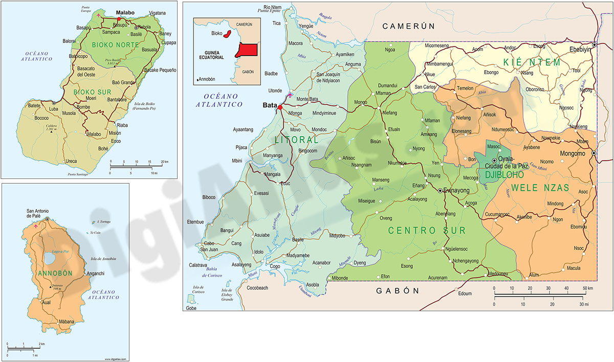
Digital political map of Equatorial Guinea (Republic of Equatorial Guinea) with the internal administrative division, its eight provinces, capitals, rivers, lakes and main roads.
Downloadable files in vector format, fully editable and organised... Read more
Adobe Illustrator, Acrobat PDF
13- Map of Ivory Coast
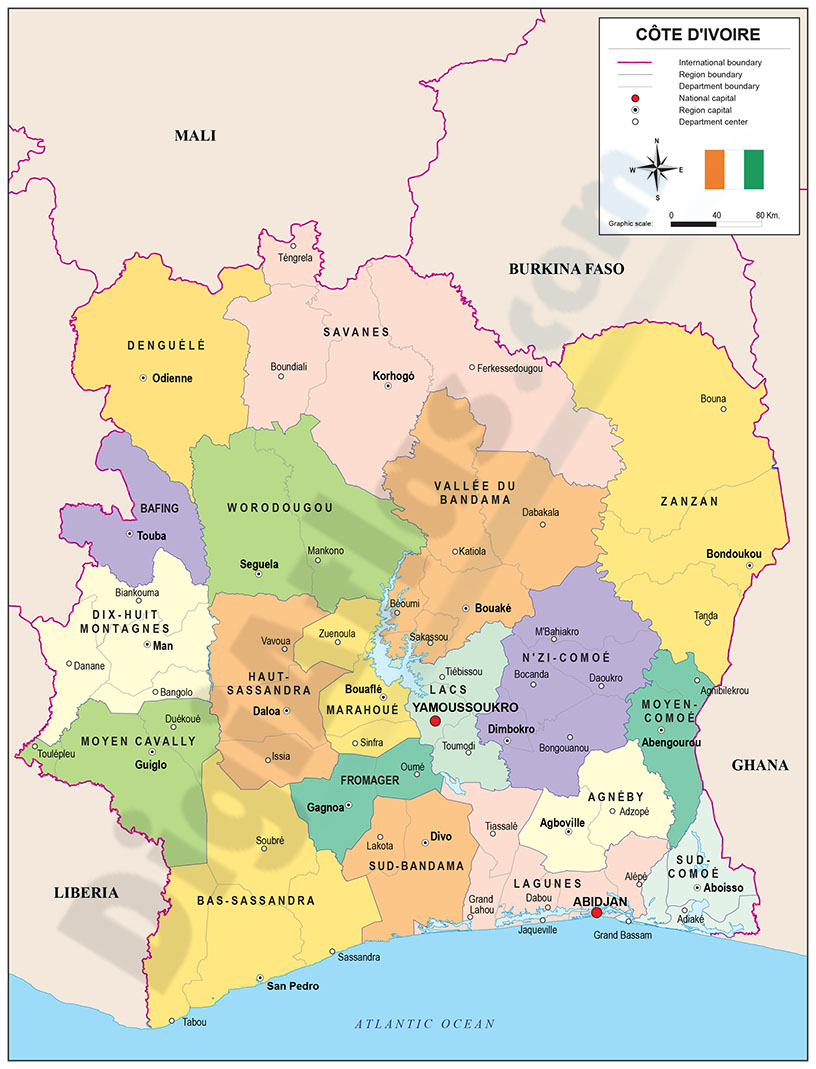
Political map of Côte d'Ivoire with internal administrative division, districts and regions, their names and capitals.
Files are downloaded in 100% editable vector format, organised in separate layers.
Adobe Illustrator, Acrobat PDF
14- Map of Lesotho
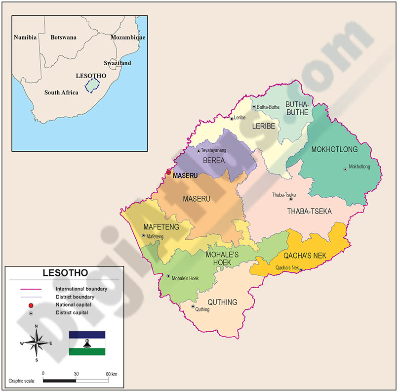
Digital map of Kingdom of Lesotho, showing their political inner administrative division, ten districts, with their names and capitals. Download Fully editable vector file.
Adobe Illustrator, PDF
15- Map of Libya

Digital political map of Libya with the former territorial division into 22 districts or shabiyat (in force between 2006 and 2012), their names and capitals.
Vector map 100% editable.
Adobe Illustrator, Acrobat PDF
