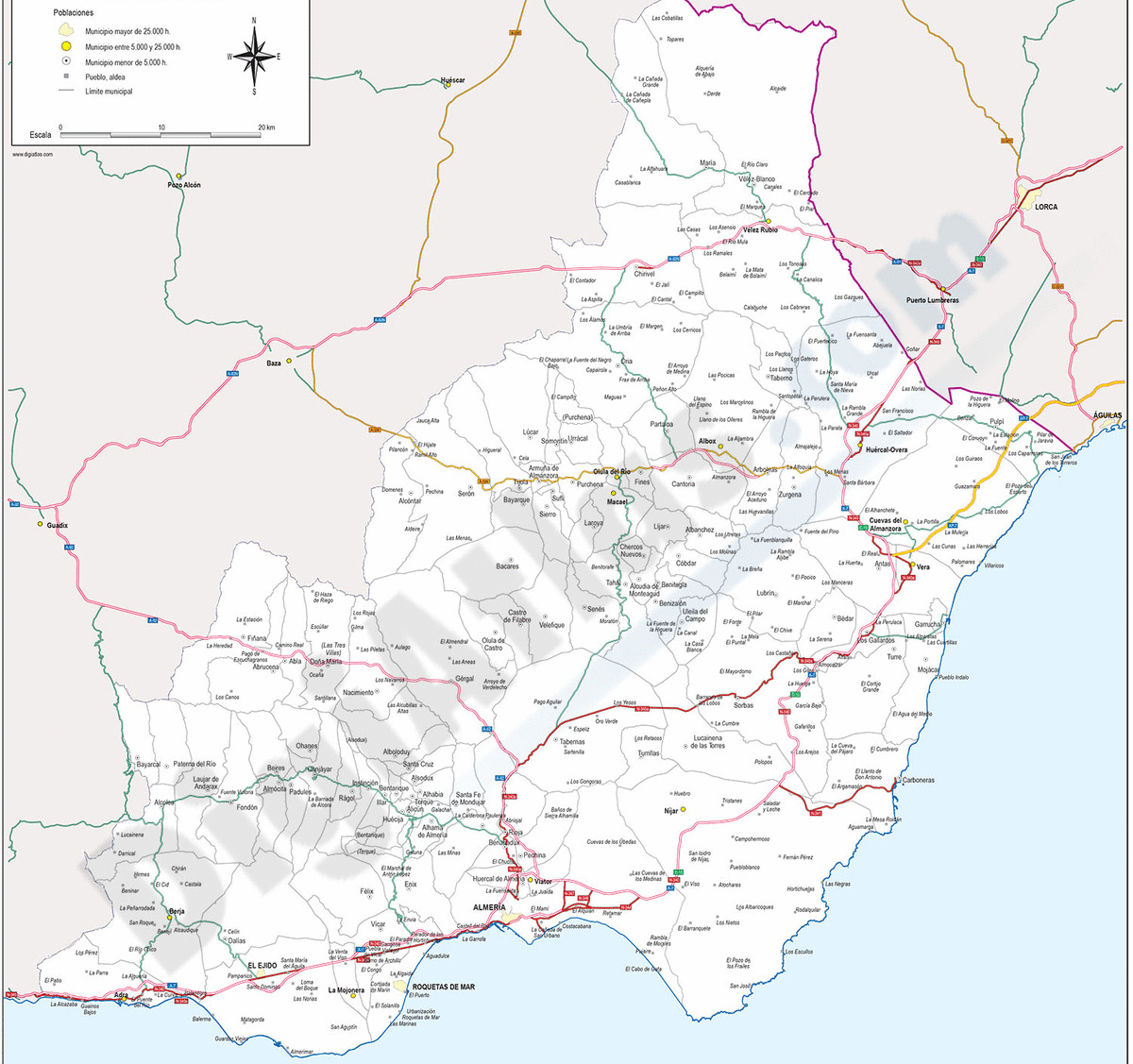
1- Almeria - Province digital map

Digital map of the ALMERIA spanish province, showing community and province boundaries, cities, highways, major and minor roads, railroad, principal rivers and lakes and other relevant political information. Scale 1:200.000. TIFF image with the... Read more
Adobe Illustrator, PDF
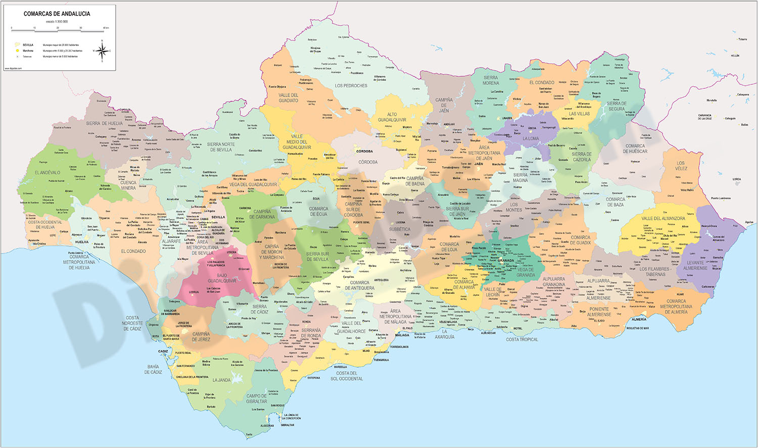
2- Andalucia provinces with municipalities
Digital maps of the 8 Andalusian provinces.
Each province is in a separate file and shows the boundaries or municipalities, the capitals, cities and towns grouped according to the number of inhabitants and the main road network (motorways, dual... Read more
Adobe Illustrator, Acrobat PDF
3- Comarcal maps of Spain autonomous communities
Maps of the comarcal division of all 17 spanish autonomous communities. Each map shows administrative limits and their coloured and named comarcas, capitals and major cities.
Vectorized and fully editable files in Adobe Illustrator and PDF formats.... Read more
Adobe Illustrator, PDF
4- Map of Eastern Andalucia (Spain)

Map of Eastern Andalucia (Granada, Jaen and ALMERIA provinces), showing community and province boundaries, cities, highways, major and minor roads, railroad, rivers and lakes and relevant geographic information. Scale 1:450.000. Relief image... Read more
Adobe Illustrator, Acrobat PDF
5- Roquetas de Mar - city map
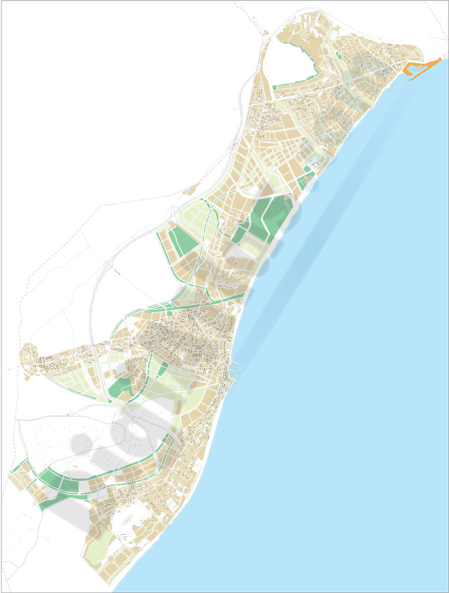
Vector-file map of Roquetas de Mar (Province of ALMERIA, autonomous community of Andalucía, Spain). All features are in separated layers.
Adobe Illustrator, PDF