1- Map of Bahamas

Fully editable vector file. Include political layers of inner administrative division, with their names and capitals.
Adobe Illustrator, PDF
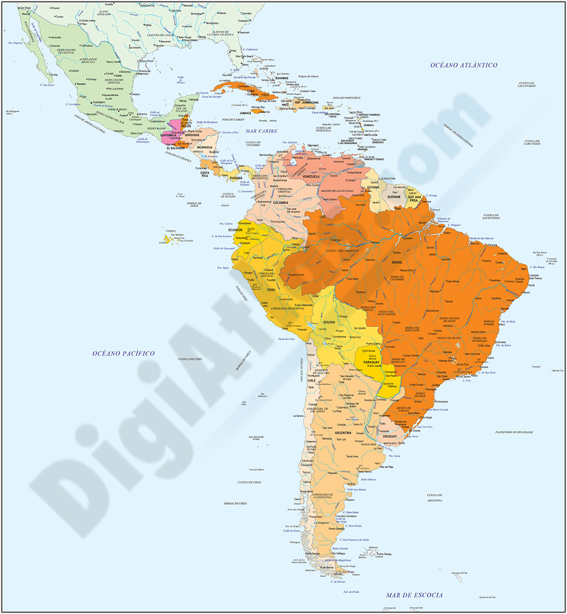
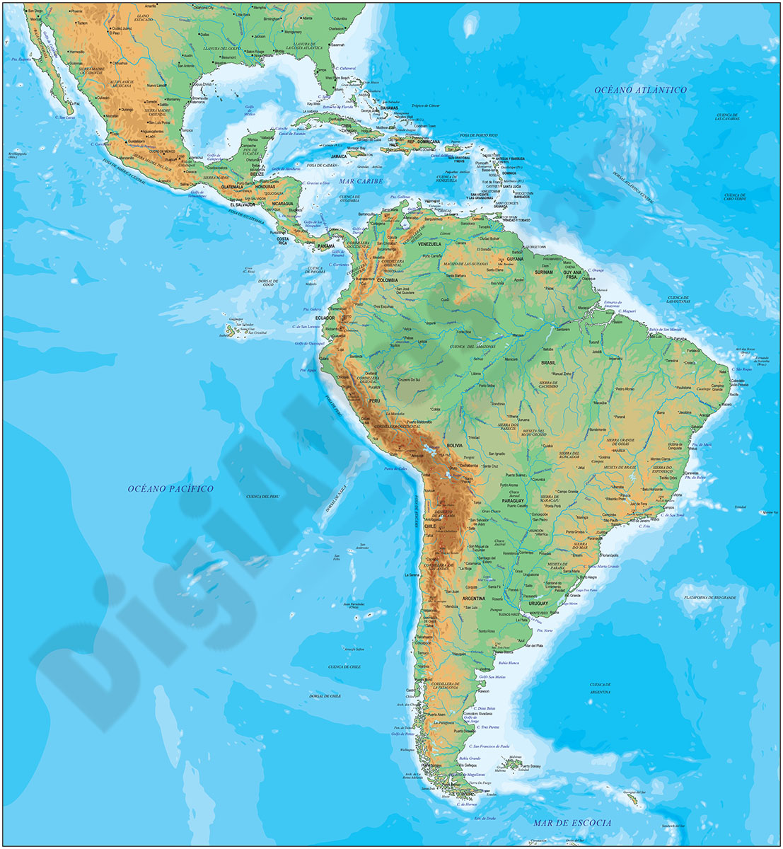
2- South and Central America and Mexico
Digital map of South America and Mexico with political and geographic information.
It contains two separate files: one with the political version: borders, coloured countries, main rivers and lakes, capitals and important cities.
A second file... Read more
Adobe Illustrator, Acrobat PDF