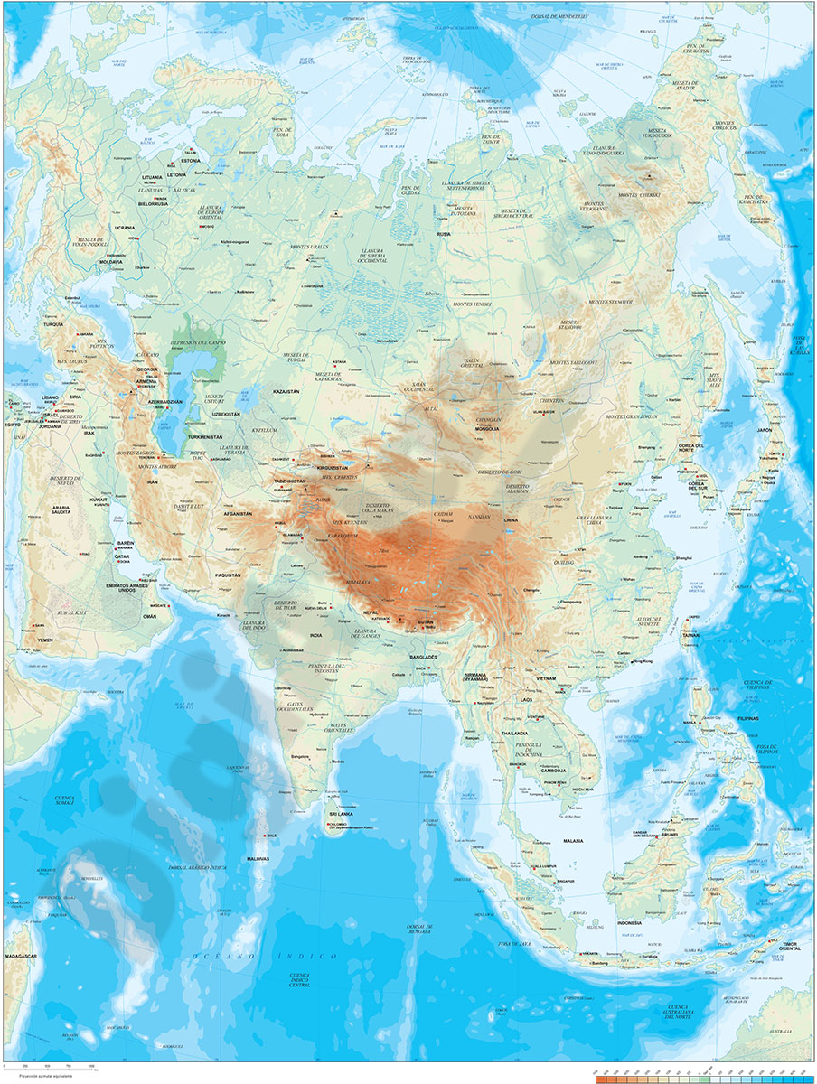
1- Asia physical vectorized-relief map
Digital map of Asia.
Map in 100% editable vector format of the entire Asian continent, with the altimetry and bathymetry strips coloured and separated in layers, all country borders with their capitals, geographical names and important towns.
A TIFF image with shaded and coloured relief is included.
See less «
Adobe Illustrator, Acrobat PDF, TIFF image
2- Asia political and geographical map

Digital political and geographical map of Asia.
Download 100% editable vectorized files with political and geographical layers of information (borders, countries, rivers, lakes, capitals, important cities and geographical names).
Includes a TIFF... Read more
Adobe Illustrator, Acrobat PDF, TIFF image
3- Map of Brunei

Fully editable vector file. Include political layers of inner administrative division, with their names and capitals.
Adobe Illustrator, PDF
4- Map of Indonesia

Digital political map of the Republic of Indonesia with internal administrative divisions, their names and capitals.
Vector map 100% editable.
Adobe Illustrator, Acrobat PDF