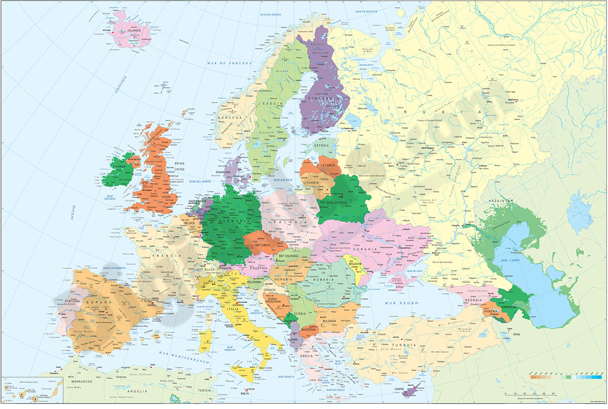
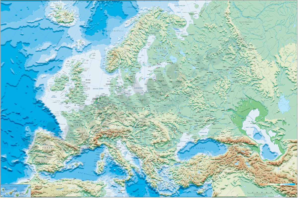
1- Europe political and geographical map
Digital physical and geographical map of Europe.
Digital cartography of the entire European continent with relevant physical and political information. Includes country borders, capitals, major rivers and lakes, important cities and geographical... Read more
Adobe Illustrator, Acrobat PDF + TIFF
2- Map of Hungary
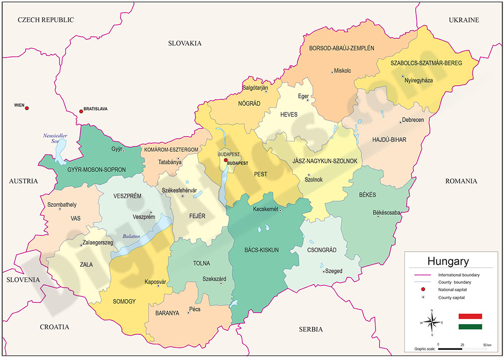
Political map of Hungary, in digital format, with the twenty coloured regions: 19 counties (megyék) and the capital city Budapest, their names and capitals.
100% editable vector map organised in separate layers.
Adobe Illustrator, Acrobat PDF
3- Map of Hungary with regions and Postal Codes
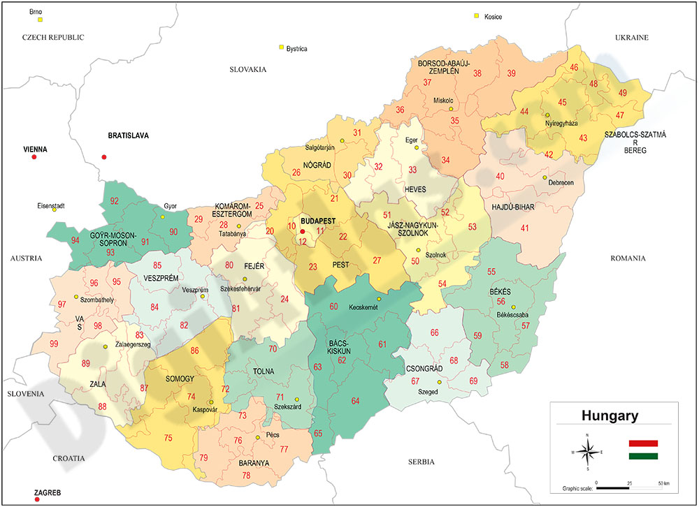
Vectorized and fully editable Map of Hungary with regions, capitals and 2-digit postal codes.
Illustrator, PDF