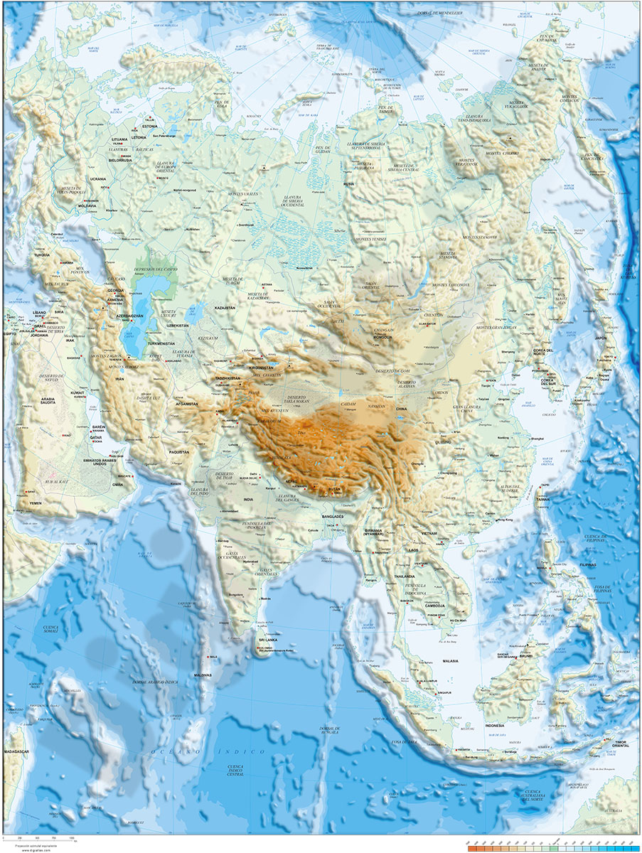
1- Asia physical vectorized-relief map
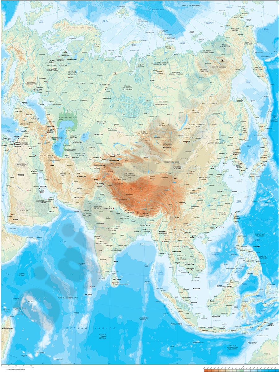
Digital map of Asia.
Map in 100% editable vector format of the entire Asian continent, with the altimetry and bathymetry strips coloured and separated in layers, all country borders with their capitals, geographical names and important towns.
A... Read more
Adobe Illustrator, Acrobat PDF, TIFF image
2- Asia political and geographical map
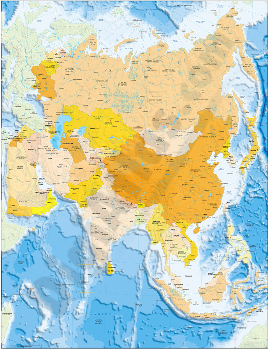
Digital political and geographical map of Asia.
Download 100% editable vectorized files with political and geographical layers of information (borders, countries, rivers, lakes, capitals, important cities and geographical names).
Includes a TIFF... Read more
Adobe Illustrator, Acrobat PDF, TIFF image
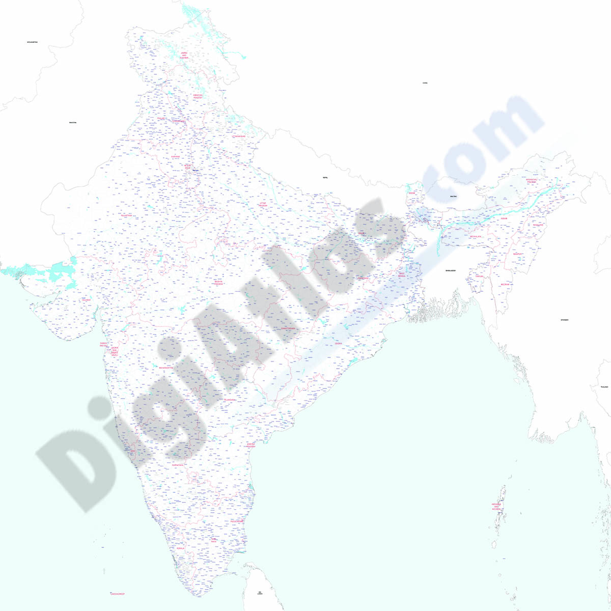
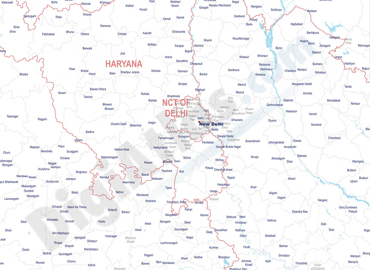
4- Map of India
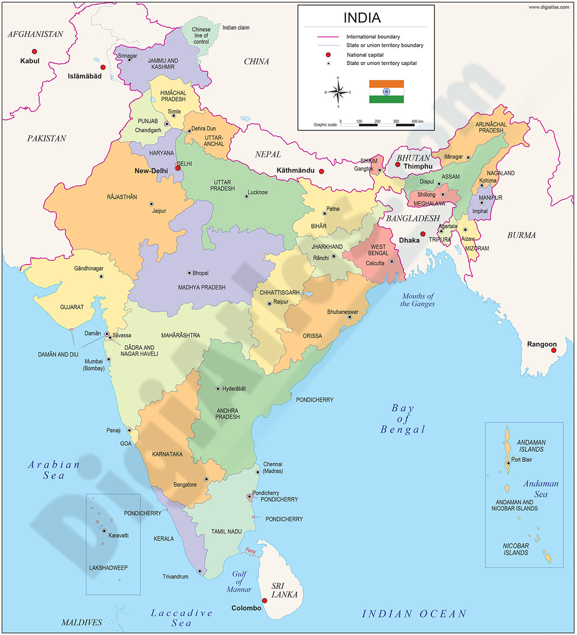
Fully editable vector file map of INDIA.
Political map of INDIA showing inner administrative division of the federal union, comprising 29 states with their names and capitals.
Downloads vectorized files organized in separate layers.
Adobe Illustrator, Acrobat PDF