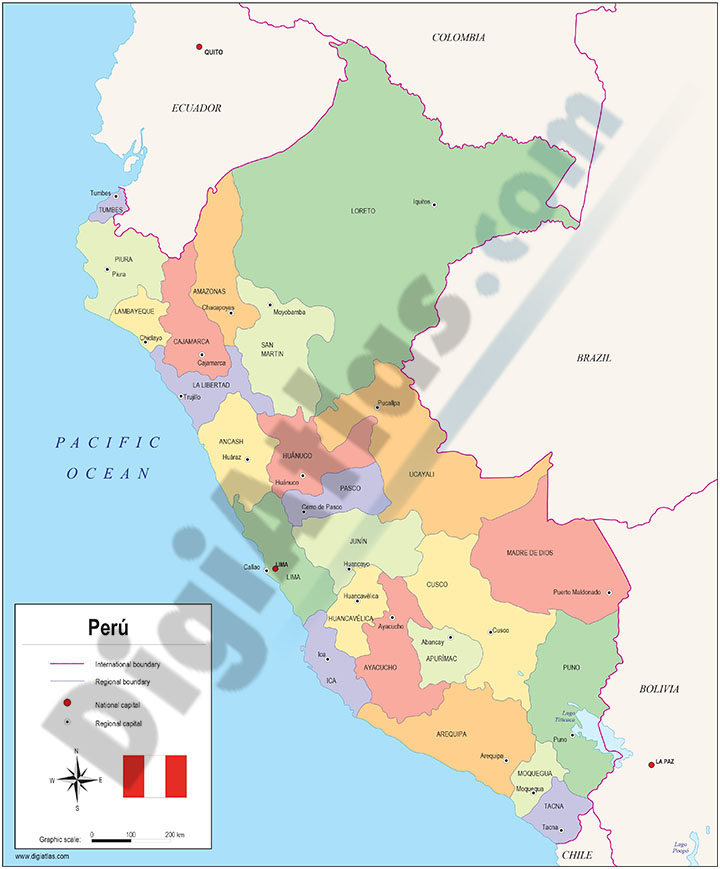
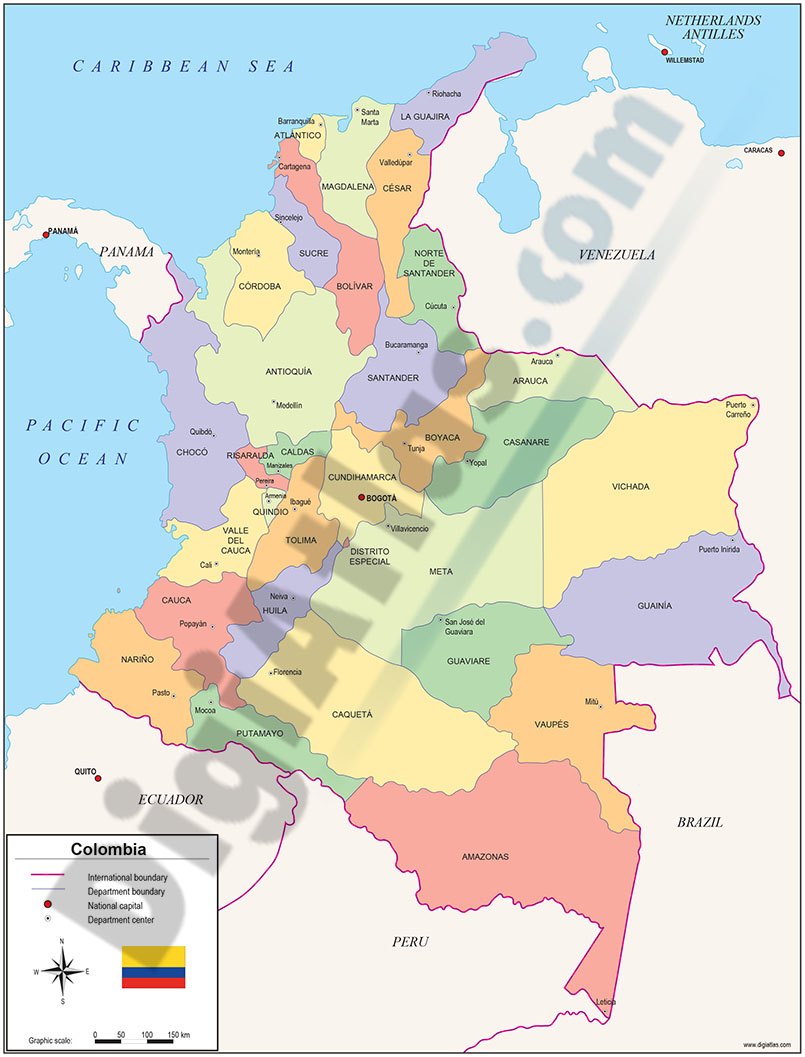
1- Maps of Central and South american countries with political division
Digital maps of Argentina, Bolivia, Brazil, Chile, Colombia, Ecuador, Guyana, Paraguay, Peru, Surinam, Uruguay, Venezuela, Guatemala, Belize, Honduras, El Salvador, Nicaragua, Costa Rica, Panamá and Mexico, with their administrative division.... Read more
Adobe Illustrator, Acrobat PDF
2- Central America political map
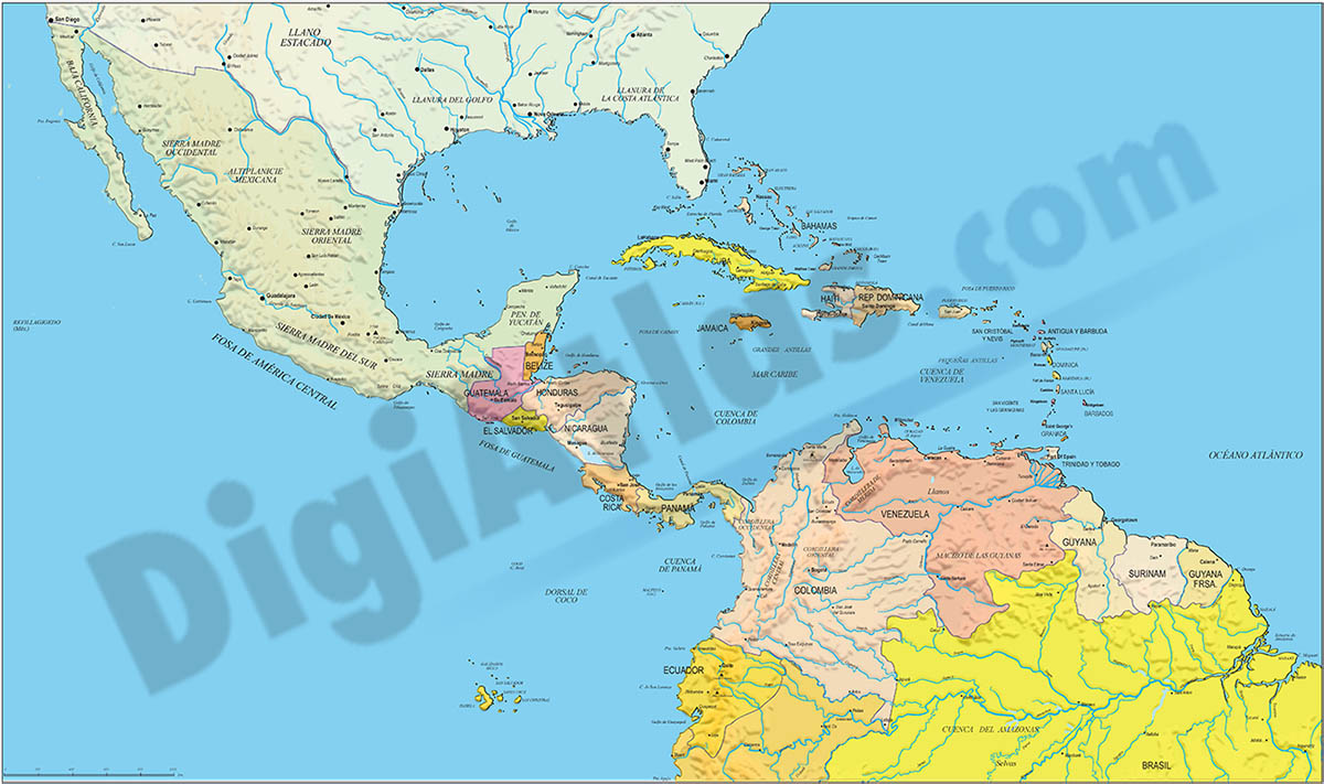
Digital file of Central America (Central America or América del centro) with the delimitation of the countries and other layers with geographical and political information (relief, rivers, lakes, capitals and important cities).
It shows the... Read more
Adobe Illustrator, Acrobat PDF, image TIFF
3- Map of Panama
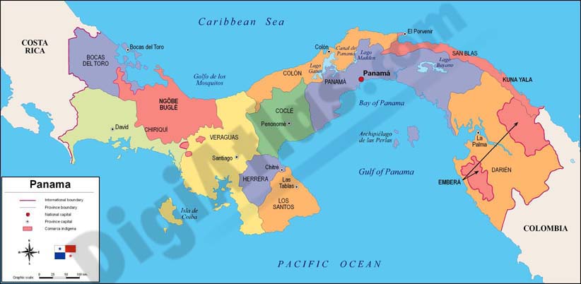
Fully editable vector file. Include political layers of inner administrative division, with their names and capitals.
Adobe Illustrator, PDF