89,00 €
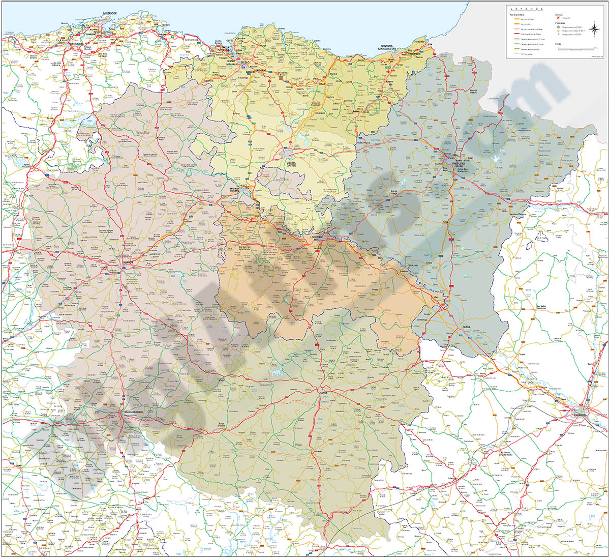
Map of Basque Country, Navarra, La Rioja, Burgos and Soria
Vector-file map of the Basque country, Navarra, La Rioja, Burgos and Soria spanish provinces, with detailed political and geographical information, such as administrative limits, towns and cities, roa
(...) Read more »
Acrobat PDF, JPG (300dpi)
98,00 €
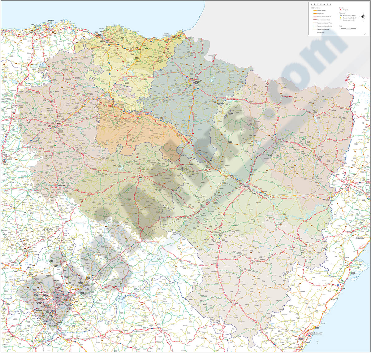
Map of Basque Country, Navarra, La Rioja, Burgos, Soria and Aragón
Vector-file map of the Basque country, Navarra, La Rioja, Burgos, Soria and Aragón spanish provinces, with detailed political and geographical information, such as administrative limits, towns and ci
(...) Read more »
Acrobat PDF, JPG (300dpi)
89,00 €
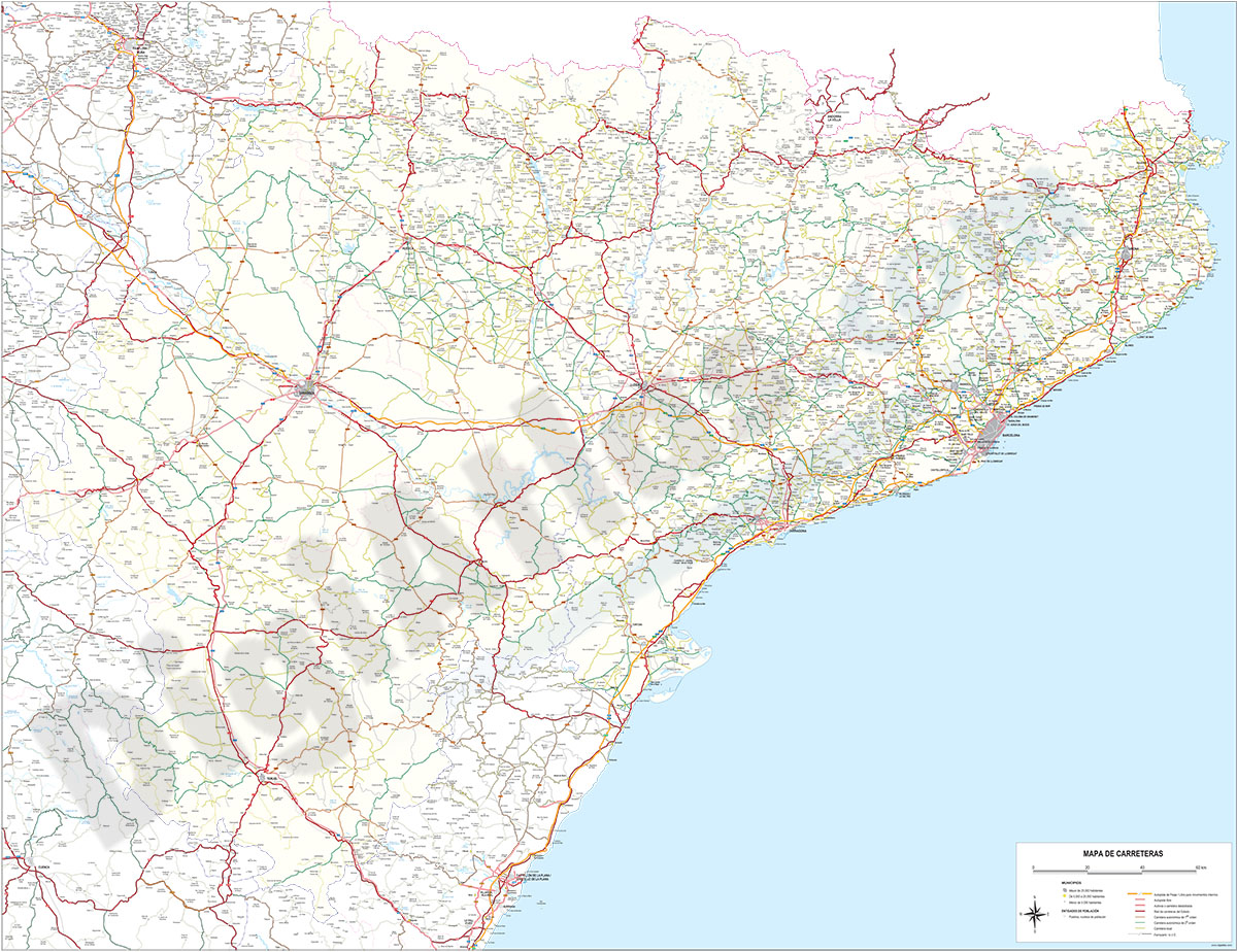
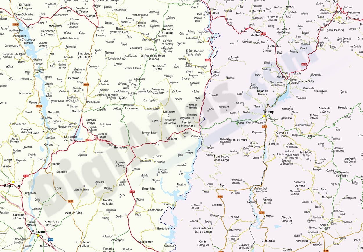
Map of Catalonia and Aragon with all roads and cities
Detailed map of Catalonia and ARAGON autonomous communities at scale 1:300,000 showing all motorways, national, regional and local roads and all towns and villages. vectorized file organized in separa
(...) Read more »
Adobe Illustrator, PDF, JPG (300dpi)
Ask price
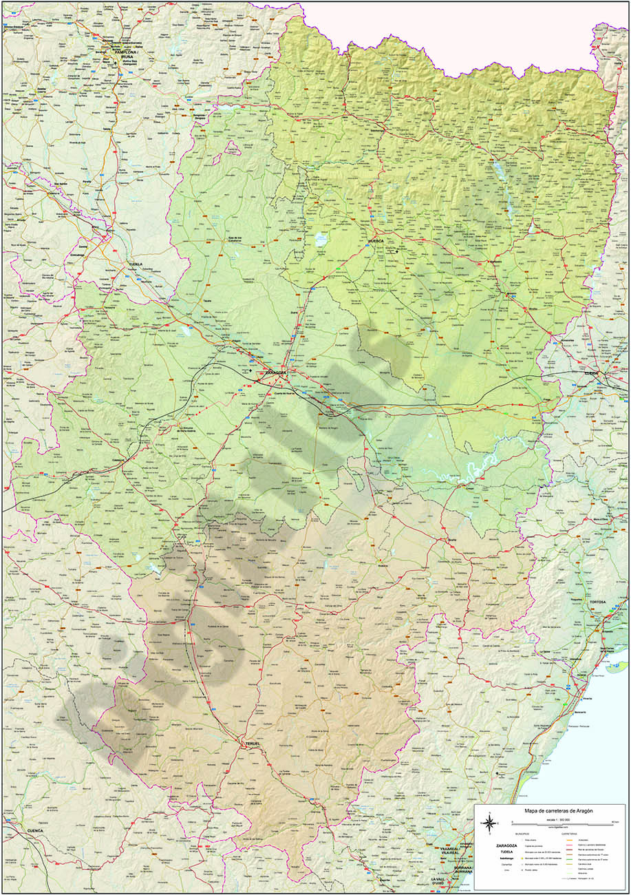
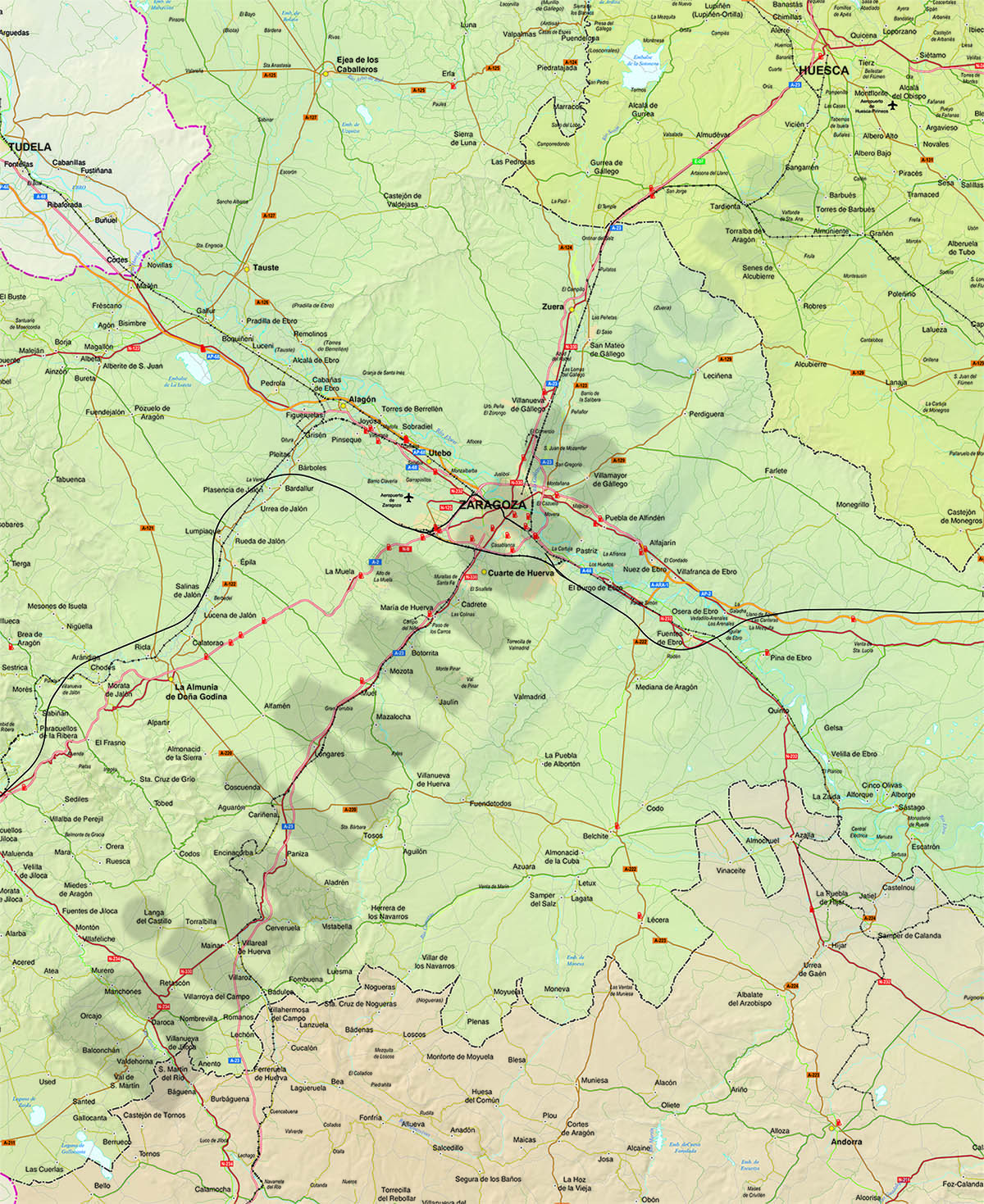
Roadmap of Aragon
Digital map of the autonomous community of ARAGON (Spain) at a scale of 1:300.000, with all the municipalities, regional and provincial boundaries, detailed network of roads, roads and tracks,
(...) Read more »
Adobe Illustrator, Acrobat PDF