29,00 €
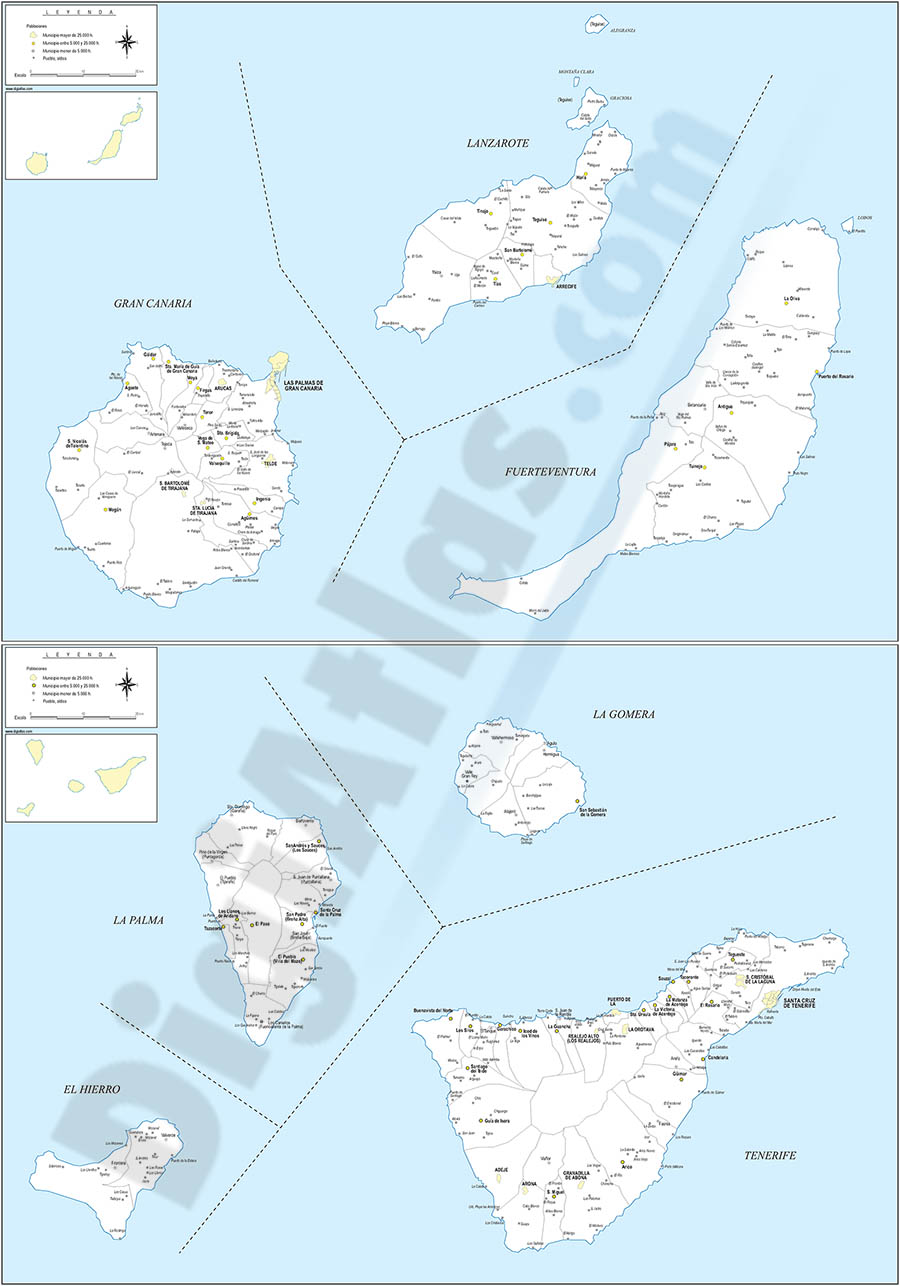
Map of Canary Islands (Spain) with municipalities
Map of Canary Islands Autonomous Community (Spain) showing their two provinces (Santa Cruz de Tenerife and Las Palmas) with the municipalities borders, capitals, towns and cities.
Adobe Illustrator, PDF

125,00 €
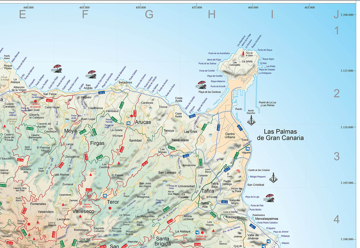
Map of Gran Canaria island (canary islands)
Gran Canaria island vector map showing detailed geographic and touristic information. High-resolution color shaded relief TIFF image is included. Scale: 1:100.000.
Adobe Illustrator, PDF
55,00 €
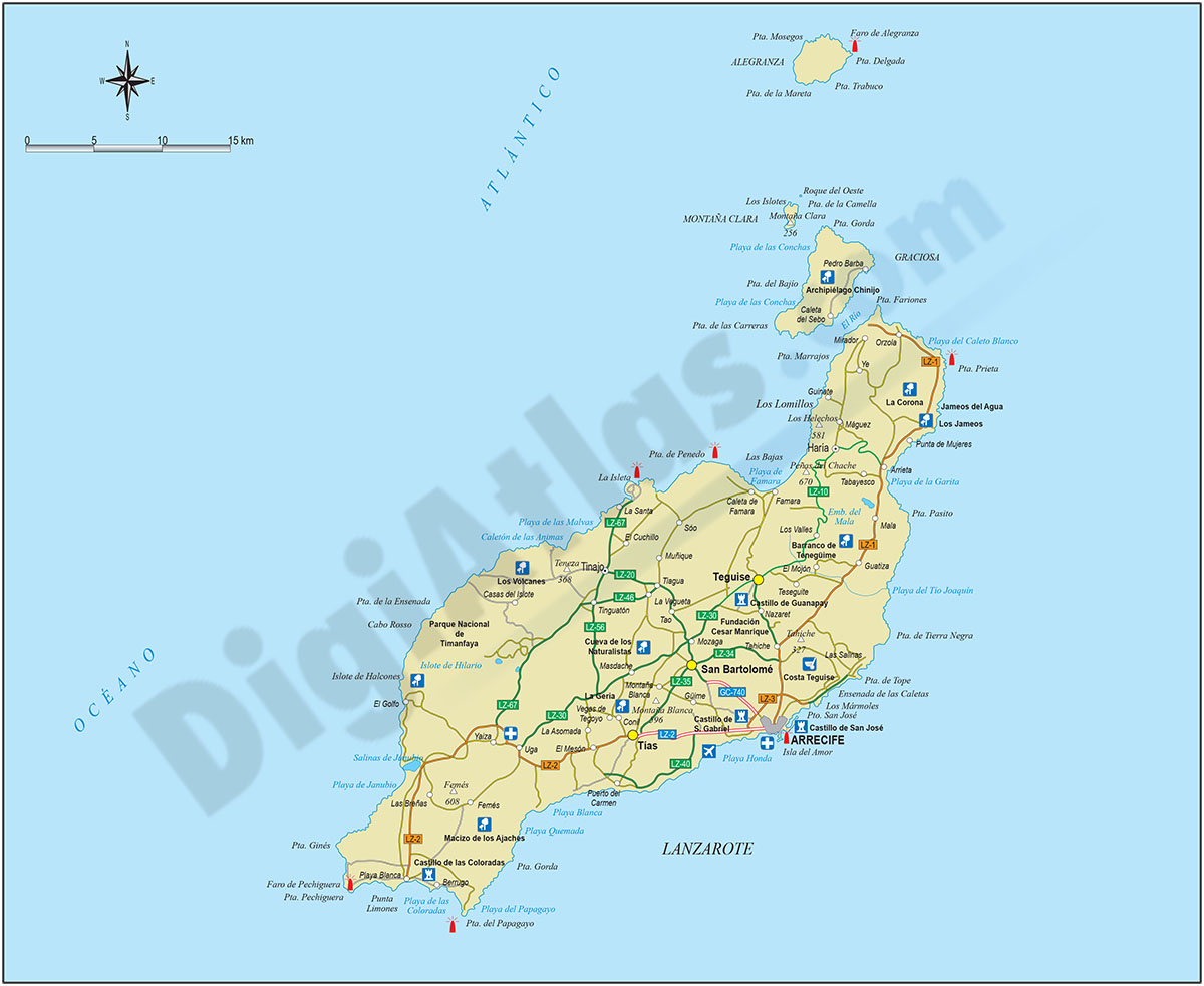
Map of Lanzarote island (canary islands)
Vector file map of Lanzarote island (Canary Islands, Spain). All features are in separated layers. Include roads, political layers and touristic information.
Adobe Illustrator, Acrobat PDF
78,65 €
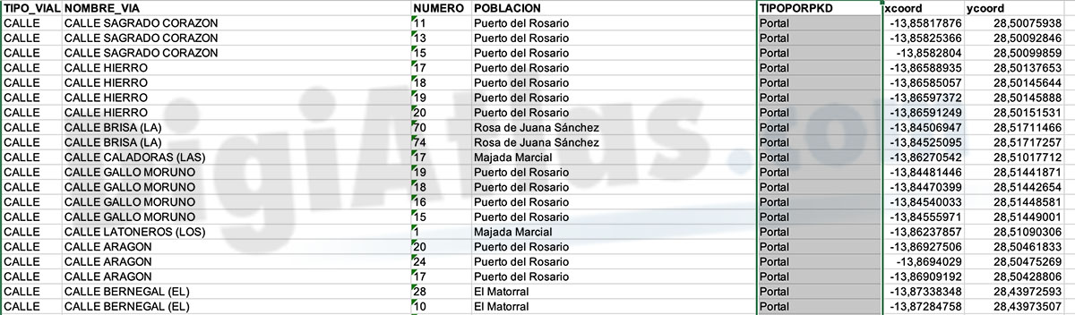
Puerto del Rosario - House site-coordinates
Excel file with the houses coordinales of Puerto del Rosario municipality.
Excel