
98,00 €
Map of Ibiza-Eivissa island (Balearic Islands)
Vectorized map of Eivissa-IBIza island (Balearic islands) howing detailed geographic and touristic information. Include High-resolution color shaded relief TIFF image. Scale: 1:70.000.
Adobe Illustrator, PDF, JPG (300dpi)

55,00 €
Map of Ibiza-Eivissa island (Balearic Islands)
Digital map of the island of IBIza (Eivissa, Illes Balears) at a scale of 1:300.000 with the main towns, road network, railway network, rivers and lakes.
(...) Read more »
Adobe Illustrator, Acrobat PDF
19,95 €
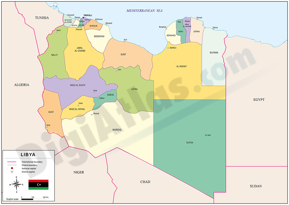
Map of Libya
Digital political map of Libya with the former territorial division into 22 districts or shabiyat (in force between 2006 and 2012), their names and capitals.
Vector map 100% editable.
Adobe Illustrator, Acrobat PDF

19,95 €
Map of Namibia
Digital political map of the Republic of NamIBIa with the internal political-administrative organisation (14 regions since the division of the Kavango region), their names and capitals.
(...) Read more »
Adobe Illustrator, Acrobat PDF