
PACK DIGIATLAS
Download up to 15 digital maps of your choice through a subscription to the 'Pack DigiAtlas'.


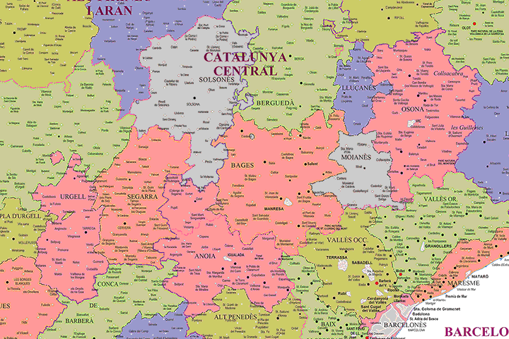
-Description:
Political map of Catalonia (Autonomous community of Spain), in digital format, with the division into Vegueries and Comarques, their capitals, towns and places of interest.
Fully editable vector format map, organised in layers to customise colours, texts and styles. High resolution files for high quality printing.
The vector format of the files allows, for example, to cut out and enlarge certain areas of the map to create working copies or print them at high quality, hide and/or visualise different layers of information to generate personalised versions of the plans, modify colours and styles to adapt them to your preferences, add more layers of information, such as logos, etc.
-Original measurements:
68x61 cm (Fully resizable vector file for High-quality printing).
-Download formats:
Adobe Illustrator, Acrobat PDF
-You can also request a quote » to modify this map and adapt it to your projects.
Download up to 15 digital maps of your choice through a subscription to the 'Pack DigiAtlas'.

Postcode maps of cities, regions and countries. Optionally with demographic data for geo-marketing projects.

City street maps with delineation of urban areas, streets, squares, parks, green areas, buildings of interest, etc.
DigiAtlas select every week until three random maps from their catalog and intends to offer them at a very lower price than its regular cost.
These maps change every 7 days. If either of them matches your interest take advantage of this opportunity to acquire digital maps to a very special price.