
Ask price
Map of Africa Poster
Poster-size digital map of Africa with detailed political and geographical information.
Adobe Illustrator, Acrobat PDF

120,00 €
Roadmap of Spain and Portugal
Digital map of roads and towns in Spain and Portugal.
(...) Read more »
Adobe Illustrator, Acrobat PDF

125,00 €
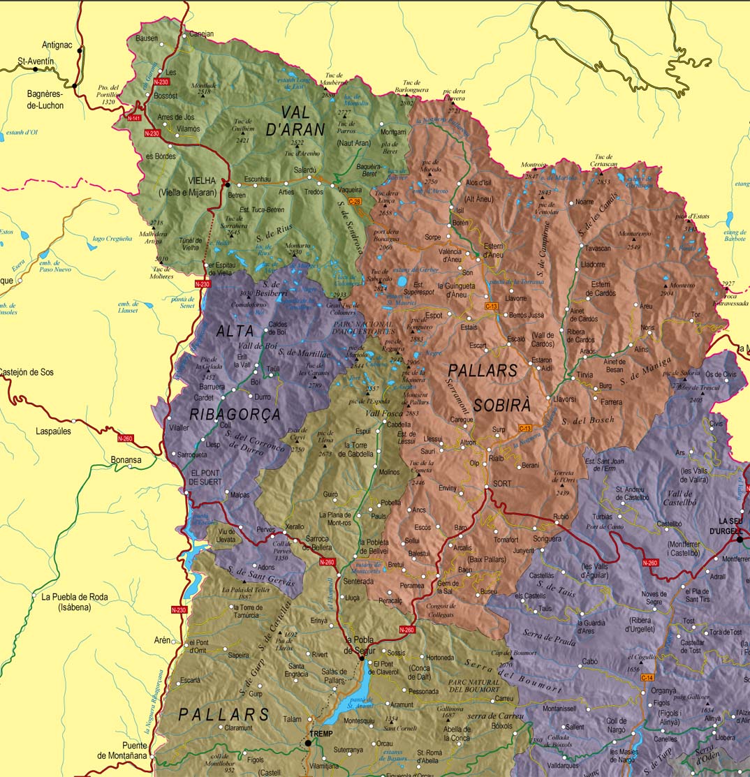
Catalonia Physical-political poster map
Poster size map of Catalonia (Catalunya in catalan, Cataluña in spanish) showing administrative borders: provinces and comarcas, roadmaps: highways, major and minor roads, railroad, principal rivers
(...) Read more »
Adobe Illustrator, PDF + TIFF, JPG (300dpi)

Ask price
Map of Africa and Europe
Map of Africa and Europe with a TIFF-image relief and vectorized bathimetry
imagen TIFF

55,00 €
Maps of Central and South american countries with political division
Digital maps of Argentina, Bolivia, Brazil, Chile, Colombia, Ecuador, Guyana, Paraguay, Peru, Surinam, Uruguay, Venezuela, Guatemala, Belize, Honduras, El Salvador, Nicaragua, Costa Rica, Panamá and
(...) Read more »
Adobe Illustrator, Acrobat PDF

98,00 €
Physical-Political Poster World map
Physical and political digital world map, with borders, colours and names of countries, capitals, main rivers and lakes, capitals and important towns, geographical names and the altimetry and bathymet
(...) Read more »
Adobe Illustrator, Acrobat PDF

55,00 €
15 maps of Spanish provinces with comarcas and municipalities
Digital maps of 15 provinces of Spain with comarcas and municipalty borders and city names. (Cáceres, Badajoz, Albacete, Ciudad Real, Toledo, Alicante, Castellón, Valencia, Murcia, Burgos, León, Sa
(...) Read more »
imagen JPG (250 dpi)
