
98,00 €
Physical-Political Poster World map
Physical and political digital world map, with borders, colours and names of countries, capitals, main rivers and lakes, capitals and important towns, geographical names and the altimetry and bathymet
(...) Read more »
Adobe Illustrator, Acrobat PDF

98,00 €
America centered physical-political Worldmap with Seaports
Fully editable vector-file world map America centered. Include country boundaries and colors, capitals, major river and lakes and major cities, geographical names. Also include 700 major Seaports.
Adobe Illustrator, Acrobat PDF

25,00 €
Carte mondiale physico-politique DIN A4
Carte digitale physico-politique du monde en format DIN A4 en français.
(...) Read more »
Adobe Illustrator, Acrobat PDF

98,00 €
China centered political worldmap
Political World map in vector format centered on China.
(...) Read more »
Adobe Illustrator, Acrobat PDF

98,00 €
Great Worldmap Poster Relief
Large digital relief map of the world.
Great Worldmap poster with relief available in a TIFF image of 23622x15249 pixels and 250 dpi resolution.
(...) Read more »
Adobe PhotoShop (.psd)

98,00 €
Physical Poster Worldmap centered in Bahrain
Poster-size physical world map centred on Bahrain
(...) Read more »
Adobe Illustrator, Acrobat PDF

98,00 €
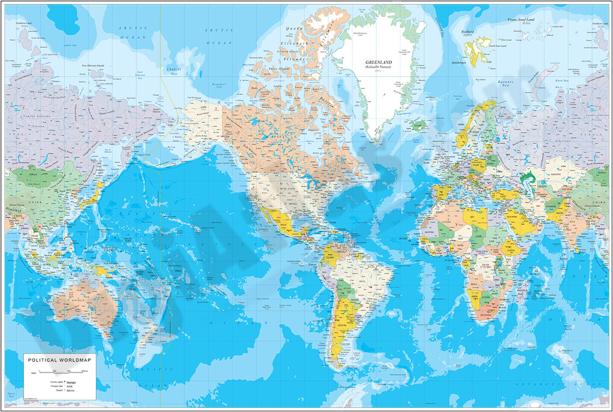
Physical Poster Worldmap vector file
Fully editable vector-file world map. Contains country boundaries and names, capitals, major cities, river and lakes and geographical names. Colors of topography and bathimetry are in separate vector
(...) Read more »
Adobe Illustrator, Acrobat PDF

98,00 €
Physical-Political DIN A3 Worldmap
Vectorial physical-political world map in Catalan, Spanish and English languages. It includes land and sea relief, coloured countries, their capitals, main cities, rivers, lakes and most relevant geog
(...) Read more »
Adobe Illustrator, Acrobat PDF

125,00 €
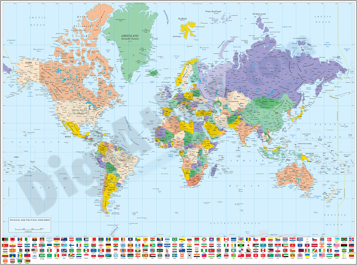
Physical-Political Poster Worldmap with flags
Physical and political digital world map with borders, colors and names of the countries, their capitals, main rivers and lakes, most important towns, geographic names and colors of land and sea relie
(...) Read more »
Adobe Illustrator, Acrobat PDF, TIFF image

175,00 €
Physical-Political Worldmap with Container Ports
Physical-political digital world mapa with container ports.
(...) Read more »
Adobe Illustrator, Acrobat PDF
98,00 €
Physical-Political Worldmap with Sea Ports and Airports
Poster-size physical-political digital world map.
(...) Read more »
Adobe Illustrator, Acrobat PDF

98,00 €
Political Poster World Map with Seaports
Fully editable vector-file world map. Include political information such as country boundaries and coloured countries, capitals, major river and lakes and major cities, geographical names and more tha
(...) Read more »
Adobe Illustrator, PDF
98,00 €
Political World map with flags
Fully editable vector file. Layers: colour and name of countries, international boundaries, major rivers and lakes and country capitals. Include flags of all countries.
Adobe Illustrator, Acrobat PDF

98,00 €
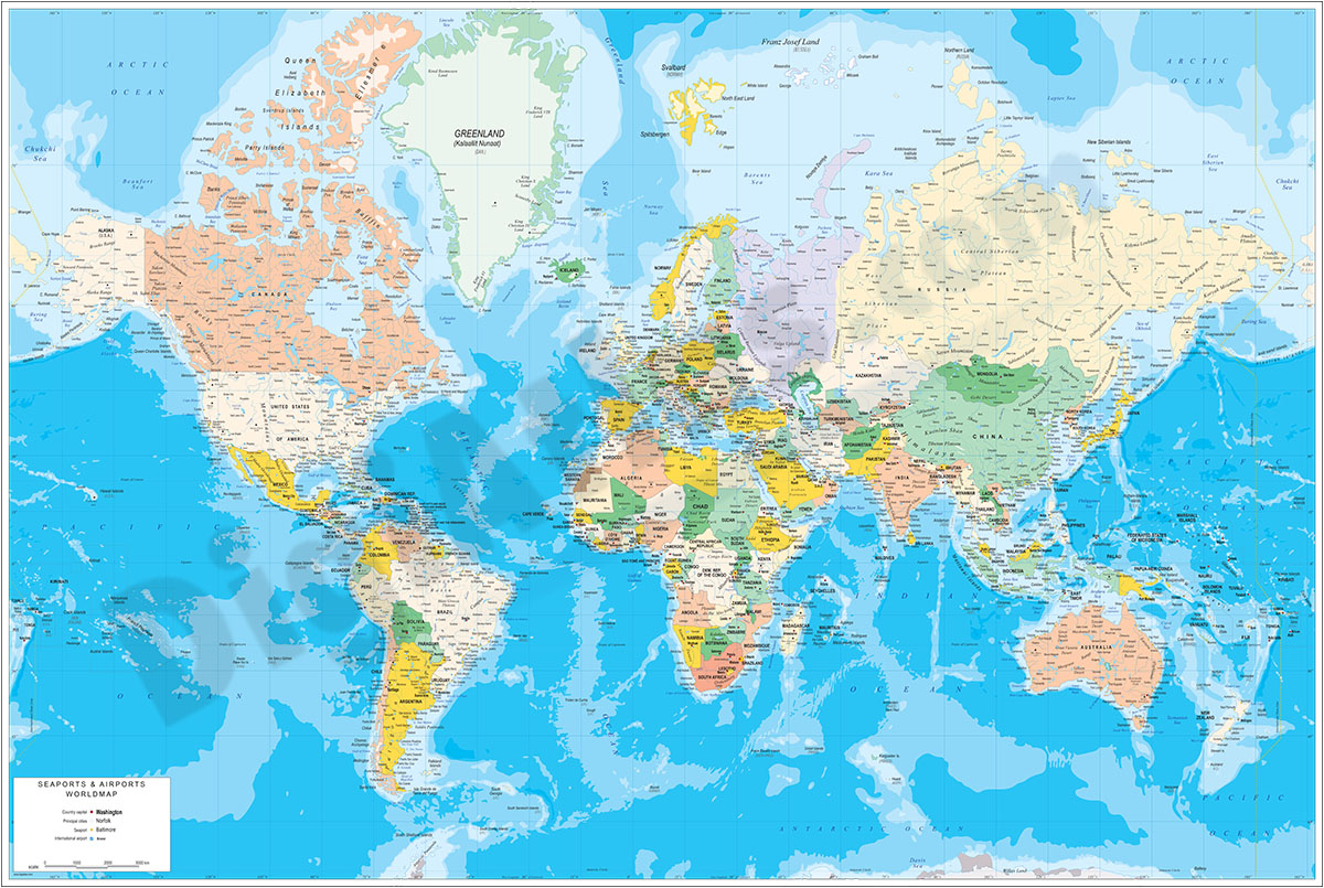
Poster Worldmap with Sea Ports and Airports
Digital world map with political information. It shows the coloured countries, capitals, main rivers and lakes, important towns, geographical names, seaports and important airports of each country.
<
(...) Read more »
Adobe Illustrator, Acrobat PDF

98,00 €
Relief Worldmap with Sea Ports
Fully editable vector file including major world sea ports and international boundaries, lakes and rivers, country capitals and U.S. states.
(...) Read more »
Adobe Illustrator, Acrobat PDF, TIFF image (300dpi)
