
PACK DIGIATLAS
Download up to 15 digital maps of your choice through a subscription to the 'Pack DigiAtlas'.

-Description:
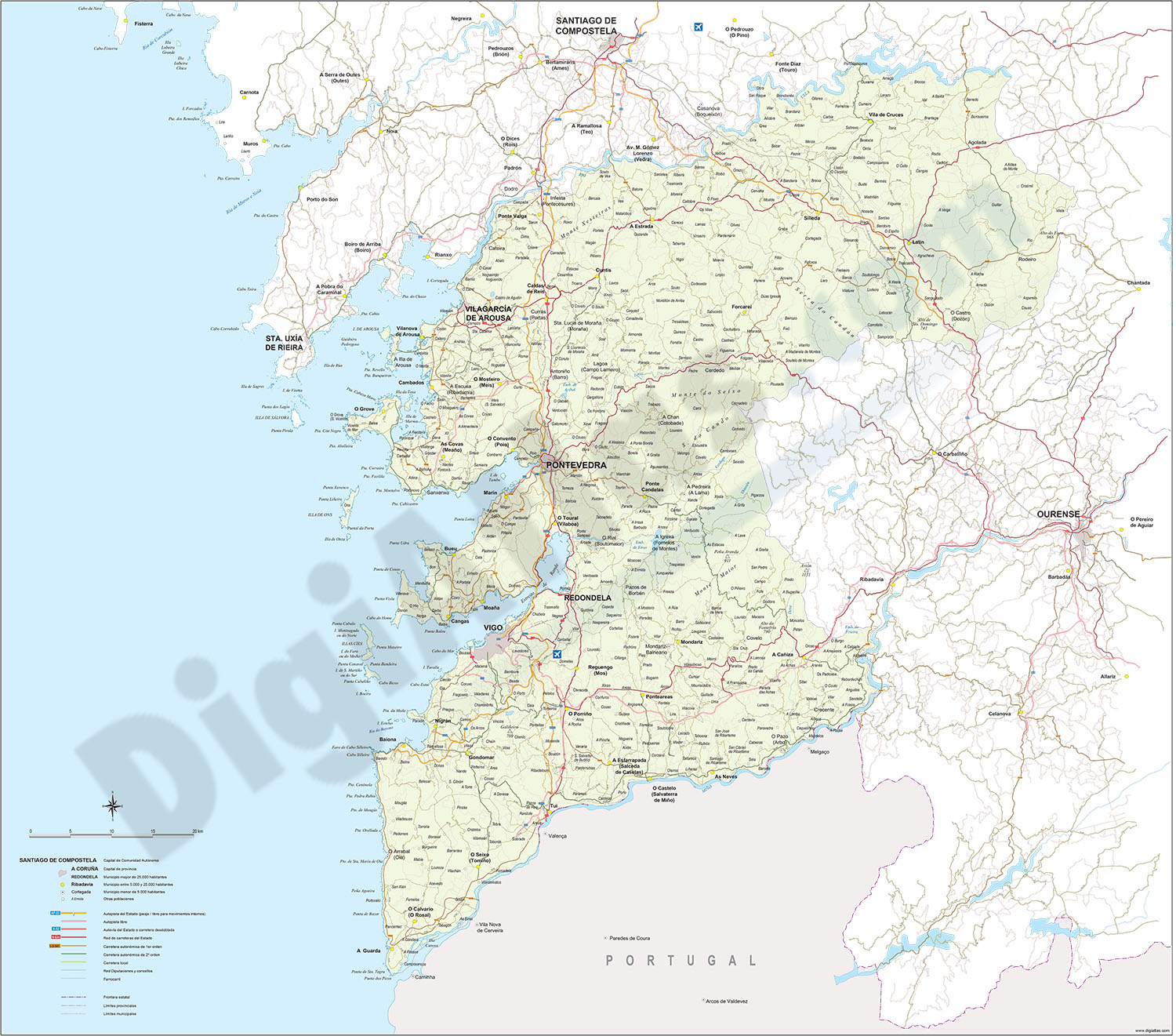
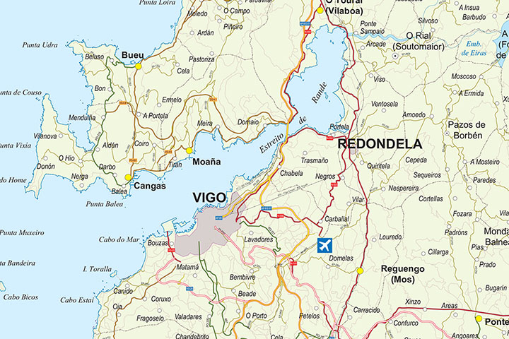
Vectorized map of the province of Pontevedra (autonomous community of Galicia, Spain) showing community and province boundaries, towns and cities, highways, detailed major and minor roads, railroad, principal rivers and lakes and other relevant political and touristic information. Scale 1:200.000. High quality for best prints.
-Original measurements:
100x88 cm (Fully resizable vector file for High-quality printing).
-Download formats:
Adobe Illustrator, PDF, JPG (300dpi)
- This map is also available through the PACK DIGIATLAS »
-You can also request a quote » to modify this map and adapt it to your projects.
Download up to 15 digital maps of your choice through a subscription to the 'Pack DigiAtlas'.

Postcode maps of cities, regions and countries. Optionally with demographic data for geo-marketing projects.

City street maps with delineation of urban areas, streets, squares, parks, green areas, buildings of interest, etc.
DigiAtlas select every week until three random maps from their catalog and intends to offer them at a very lower price than its regular cost.
These maps change every 7 days. If either of them matches your interest take advantage of this opportunity to acquire digital maps to a very special price.