275,00 €
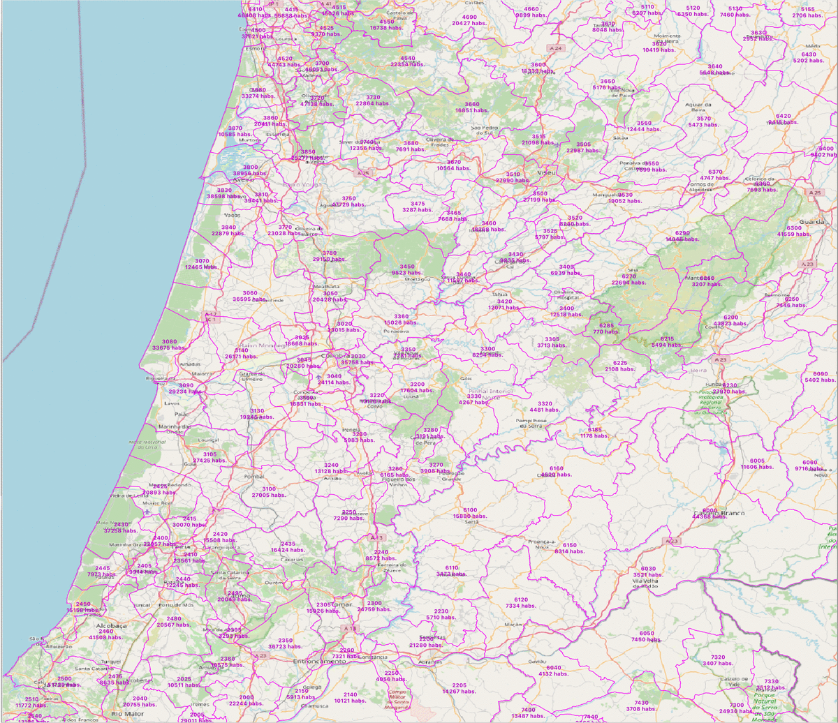
Portugal - population by 4 digit postal codes
Digital map of Portugal postcodes with population data.
(...) Read more »
Shapefile, Excel

55,00 €
El Prat de Llobregat (Spain) - city map
Digital street map of El Prat de Llobregat (province of Barcelona) with the delineation of streets and squares, blocks of houses, parks and green areas, with colours and names.
(...) Read more »
Adobe Illustrator, Acrobat PDF
59,00 €
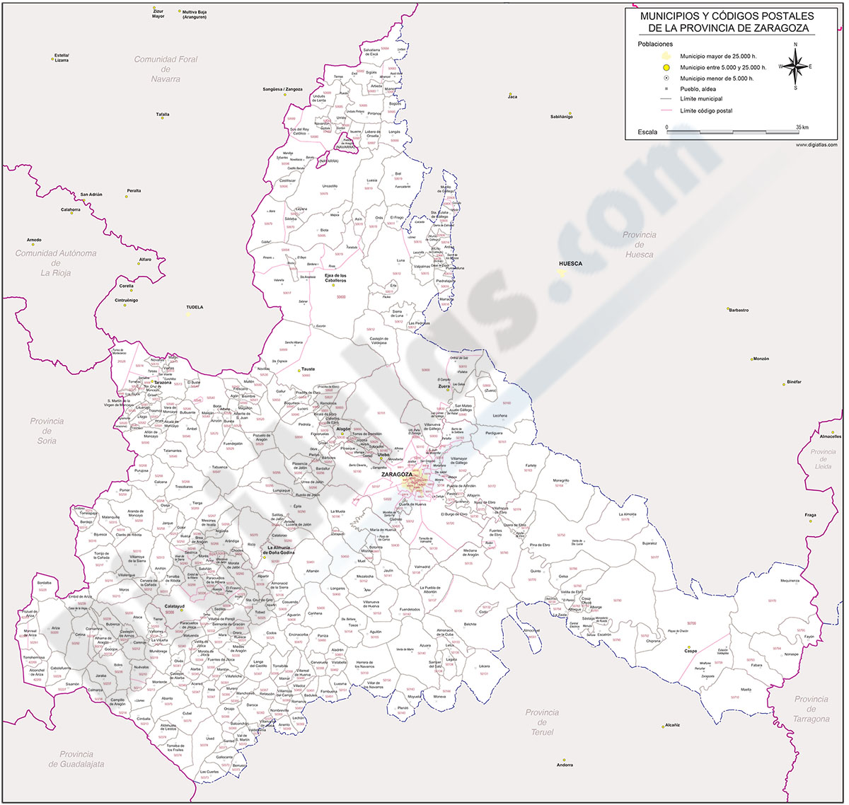
Map of Zaragoza province with municipalities and postal codes
-Postal codes map of Zaragoza province (autonomous community of Aragón, Spain), with municipalities borders, their capitals, cities and towns organized depending on population size, limits of the capital districts and all 5-digit postal code or ZIP code areas.
-Postal codes cartography of Zaragoza is available in vectorized format, organized in separate layers which can be shown / hidden for generating personalized versions of the map, as well as to customize colors, texts and styles, highlight municipalities, postal codes polygons and be able to obtain different kinds of maps.
-Buying the map you will download two digital files: one copy in fully editable Adobe Illustrator (.ai) format, if appropriate graphics applications are available, and other version in Acrobat PDF format to easily be displayed and directly print to desired size, always with the highest resolution and print quality.
See less «