59,99 €
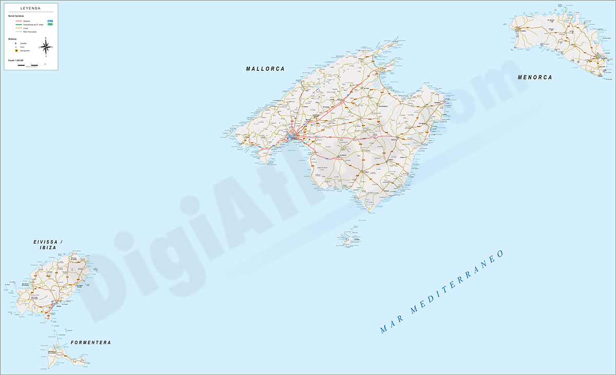
Mallorca - Map of Balearic Islands
Digital map of the Balearic Islands, including the entire Balearic archipelago: Mallorca, Menorca, Ibiza-Eivissa and Formentera. Tourist map at a scale of 1:300.000 with the main towns, road network,
(...) Read more »
Adobe Illustrator, Acrobat PDF
59,99 €
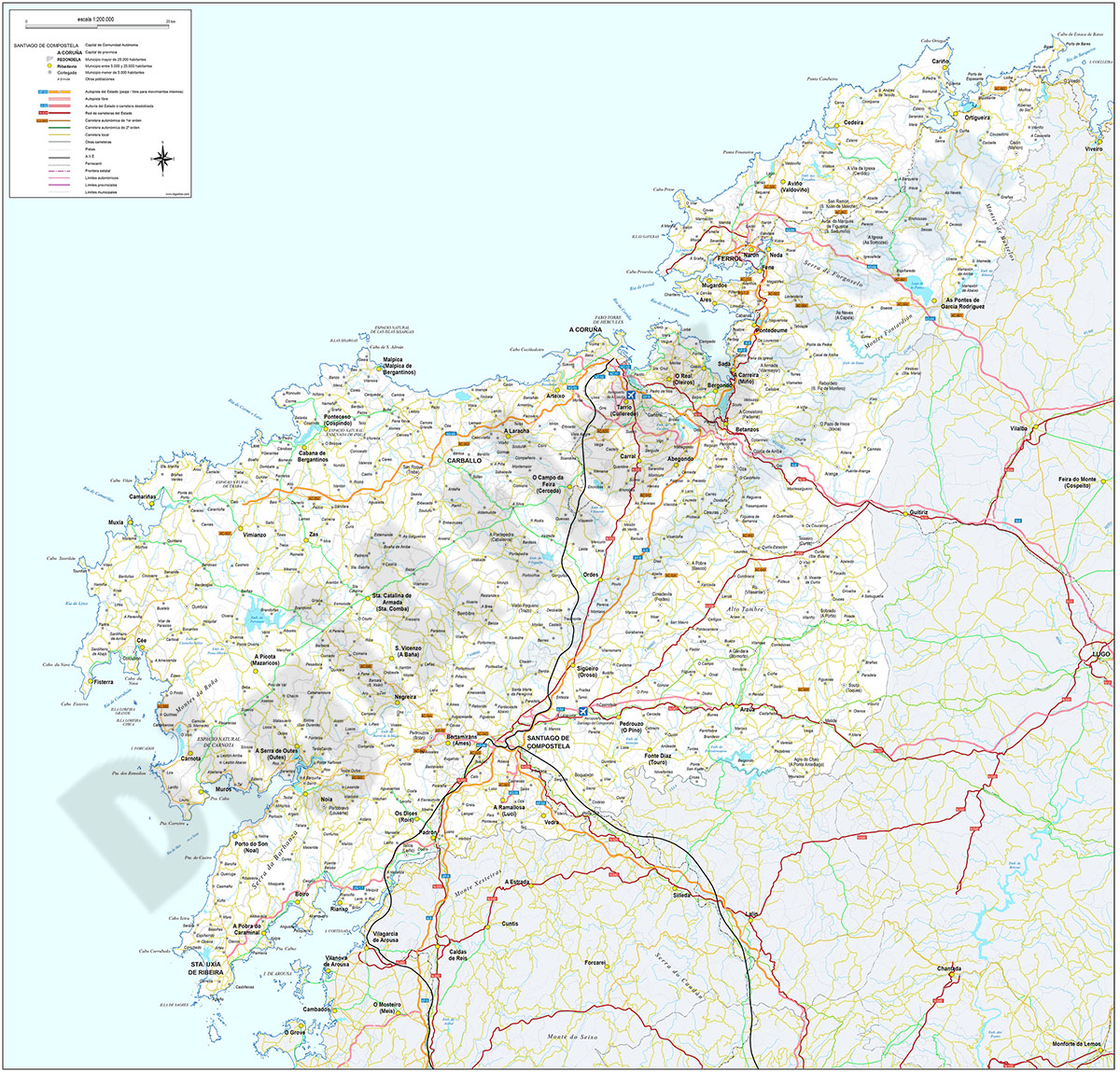
Map of A Coruña (Corunna)
Digital map of the province of A Coruña (Galicia) at a scale of 1:200.000 with the autonomous, provincial and municipal limits (Concellos), capitals, cities and population centres organised ac
(...) Read more »
Adobe Illustrator, Acrobat PDF

59,99 €
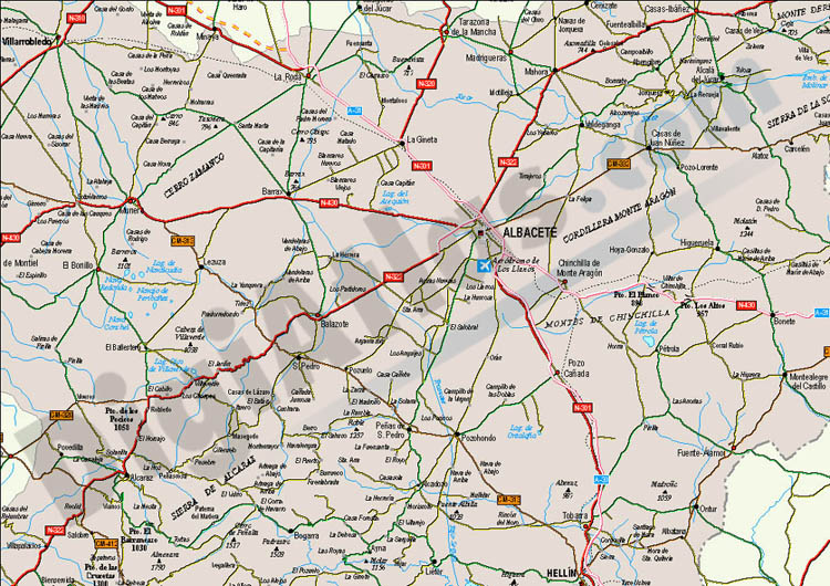
Map of Albacete
Digital map of the province of Albacete (Castilla-La Mancha) at a scale of 1:300.000 with the autonomous and provincial limits, municipalities and towns, motorways, dual carriageways, national and aut
(...) Read more »
Adobe Illustrator, Acrobat PDF
125,00 €
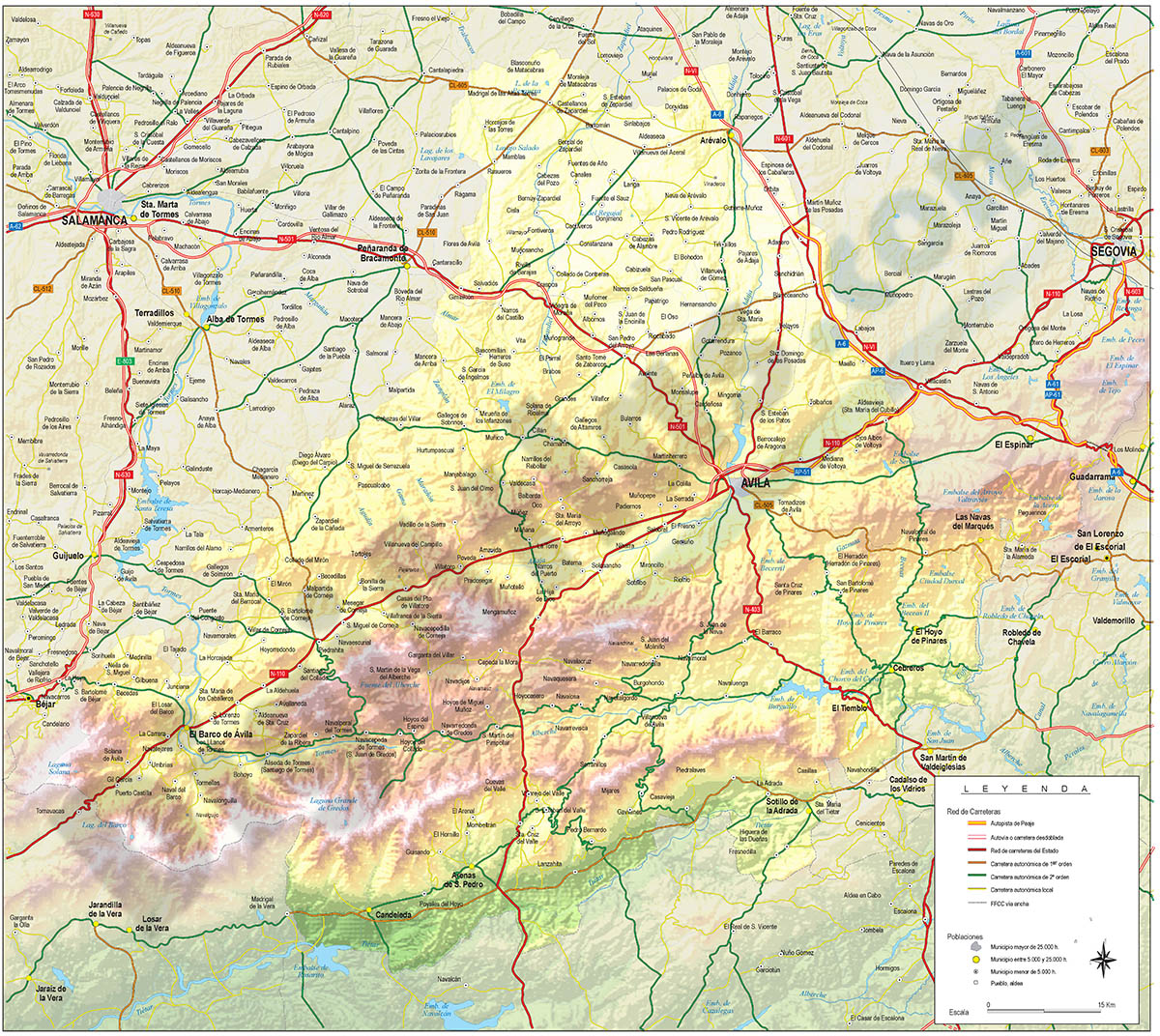
Map of Avila
Vector format spain province map showing community and province boundaries, cities, highways, major and minor roads, railroad, principal rivers and lakes and other relevant political information. Scal
(...) Read more »
Adobe Illustrator, PDF
Ask price
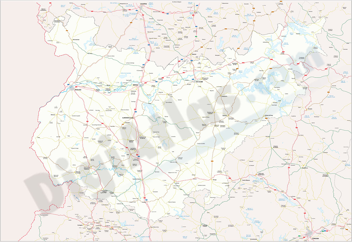
Map of Badajoz
Map of the province of Badajoz (Autonomous community of Extremadura, Spain) at a scale of 1:300.000 with regional, provincial and municipal boundaries (municipalities), capitals, towns and cities grou
(...) Read more »
Adobe Illustrator, Acrobat PDF
59,99 €
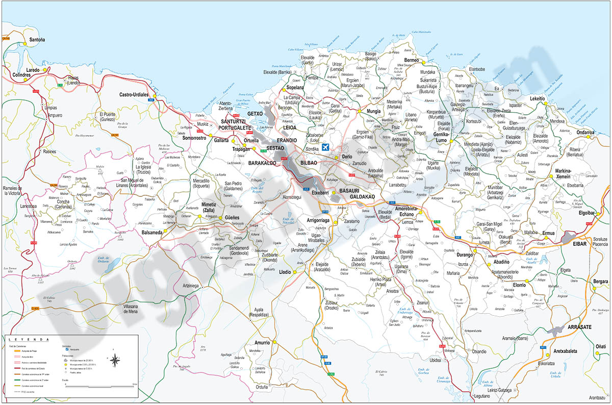
Map of Bizkaia
Digital map of Biscay (Basque Country province) showing community and province boundaries, towns and cities, highways, major and minor roads, railroad, principal rivers and lakes and other relevant po
(...) Read more »
Adobe Illustrator, Acrobat PDF
59,99 €
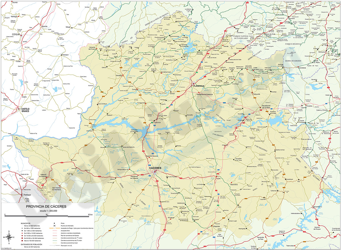
Map of Caceres
Digital map of the province of Cáceres (Extremadura, Spain) on a scale of 1:300.000
(...) Read more »
Adobe Illustrator, Acrobat PDF
59,99 €
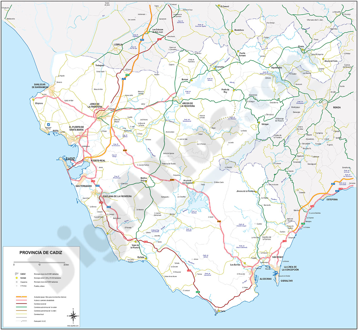
Map of Cadiz
Map of province of Cadiz (Andalusia, Spain) showing community and province boundaries, cities, highways, major and minor roads, railroad, principal rivers and lakes and other relevant political inform
(...) Read more »
Adobe Illustrator, PDF