Carte mondiale physico-politique DIN A4
Carte digitale physico-politique du monde en format DIN A4 en français.
Carte pour l'école, la maison ou le bureau. Comprend le relief terrestre et maritime, les pays en couleur, les noms des pays, les principaux fleuves et lacs et les noms géographiques les plus importants.
Digital physical-political world map in DIN A4 size in French.
Map for school, home or office use. Includes land and sea relief, coloured countries, names of countries, main rivers and lakes and the most important geographical names.
See less «
Adobe Illustrator, Acrobat PDF
Castilla y Leon map with municipalities
Map of Castile and León (Castilla y León autonomous commuity) showing their provinces with municipalities in digital format.
Adobe Illustrator, PDF
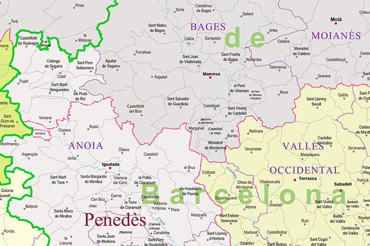
Catalonia - map of municipalities, counties and vegueries
Map of municipalities, comarques and vegueries of Catalonia.
Digital map of Catalonia with the municipalities, county boundaries and the countryside.
(...) Read more »
Adobe Illustrator, Acrobat PDF
Catalonian map with comarcal and vegueries boundaries
Political map of Catalonia (Autonomous community of Spain), in digital format, with the division into Vegueries and Comarques, their capitals, towns and places of interest.
(...) Read more »
Adobe Illustrator, Acrobat PDF
Central America political map
Digital file of Central America (Central America or América del centro) with the delimitation of the countries and other layers with geographical and political information (relief, rivers, lakes, cap
(...) Read more »
Adobe Illustrator, Acrobat PDF, image TIFF
China centered political worldmap
Political World map in vector format centered on China.
(...) Read more »
Adobe Illustrator, Acrobat PDF
Colombia - city map
Detailed map of Colombia (Republic of Colombia) showing the inner administrative division, departments, the Capital District of Bogotá, municipality borders, a lot of towns and cities. Poster size ma
(...) Read more »
Acrobat PDF
Comarcal maps of Spain autonomous communities
Maps of the comarcal division of all 17 spanish autonomous communities. Each map shows administrative limits and their coloured and named comarcas, capitals and major cities.
(...) Read more »
Adobe Illustrator, PDF


