1- Algar de Palancia map

Map of ALGAR de Palancia in digital format, showing relief and urban area
Adobe Acrobat PDF
2- Faro (Portugal) city map
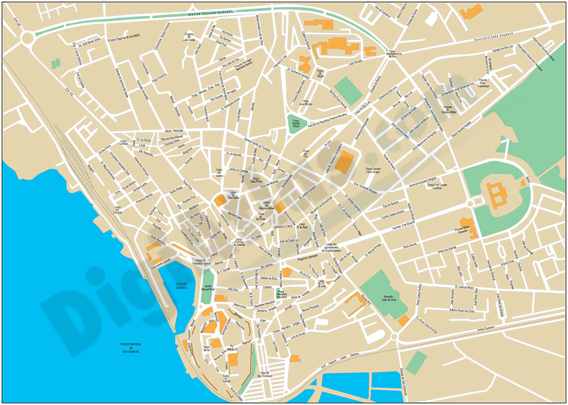
Street map of Faro (Portugal) showing street and square delineation, blocks of houses and green areas, with colours and names. All elements are grouped in separate layers fully editable.
Adobe Illustrator, Acrobat PDF
3- Map of Algarve (Portugal)

Map of the ALGARve region (Portugal) with municipalities, roads and towns.
Digital file in 100% editable vector format, organized in separate layers.
Adobe Illustrator, Acrobat PDF
4- Map of Bulgaria

Mapa político de Bulgaria en formato digital, con la división administrativa interna, sus nombres y capitales.
Se descargan ficheros vectoriales 100% editables.
Adobe Illustrator, Acrobat PDF
5- Map of Bulgaria with regions and Postal Codes

Digital map of Bulgaria (Republic of Bulgaria) showing political division (provinces and municipalities) and 2-digit postcode areas.
Files are downloaded in vector format organised in separate, 100% editable layers.
Adobe Illustrator, Acrobat PDF
6- Road Map of Portugal

Digital road map of Portugal, with the motorways, dual carriageways and the main road network. Also include towns and villages
Files in vector format 100% editable and organised in separate layers.
Adobe Illustrator, Acrobat PDF