1- Andalucia provinces with municipalities

Digital maps of the 8 Andalusian provinces.
Each province is in a separate file and shows the boundaries or municipalities, the capitals, cities and towns grouped according to the number of inhabitants and the main road network (motorways, dual... Read more
Adobe Illustrator, Acrobat PDF
2- Comarcal maps of Spain autonomous communities

Maps of the comarcal division of all 17 spanish autonomous communities. Each map shows administrative limits and their coloured and named comarcas, capitals and major cities.
Vectorized and fully editable files in Adobe Illustrator and PDF formats.... Read more
Adobe Illustrator, PDF
3- Cordoba province map with municipalities borders and major roads
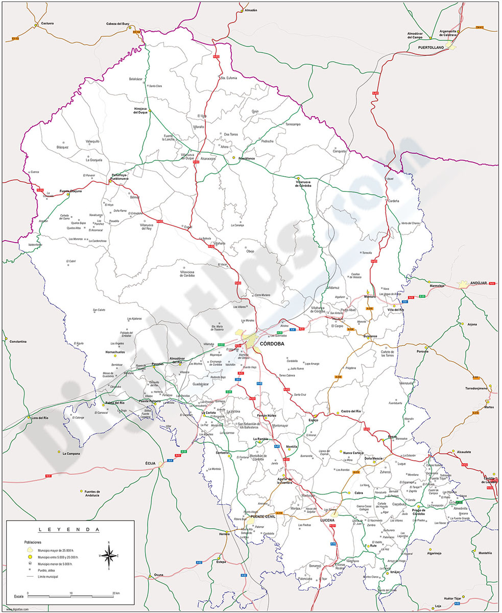
Map of Cordoba (Cordova) province (Andalucia-Spain) showing municipalities borders, cities and major roads.
Adobe Illustrator, PDF
4- Sevilla center street map

City Map of SEVILLA center in digital format. Fully editable vectorized file organized in layers. Street map of central area shows urban blocks of buildings, parks and green zones, street and square names. Fully editable vectorized file organized in... Read more
Adobe Illustrator, PDF
5- Sevilla province map with municipalities

Province of SEVILLA (Andalucia-Spain) with municipalities and cities.
Adobe Illustrator, PDF