
29,00 €
Alt Urgell map (comarca in Catalonia)
Digital map of the Alt Urgell comarca (LLEIDA province, Catalunya), showing road network, cities and towns.
(...) Read more »
Adobe Illustrator, Acrobat PDF

125,00 €
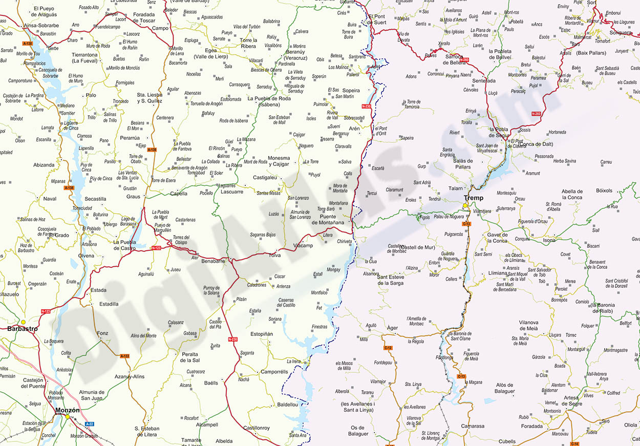
Geographical map of provice of Lleida and eastern Aragon zone
Poster-size digital map of the province of LLEIDA (Catalonia, Spain) with detailed geographical information.
(...) Read more »
Adobe Illustrator, Acrobat PDF + TIFF

114,95 €
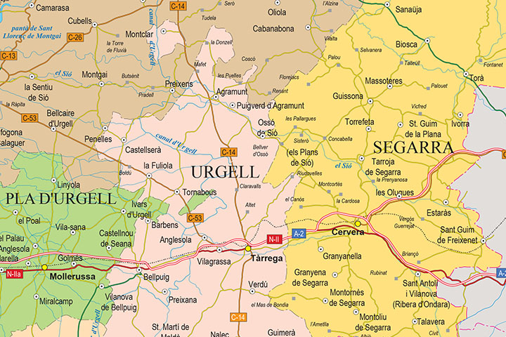
Map of Huesca and Lleida
Digital map of the provinces of Huesca and LLEIDA at a scale of 1:300.000, with the autonomous and provincial limits, municipalities, cities and towns, road and railway network, motorways, dual carria
(...) Read more »
Adobe Illustrator, Acrobat PDF

95,59 €
Map of the province of Lleida
Digital map of the province of LLEIDA in poster size (scale 1:300.000) showing the autonomous, provincial and municipal boundaries (municipalities), coloured comarcas, capitals of municipalities, citi
(...) Read more »
Adobe Illustrator, Acrobat PDF