19,95 €
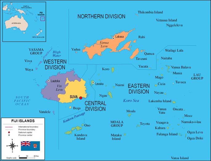
Map of Fiji
Fully editable vector file. Include political layers of inner administrative division, with their names and capitals.
Adobe Illustrator, PDF

19,95 €
Map of Papua New Guinea
Fully editable vector file map of of Papua New Guinea showing political layers of inner administrative division, with their names and capitals.
Adobe Illustrator, PDF

79,00 €
Oceania physical relief map
Digital map of OCEANIA geographic region (continent) showing bathymetric and topographic intervals. Fully editable vectorized file organized in separate layers.
Adobe Illustrator, acrobat PDF

79,00 €
Oceania political and geographical map
Fully editable vector file. Layers: colour and name of countries, international boundaries, major lakes, country capitals and relevant geographic names. High-resolution color shaded relief TIFF image.
Adobe Illustrator, PDF + TIFF, JPG (300dpi)