
PACK DIGIATLAS
Download up to 15 digital maps of your choice through a subscription to the 'Pack DigiAtlas'.


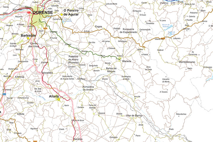
-Description:
Digital map of the province of Ourense (Galicia) at scale 1:250.000.
The map shows the municipal, provincial and regional boundaries, capitals and towns grouped by population, road network, AVE and railroad (highways, freeways, national and regional roads of first and second order, local road network, roads and tracks), rivers and major lakes.
Download files in vector format 100% editable and organized in separate layers to modify colors, texts and styles.
Poster size map for high quality printing.
Click here to download a sample of the map in vectorial format.
-Original measurements:
59,4x42 cm (DIN A2) (Fully resizable vector file for High-quality printing).
-Download formats:
Adobe Illustrator, Acrobat PDF
- This map is also available through the PACK DIGIATLAS »
-You can also request a quote » to modify this map and adapt it to your projects.
Download up to 15 digital maps of your choice through a subscription to the 'Pack DigiAtlas'.

Postcode maps of cities, regions and countries. Optionally with demographic data for geo-marketing projects.

City street maps with delineation of urban areas, streets, squares, parks, green areas, buildings of interest, etc.
DigiAtlas select every week until three random maps from their catalog and intends to offer them at a very lower price than its regular cost.
These maps change every 7 days. If either of them matches your interest take advantage of this opportunity to acquire digital maps to a very special price.