90,75 €
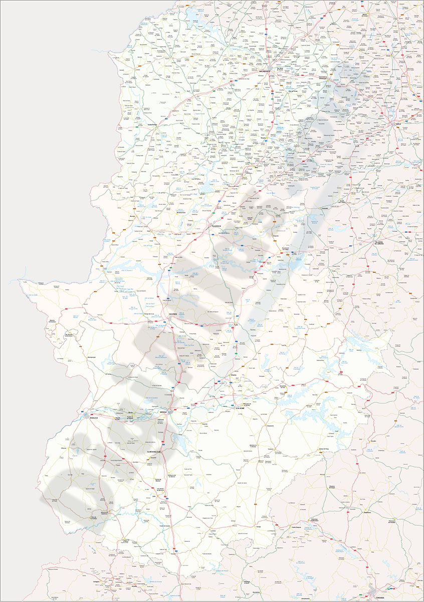
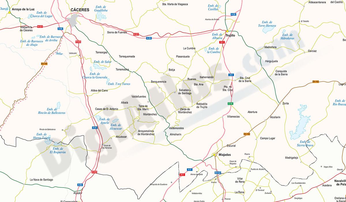
Cáceres-Badajoz-Salamanca provinces (Spain) - vector maps
Digital map of Spanish provinces of Cáceres, Badajoz and SALAMANCA with administrative borders, municipalities and localities, motorways, highways, national roads, regional and local roads, rail netw
(...) Read more »
Adobe Illustrator, Acrobat PDF
59,99 €
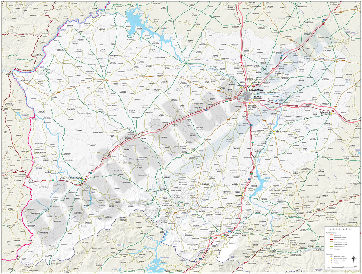
Map of Salamanca
Digital map of province of SALAMANCA (autonomous community of Castile and León, Castilla y León) showing community and province boundaries, towns and cities, highways, major and minor roads, railroa
(...) Read more »
Adobe Illustrator, PDF