55,00 €
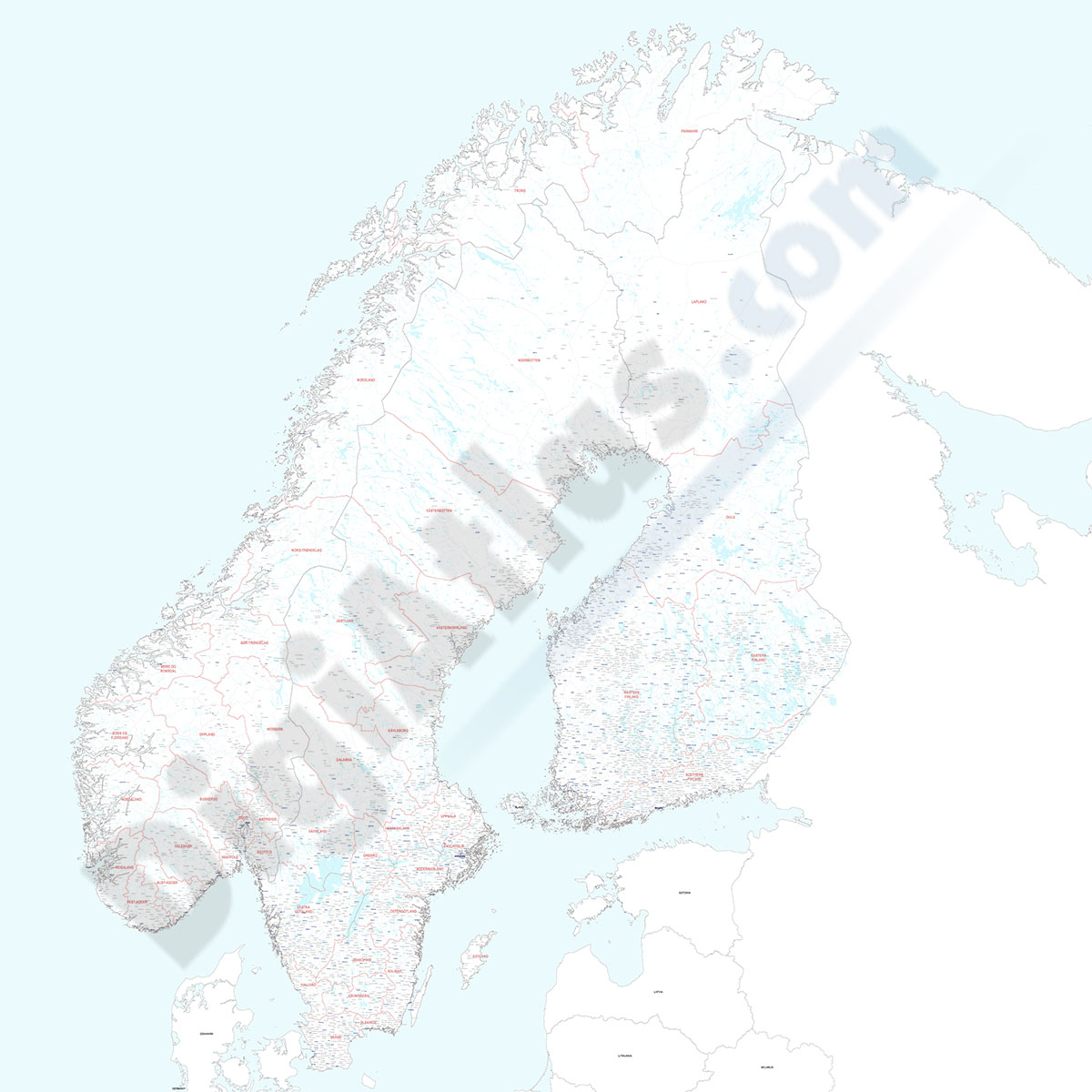
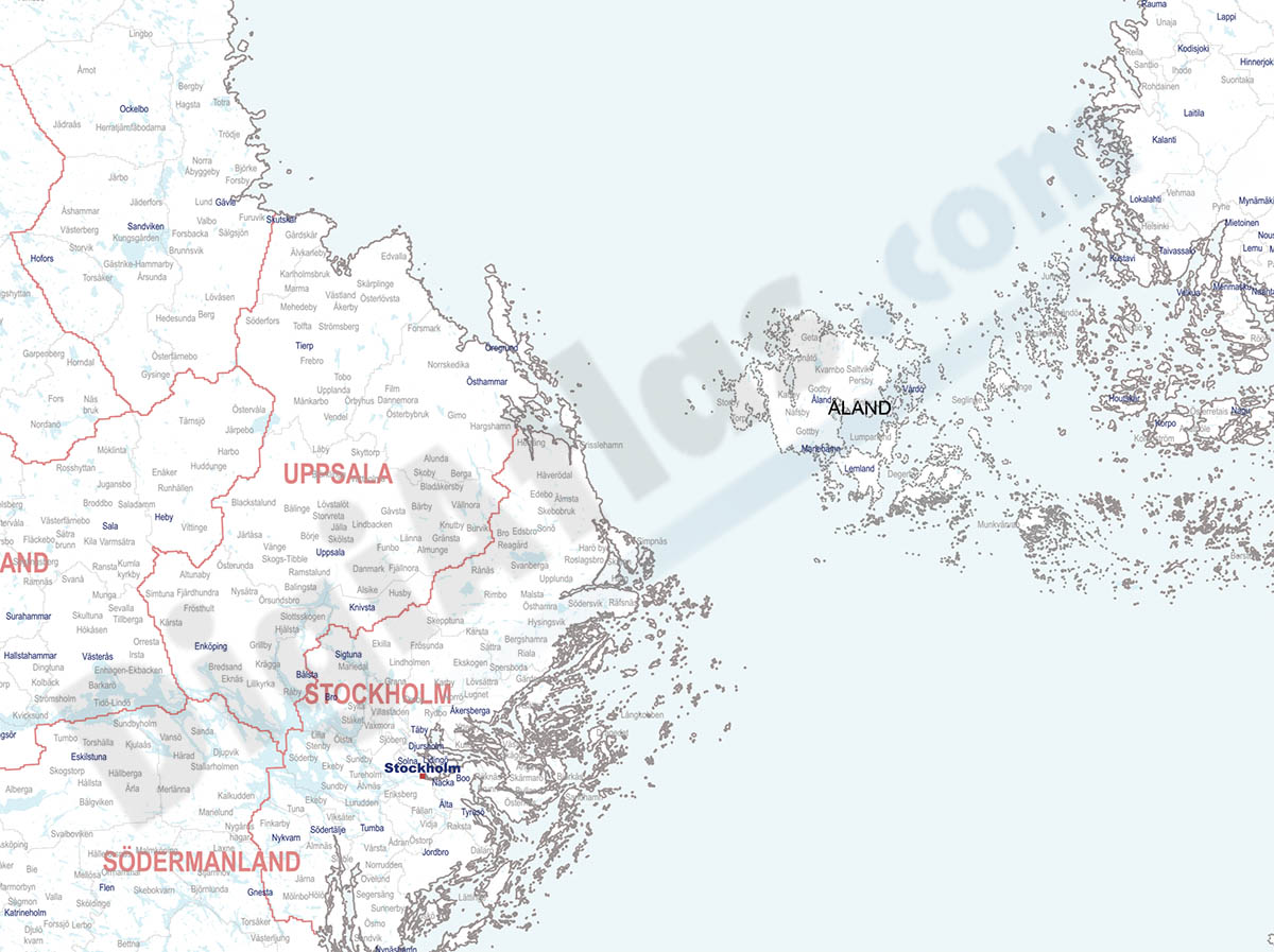
Finland, Norway and Sweden - city map
Detailed map of Finland, Norway and Sweden showing the inner administrative division, counties and municipality borders and a larger number of towns and cities. Poster size map in PDF vectorized file format.
See less «
Acrobat PDF
55,00 €
Map of Denmark with regions and 2 digit postal codes areas
Vectorized and fully editable Map of Denmark with regions, capitals and 2-digit postal codes areas.
Adobe Illustrator, Acrobat PDF

55,00 €
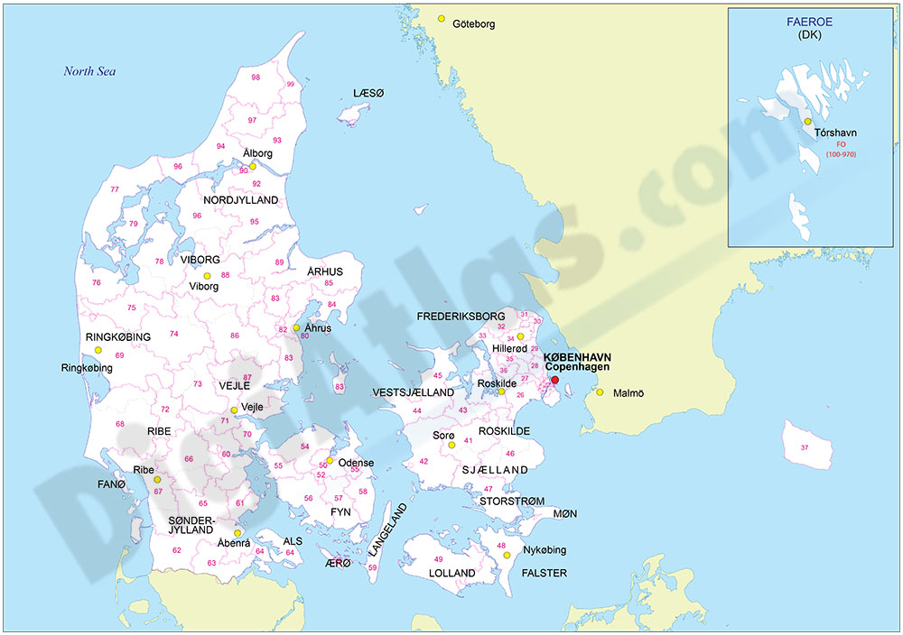
Map of Norway with regions and 2 digit postal codes areas
Vectorized and fully editable Map of Norway with regions, capitals and 2-digit postal codes areas. Include a KML file for Google Earth.
Illustrator, PDF, KML

55,00 €
Road Map of Portugal
Digital road map of Portugal, with the motorways, dual carriageways and the main road network. Also include towns and villages
(...) Read more »
Adobe Illustrator, Acrobat PDF

55,00 €
Map of Algarve (Portugal)
Map of the Algarve region (Portugal) with municipalities, roads and towns.
Digital file in 100% editable vector format, organized in separate layers.
Adobe Illustrator, Acrobat PDF

55,00 €
Faro (Portugal) city map
Street map of FARO (Portugal) showing street and square delineation, blocks of houses and green areas, with colours and names. All elements are grouped in separate layers fully editable.
Adobe Illustrator, Acrobat PDF