
550,00 €
Maps of Spanish Provinces with Postal Codes
-Complete collection of postcode maps of ALL 50 Spanish provinces (plus Ceuta and Melilla) with
(...) Read more »
Adobe Illustrator, Acrobat PDF

Ask price
Maps of Spain with Postal Codes areas
Postal codes map of Spain
Georeferenced cartography of all postal codes in Spain (peninsula, Balearic Islands, Canary Islands, Ceuta and Melilla).
(...) Read more »
Shapefile format (.shp), KML

60,50 €
Map of Europe with 2-digit postal codes
Political map of Europe, in fully editable digital format, with the countries coloured, the regions and provinces with their capitals and the two-digit postal codes.
Two files are downloaded i
(...) Read more »
Adobe Illustrator, Acrobat PDF

150,00 €
Map of Spain with all 5 digit postal codes
-Vectorised digital map of the whole of Spain with the 5-digit postcode areas and the boundaries and capitals of all the municipalities.
(...) Read more »
Acrobat PDF

125,00 €
Maps of European countries with regions and Postal Codes
Vectorized maps of European countries with administrative division and 2-digit postcodes areas. Include Andorra, Austria, Belgium, Bulgaria, Czech Republic, Denmark, Germany, Finland, France, Greece,
(...) Read more »
Adobe Illustrator, Acrobat PDF

79,00 €
Spain - postal codes by municipality and comarca
Complete Excel file with all the Postal Codes of Spain, along with the corresponding municipality, county and geographic coordinates. With 15,247 zip code areas, it is the definitive guide to l
(...) Read more »
Excel

79,00 €
A Coruña (Corunna) - Map of province with parroquias and postal codes
Map of the province of A Coruña (Galicia, Spain) with regional and provincial boundaries, coloured municipalities, parish boundaries and all postcodes.
Adobe Illustrator, Acrobat PDF

78,65 €
A Coruña City map with postcode districts
Street map of the entire urban area of the municipality of A Coruña in digital format and poster size, with the delineation of the urban area, blocks of houses, unique buildings, hydrographic network
(...) Read more »
Adobe Illustrator, Acrobat PDF
95,00 €
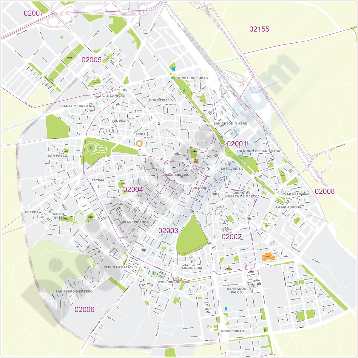
Albacete - city map
Street map of Albacete city (capital of the province of Albacete, autonomous community of Castilla-La Mancha, Spain) in digital format.
(...) Read more »
Adobe Illustrator, Acrobat PDF

55,00 €
Alcala de Henares city map with postcode districts
Map of Alcalá de Henares city (Madrid) showing 5-digit postcode areas.
Adobe Illustrator, Acrobat PDF

95,00 €
Alicante - city map with postal codes
Digital street map of the city of Alacant/Alicante (Valencian Community) with the delineation of blocks of houses, singular buildings, hydrographic network, parks, green areas, railways, urban roads,
(...) Read more »
Adobe Illustrator, Acrobat PDF

125,00 €
Alicante - provincial poster map with postcodes
Digital map of the province of Alacant/Alicante (Valencian Community).
Vector map of the whole province at 250x250 cm, in PDF format organised in separate layers, which can be displayed and/or hidden
(...) Read more »
Acrobat PDF

135,00 €
Andalusia - autonomous community map with municipalities and postal codes
Map of the 8 provinces of Andalusia (autonomous community in southern Spain) showing municipalities borders and 5-digit postal codes areas. Continuously Updated. Vectorized and fully editable formats.
Adobe Illustrator, PDF
Ask price
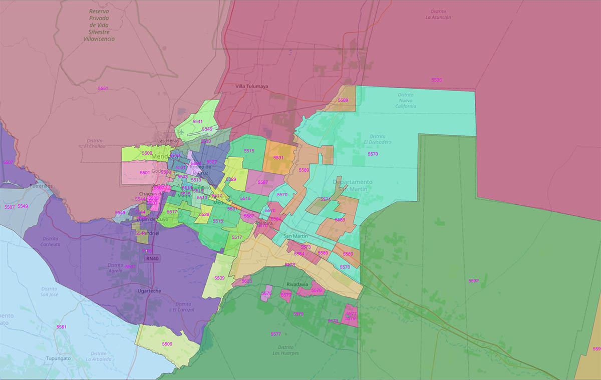
Argentina - map of 4 digit postal codes
Digital map of the postal codes of Argentina in georeferenced Shapefile format.
Shapefile (.shp)

59,00 €
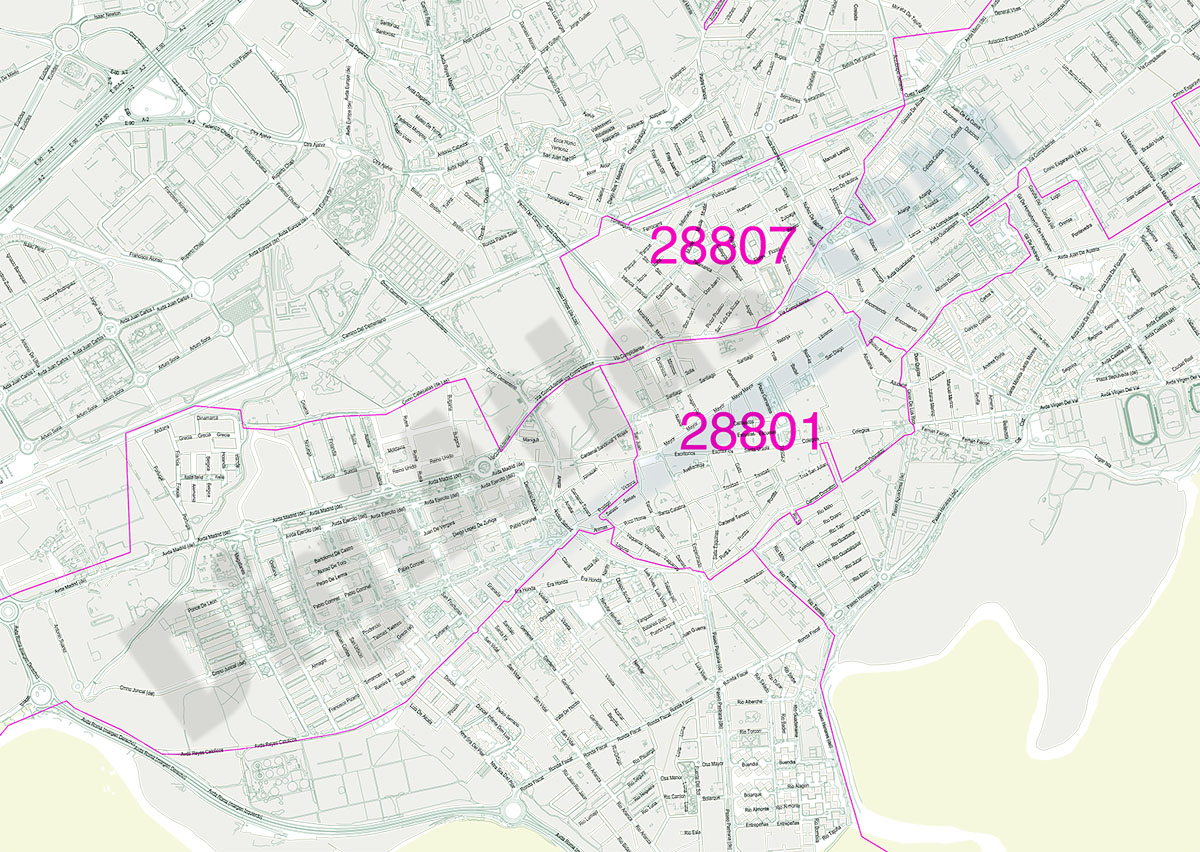
Asturias, Principality of - Map with municipalities, major roads and postal codes
Digital map of the Principality of Asturias (Spanish autonomous community), with postcodes and municipalities, capitals, cities and towns organised according to their number of inhabitants, roa
(...) Read more »
Adobe Illustrator y PDF
