Ask price
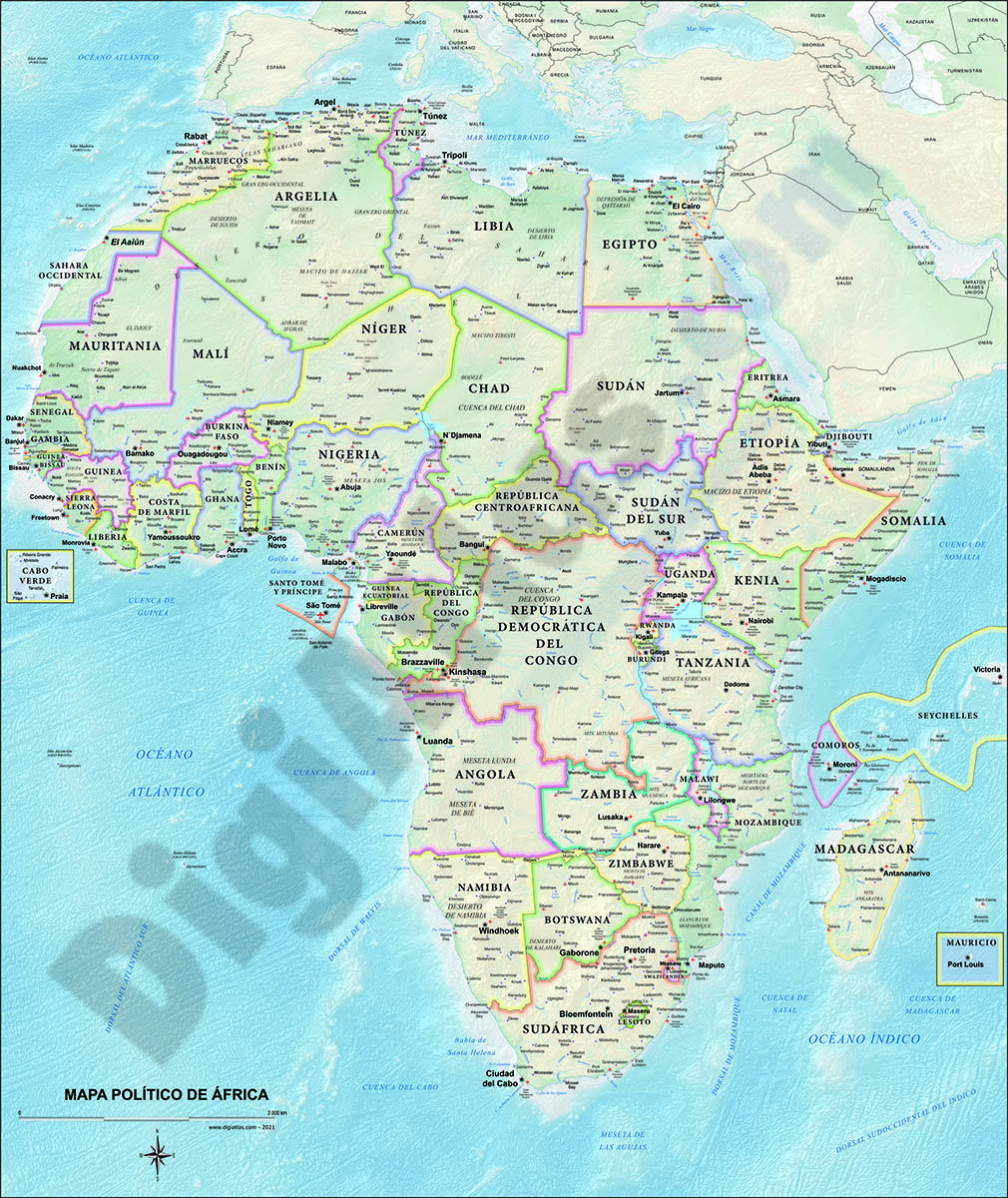
Map of Africa Poster
Poster-size digital map of Africa with detailed political and geographical information.
Adobe Illustrator, Acrobat PDF

120,00 €
Roadmap of Spain and Portugal
Digital map of roads and towns in Spain and Portugal.
(...) Read more »
Adobe Illustrator, Acrobat PDF

125,00 €
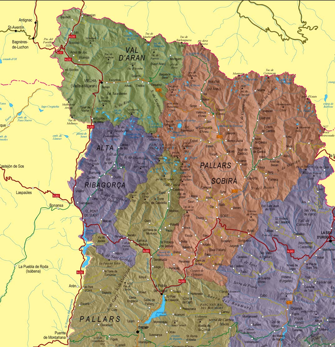
Catalonia Physical-political poster map
Poster size map of Catalonia (Catalunya in catalan, Cataluña in spanish) showing administrative borders: provinces and comarcas, roadmaps: highways, major and minor roads, railroad, principal rivers
(...) Read more »
Adobe Illustrator, PDF + TIFF, JPG (300dpi)

Ask price
Map of Africa and Europe
Map of Africa and Europe with a TIFF-image relief and vectorized bathimetry
imagen TIFF

55,00 €
Maps of Central and South american countries with political division
Digital maps of Argentina, Bolivia, Brazil, Chile, Colombia, Ecuador, Guyana, Paraguay, Peru, Surinam, Uruguay, Venezuela, Guatemala, Belize, Honduras, El Salvador, Nicaragua, Costa Rica, Panamá and
(...) Read more »
Adobe Illustrator, Acrobat PDF

98,00 €
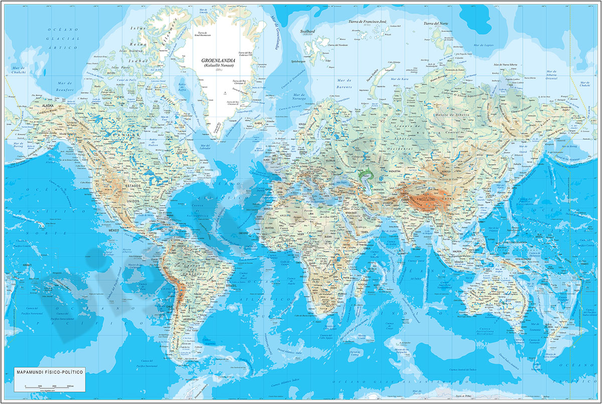
Physical-Political Poster World map
Physical and political digital world map, with borders, colours and names of countries, capitals, main rivers and lakes, capitals and important towns, geographical names and the altimetry and bathymet
(...) Read more »
Adobe Illustrator, Acrobat PDF

55,00 €
15 maps of Spanish provinces with comarcas and municipalities
Digital maps of 15 provinces of Spain with comarcas and municipalty borders and city names. (Cáceres, Badajoz, Albacete, Ciudad Real, Toledo, Alicante, Castellón, Valencia, Murcia, Burgos, León, Sa
(...) Read more »
imagen JPG (250 dpi)
79,00 €
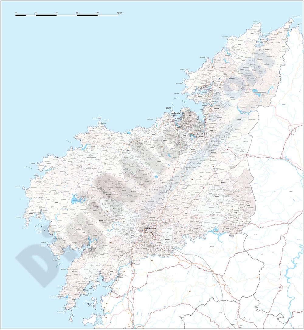
A Coruña (Corunna) - Map of province with parroquias and aldeas
Map of A Coruña province (Galicia, Spain) showing Autonomous Communities, provinces, concellos and parroquias boundaries. Include cities, 'aldeas', highways, major and minor roads, railroad, princip
(...) Read more »
Adobe Illustrator, PDF

79,00 €
Africa physical vectorized-relief map
Physical map of Africa.
(...) Read more »
Adobe Illustrator, Acrobat PDF

79,00 €
Africa political and geographical map
Fully editable vectorized file map of Africa with coloured countries, international boundaries, major lakes, important cities and capitals and relevant geographic features. Poster size map in high-res
(...) Read more »
Adobe Illustrator, PDF + TIFF, JPG (300dpi)

59,99 €
Alava (Araba) - Map of the province
Digital map of the province of Araba/Álava (Basque Autonomous Community)
(...) Read more »
Adobe Illustrator, Acrobat PDF
19,99 €
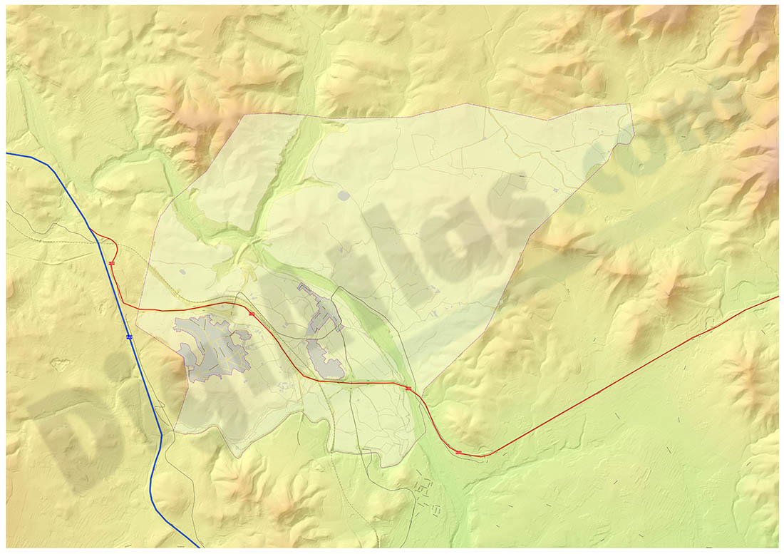
Algar de Palancia map
Map of Algar de Palancia in digital format, showing relief and urban area
Adobe Acrobat PDF

59,99 €
Alicante - Map of province
Vector format spain province map showing community and province boundaries, cities, highways, major and minor roads, railroad, principal rivers and lakes and other relevant political information. Scal
(...) Read more »
Adobe Illustrator, PDF, JPG (300dpi)
59,99 €
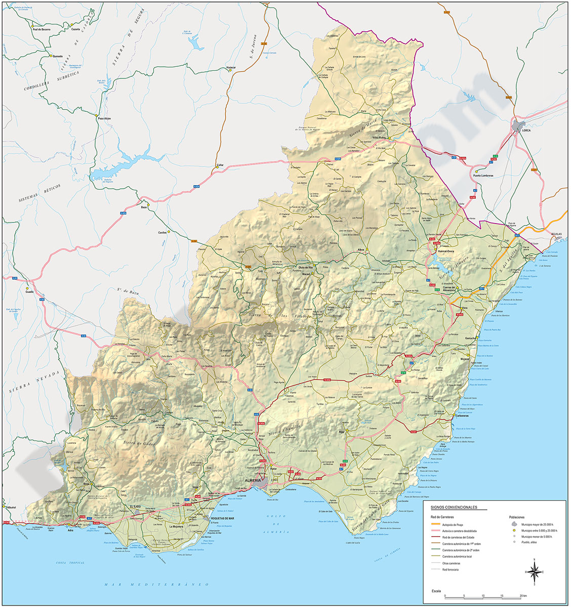
Almeria - Province digital map
Digital map of the Almeria spanish province, showing community and province boundaries, cities, highways, major and minor roads, railroad, principal rivers and lakes and other relevant political infor
(...) Read more »
Adobe Illustrator, PDF

29,00 €
Alt Urgell map (comarca in Catalonia)
Digital map of the Alt Urgell comarca (Lleida province, Catalunya), showing road network, cities and towns.
(...) Read more »
Adobe Illustrator, Acrobat PDF
