
75,00 €
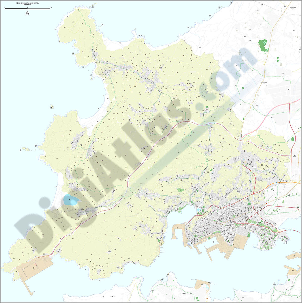
Ferrol - city map
Digital street map of Ferrol (Province of A Coruña) with the delineation of the urban area, municipal boundaries and names of streets, squares and singular buildings.
(...) Read more »
Adobe Illustrator, Acrobat PDF

151,25 €
Population by census area of Galicia
Number of inhabitants for each census section in Galicia autonomous community, Spain.
(...) Read more »
Excel, KML

75,00 €
Postcodes 50 km radius from Lleida
Map of postcodes within a 50 km radius of the centre of Lleida.
The map shows the municipal boundaries, their capitals and the areas of all the postcodes.
(...) Read more »
Adobe Illustrator, Acrobat PDF

98,00 €
Gijón - city map
Digital street map of Gijón (Principality of Asturias) with urban area delineation, municipal boundaries and street and square names. Poster size map 1414x1000 mm (ISO B0).
(...) Read more »
Adobe Illustrator, Acrobat PDF
95,00 €
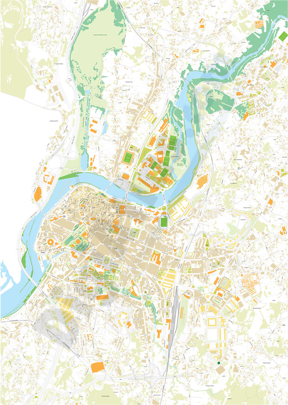
Pontevedra - city map
Digital street map of the city of Pontevedra (Galicia) with the delineation of blocks of houses, singular buildings, hydrographic network, parks, green areas, railways, urban roads and the names of st
(...) Read more »
Adobe Illustrator, Acrobat PDF
114,95 €
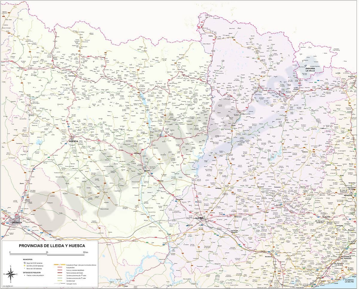
Map of Huesca and Lleida
Digital map of the provinces of Huesca and Lleida at a scale of 1:300.000, with the autonomous and provincial limits, municipalities, cities and towns, road and railway network, motorways, dual carria
(...) Read more »
Adobe Illustrator, Acrobat PDF

90,75 €
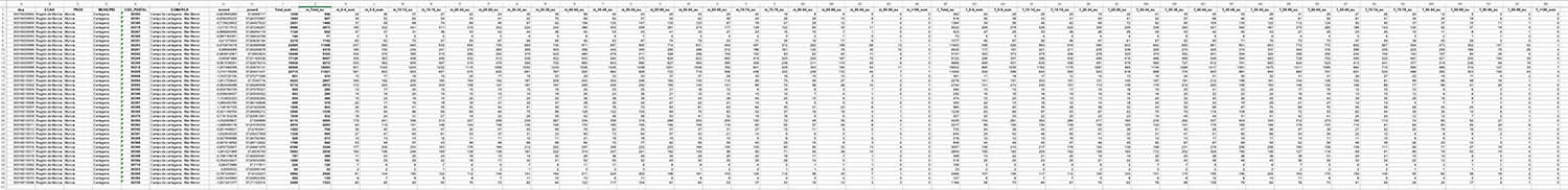
Cartagena and Madrid community - Population by postal code
Historical population data by postal code of the municipality of Cartagena (Region of Murcia) and the Community of Madrid.
Population data from 2017 to 2021.
(...) Read more »
Excel

175,00 €
Population by postcode in Spain
-NUMBER OF INHABITANTS OF EACH ZIP CODE IN SPAIN.
Learn the population data for every zip code in Spain with this comprehensive database.
(...) Read more »
Excel

98,00 €
Map of Castellón and Valencia provinces
Digital map of the provinces of Valencia and Castellón with detailed geographical information: regional and provincial boundaries, municipalities and towns, motorways, dual carriageways, natio
(...) Read more »
Adobe Illustrator, Acrobat PDF

45,00 €
Cartagena - Population by postal code
Population by postal code of the municipality of Cartagena (Region of Murcia).
(...) Read more »
Excel

Ask price
Switzerland - Population by postal code
-Number of inhabitants of each postcode in Switzerland
Digital mapping of the 4-digit postcodes of Switzerland in geo-referenced Shapefile format.
(...) Read more »
Shapefile (.shp)
89,00 €
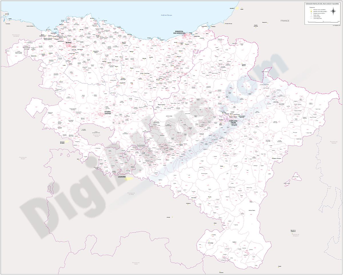
Euskadi and Navarra - map of postal codes
EUSKADI POSTAL CODES
(...) Read more »
Adobe Illustrator, Acrobat PDF

89,00 €
Euskadi - map of postal codes
EUSKADI POSTAL CODES
(...) Read more »
Adobe Illustrator, Acrobat PDF

Ask price
Inhabitants per postcode in Spain (5-year groups)
-POPULATION DATA FOR EACH POSTCODE IN SPAIN.
(...) Read more »
Excel

Ask price
Spain - maps of postal codes by comarca
Postal codes by county, province and municipality.
Maps of the 50 Spanish provinces with municipal boundaries, zip codes areas and comarcas colored.
Imagen JPG

