
Ask price
diary maps - maps for agendas
Political maps for school agendas and projects.
(...) Read more »
Adobe Illustrator, Acrobat PDF
95,00 €
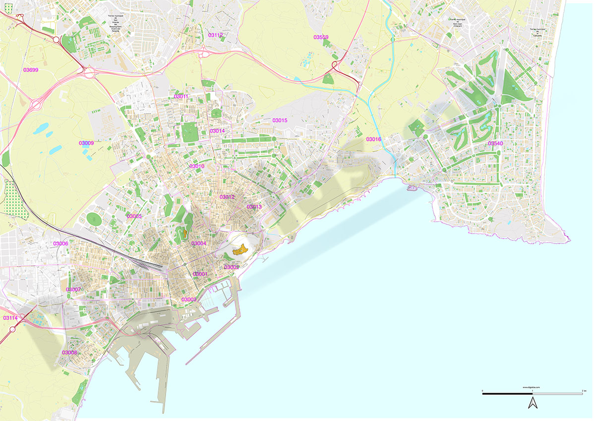
Alicante - city map with postal codes
Digital street map of the city of Alacant/Alicante (Valencian Community) with the delineation of blocks of houses, singular buildings, hydrographic network, parks, green areas, railways, urban roads,
(...) Read more »
Adobe Illustrator, Acrobat PDF
65,00 €
Jumilla - city map
Digital street map of Jumilla (Region of Murcia) with the delineation of streets and squares, blocks of houses, parks and green areas with colours and names.
(...) Read more »
Adobe Illustrator, Acrobat PDF
79,00 €
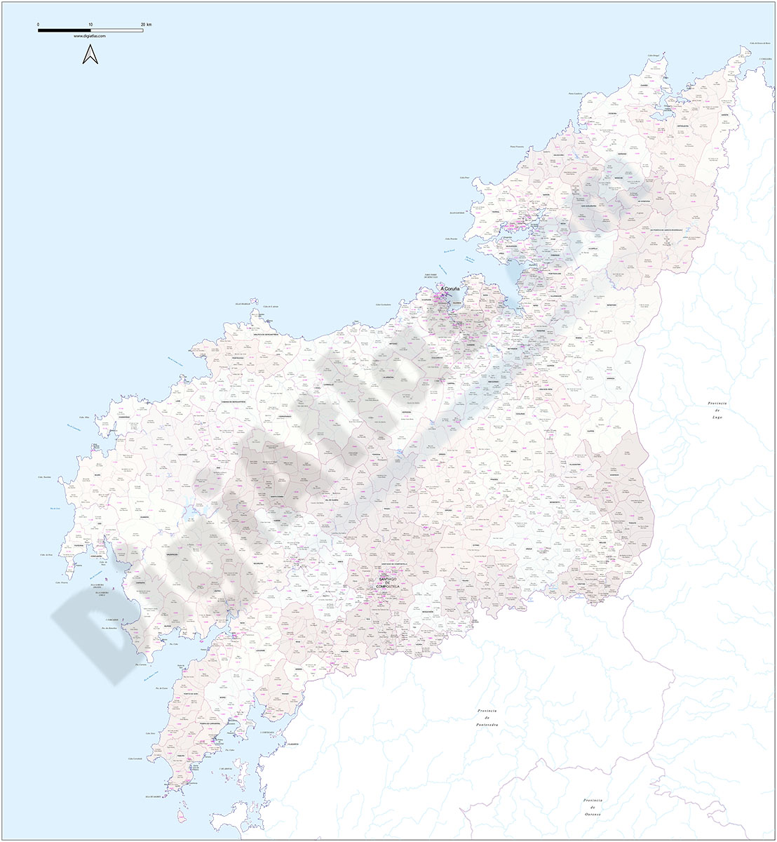
A Coruña (Corunna) - Map of province with parroquias and postal codes
Map of the province of A Coruña (Galicia, Spain) with regional and provincial boundaries, coloured municipalities, parish boundaries and all postcodes.
Adobe Illustrator, Acrobat PDF

45,00 €
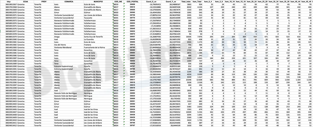
Santa Cruz de Tenerife- Population by postal code
Population data by postcode for the province of Santa Cruz de Tenerife (Canary Islands).
(...) Read more »
Excel

Ask price
Portugal - Population by 7-digit postal code
Excel file with the inhabitants by 7-digit postcodes of Portugal.
(...) Read more »
Excel
Ask price
Population by Postcode (Historical 2012-2022 biannual)
-HISTORICAL POPULATION BY POSTCODE IN SPAIN.
These are several digital files, in Excel format, with population data by postcode from 2012 to 2022, every two years.
(...) Read more »
Excel

98,00 €
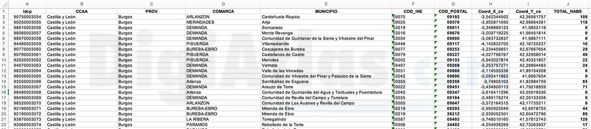
Burgos and La Rioja - inhabitants by postcode
Digital map of the province of Burgos and the autonomous community of La Rioja showing the municipalities, postcode boundaries and the number of inhabitants of each postcode.
(...) Read more »
Adobe Illustrator, Acrobat PDF y Excel
975,00 €
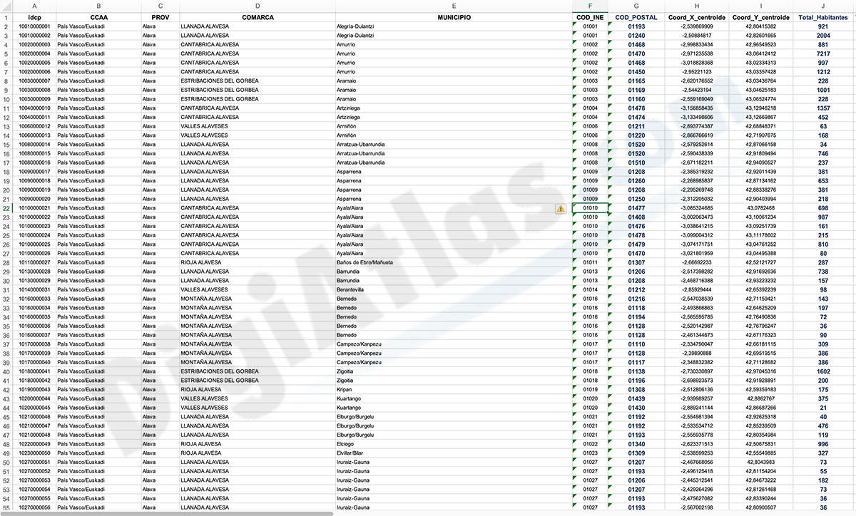
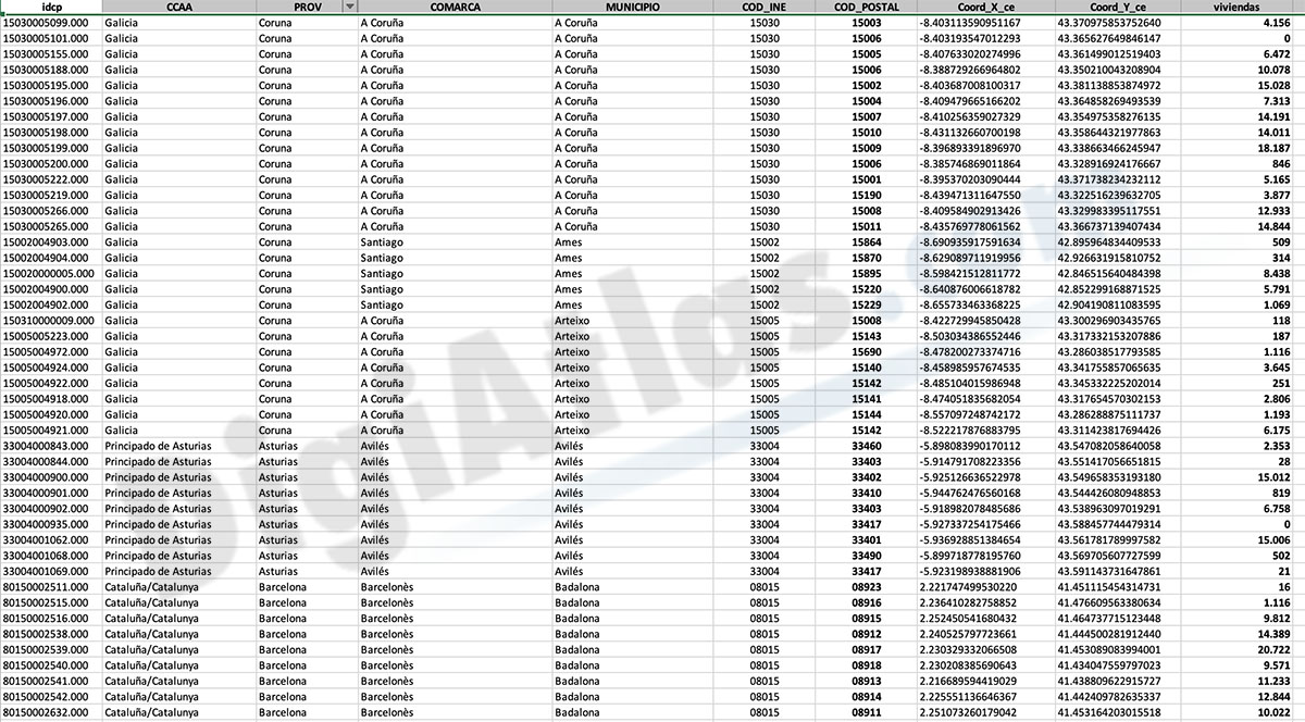
Number of dwellings by postcode in Spain
Number of dwellings by Postal Code
There are 235 municipalities in Spain with more than 25,000 inhabitants and with more than one postal code within their municipal boundaries.
(...) Read more »
Excel

175,00 €
Barcelona - City map with portal numbers
Digital street map of Barcelona with street numbers.
(...) Read more »
Acrobat PDF

75,00 €
Sarria district map
Digital map of the district of Sarrià (Barcelona)
Adibe Illustrator, Acrobat PDF

245,00 €
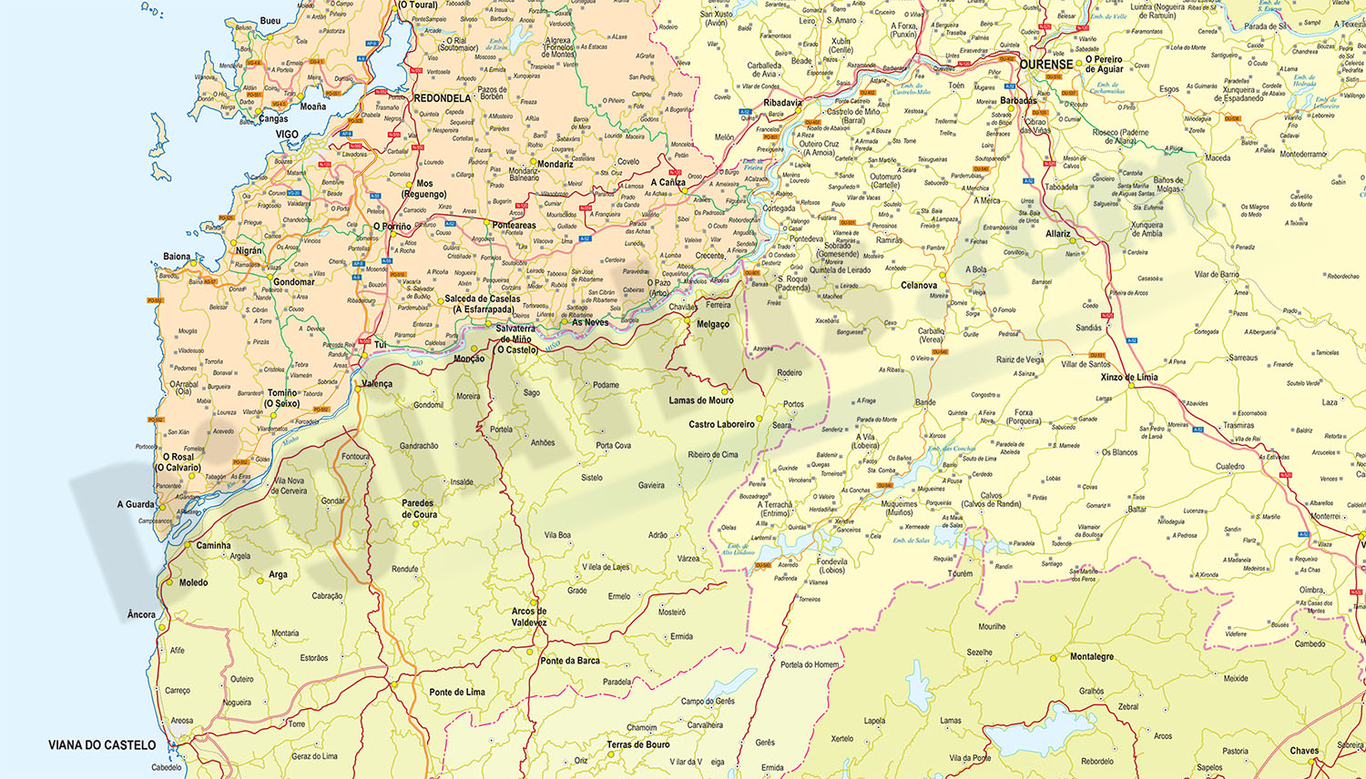
Map of Galicia and North Portugal
Vector map of the Autonomous Community of Galicia and Northern Portugal.
(...) Read more »
Adobe Illustrator, Acrobat PDF
175,00 €
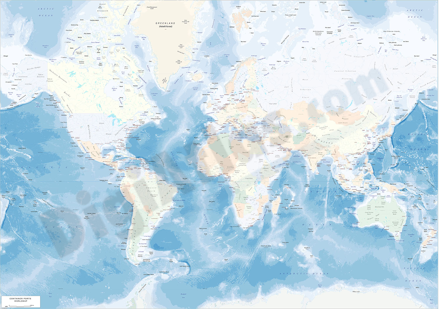
Physical-Political Worldmap with Container Ports
Physical-political digital world mapa with container ports.
(...) Read more »
Adobe Illustrator, Acrobat PDF

125,00 €
Portugal - Excel population by 4-digit postal code
Excel file with the inhabitants by 4-digit postcode of Portugal.
(...) Read more »
Excel

75,00 €
A Coruña - map Municipal District
Digital street map of A Coruña (Capital of the Province of A Coruña) with the delineation of the urban area, municipal limits and names of streets, squares and singular buildings.
(...) Read more »
Adobe Illustrator, Acrobat PDF
