
78,65 €
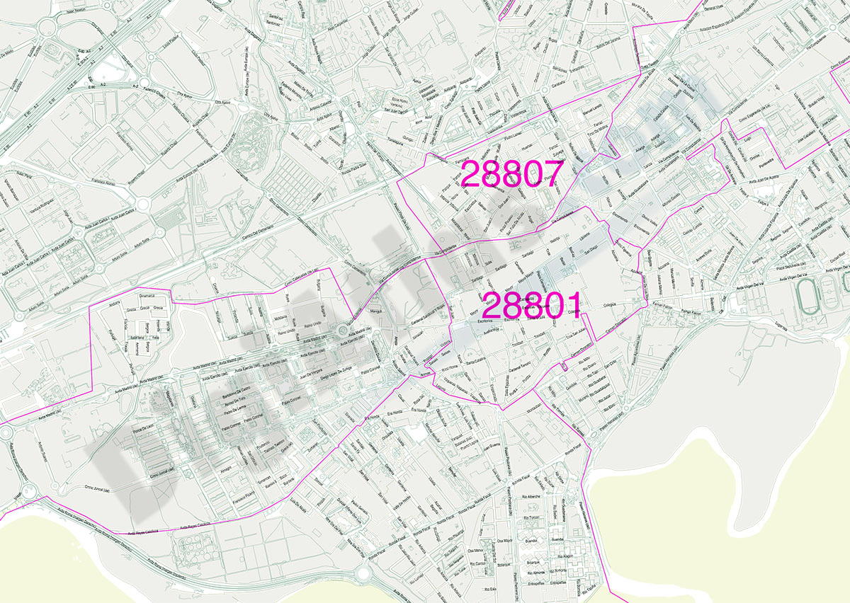
A Coruña City map with postcode districts
Street map of the entire urban area of the municipality of A Coruña in digital format and poster size, with the delineation of the urban area, blocks of houses, unique buildings, hydrographic network
(...) Read more »
Adobe Illustrator, Acrobat PDF
95,00 €
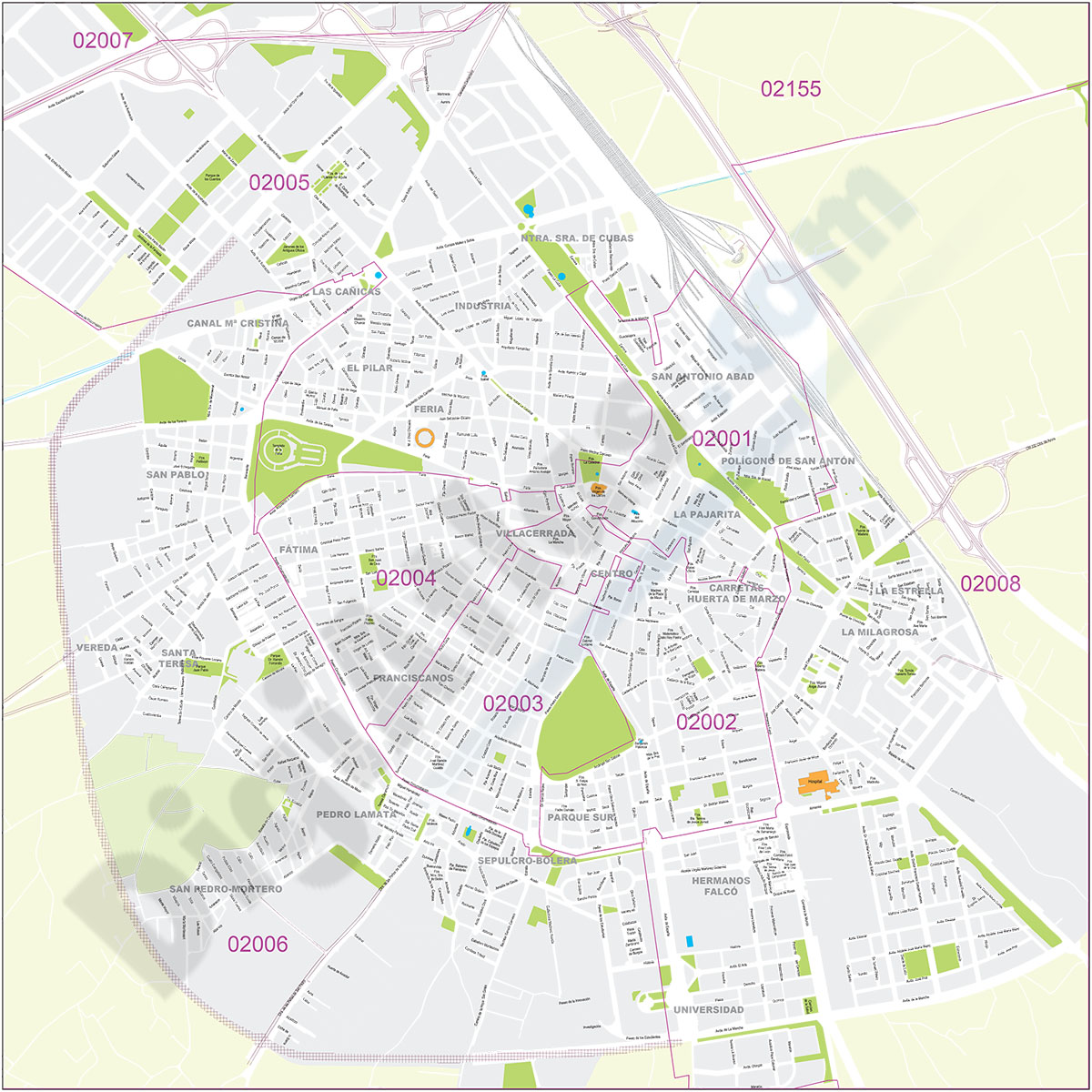
Albacete - city map
Street map of Albacete city (capital of the province of Albacete, autonomous community of Castilla-La Mancha, Spain) in digital format.
(...) Read more »
Adobe Illustrator, Acrobat PDF

55,00 €
Alcala de Henares city map with postcode districts
Map of Alcalá de Henares city (Madrid) showing 5-digit postcode areas.
Adobe Illustrator, Acrobat PDF

95,00 €
Alicante - city map with postal codes
Digital street map of the city of Alacant/Alicante (Valencian Community) with the delineation of blocks of houses, singular buildings, hydrographic network, parks, green areas, railways, urban roads, postal codes and the names of streets and squares.
Two vector files can be downloaded: one in Adobe Illustrator (.ai) format, which is 100% editable and allows you to modify and customise colours, texts and styles, as well as manage (colour) each postcode separately.
A second version is in Acrobat PDF format, which allows the map to be printed directly at the desired size, always with the maximum resolution.
Both files are organised in layers, which can be displayed and/or hidden to generate various types of customised maps.
The map is optimised to establish commercial areas, distribution and sales zones, delivery routes, graphic design, advertising, etc. Updated to the current year.
See less «
Adobe Illustrator, Acrobat PDF
71,39 €
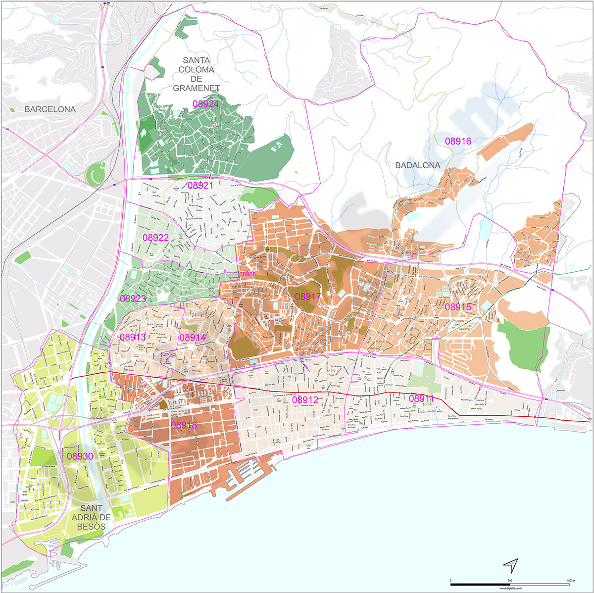
Badalona, Santa Coloma de Gramanet and Sant Adrià del Besòs with postal codes
Map of the Badalona, Santa Coloma de Gramanet and Sant Adrià del Besòs with 5-digit coloured postal code areas in vectorized PDF format. Also shows urban blocks of buildings, parks, green zones, str
(...) Read more »
Acrobat PDF

179,00 €
Barcelona and surroundings with postal codes
Digital map of the municipalities of Barcelona, l'Hospitalet de Llobregat, Santa Coloma de Gramanet, Sant Adrià del Besòs and Badalona with postal codes .
(...) Read more »
Adobe Illustrator, Acrobat PDF

125,00 €
Barcelona city map with postcode districts
Street map of the city of Barcelona with districts and postcodes in digital format.
(...) Read more »
Adobe Illustrator, Acrobat PDF

95,00 €
Bilbao - city map with postal codes
Digital street map of the city of Bilbo/Bilbao (Euskadi) with the delineation of blocks of houses, singular buildings, hydrographic network, parks, green areas, railroads, urban roads, postal codes an
(...) Read more »
Adobe Illustrator, Acrobat PDF

95,00 €
Burgos - city map
Digital map of Burgos capital city (Province of Burgos, autonomous community of Castile and León, Spain). Maps include streets and square, their names and postal code areas. All features are in separ
(...) Read more »
Adobe Illustrator, PDF

59,00 €
Cartagena - city map
Digital street map of Cartagena (Region of Murcia, Spain).
(...) Read more »
Adobe Illustrator, Acrobat PDF

55,00 €
Castellón de la Plana - center with postal districts
Vector-file map of Castellón de la Plana - Castelló de la Plana (province of Castelló, Spain) with postal codes and districts.
Adobe Illustrator, Acrobat PDF

98,00 €
Castellón de la Plana - city map
Vector-file map of Castellón de la Plana - Castelló de la Plana (province of Castelló, Valencian autonomous community). Digital map in vector format with all cartographic features organized in sepa
(...) Read more »
Adobe Illustrator, Acrobat PDF

75,00 €
Gijón - city map with postal codes
Digital street map of Gijón (Principality of Asturias) with urban area delineation, municipal boundaries, postcode limits, and street and square names. Poster size map 1189x841 cm (A0).
(...) Read more »
Adobe Illustrator, Acrobat PDF
59,00 €
Granada - city map with postcodes
Postal code map of Granada city, capital of province of Granada (autonomous community of Andalusia, Spain), in digital format showing urban blocks of buildings, parks and green zones, street and squar
(...) Read more »
Adobe Illustrator, PDF, JPG (300dpi)

75,00 €
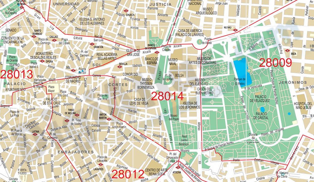
Madrid center city with postal districts
City Map of Madrid center in digital format. Fully editable vectorized file organized in layers. Street map of central area shows urban blocks of buildings, parks and green zones, street and square na
(...) Read more »
Adobe Illustrator, PDF
