
75,00 €
Madrid city map with postal code areas
Vectorized and high quality file map of Madrid municipality. Digital map of Madrid shows major street names and district limits, 5-digit postal code areas.
Adobe PDF

75,00 €
Madrid city map with postal code areas
Postal code map of Madrid.
(...) Read more »
Acrobat PDF

95,00 €
Malaga (Andalusia, Spain) - city map with postal codes
Digital street map of Malaga with postcodes
(...) Read more »
Adobe Illustrator, Acrobat PDF

125,00 €
Metropolitan Area of Barcelona with postal codes
Digital map of the Metropolitan Area of Barcelona with postcodes.
(...) Read more »
Adobe Illustrator, Acrobat PDF

95,00 €
Palma de Mallorca city map with postcode districts
Digital map of the city of Palma (Island of Mallorca, Balearic Islands, Spain).
(...) Read more »
Adobe Illustrator, Acrobat PDF

59,00 €
Pontevedra (Galicia, Spain) - city map with postal codes
City Map of Pontevedra (Galicia, Spain) in digital format showing urban blocks of buildings, parks, green zones, street and square names and 5-digit postal code areas. Downloads a fully editable vecto
(...) Read more »
Adobe Illustrator, PDF

78,65 €
Sevilla City map with postcode areas
Digital map of Sevilla or Seville city (Andalusia, Spain) with the delineation of streets and squares, blocks of houses, parks and green areas, singular buildings and the names of streets and s
(...) Read more »
Acrobat PDF

55,00 €
Street map of Madrid with districts
Map of the municipality of Madrid showing all district areas.
Adobe Illustrator, PDF, JPG (300dpi)
89,95 €
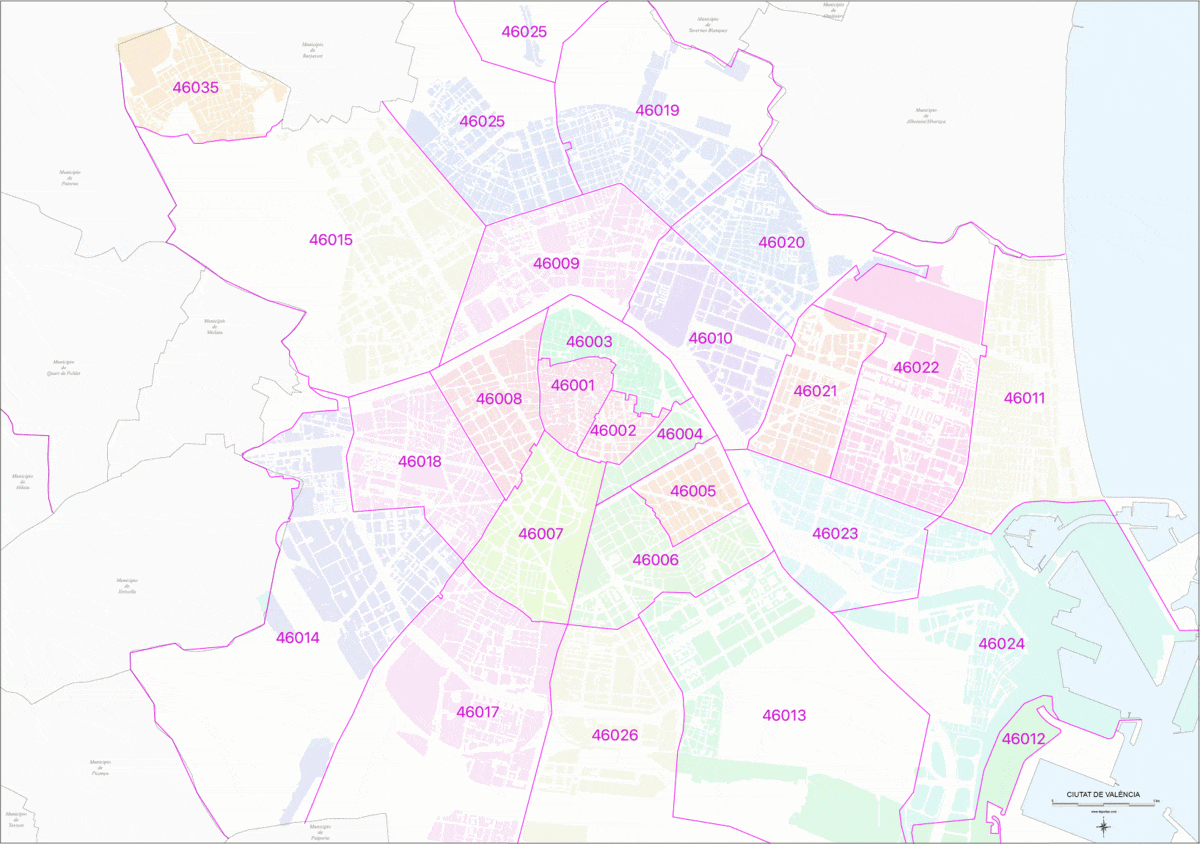
Valencia City map with postcode districts
Digital street map of the city of Valencia, with the delineation of streets and squares, blocks of houses, parks, green areas, zip codes, districts, neighborhoods and the names of streets and squares.
(...) Read more »
Adobe Illustrator, Acrobat PDF

59,00 €
Vigo - city map with postalcodes
Vector-file map of Vigo Metropolitan Area (province of Pontevedra, Spain) with all postal code districts, surrounding municipalities, cities and major roads. Digital map in poster size in high resolut
(...) Read more »
Adobe Illustrator, PDF, JPG (300dpi)
